laura paddles delmarva

Circumnavigating 600 miles of Delmarva's shorelines


Leave a comment

South Point to Truitt’s Landing

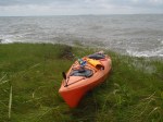
Longest paddling trip of my life (to date): 16.5 miles (see map near the bottom of this post).  Completed on Sunday, September 15, 2013.

Long, painful, and exhausting are all words that first come to mind to describe this paddle.  I really shouldn’t be saying that though.  When I really start thinking about it, it’s more like peaceful, isolated (in a good way), and accomplished.

OLYMPUS DIGITAL CAMERA
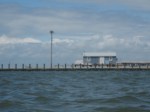
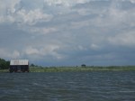
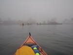
Here was the plan: hit the water before sunrise, paddle south for 4 hours or so, and Brian will be leaving work in time to be at Truitt’s Landing around 11:30 to pick me up.  I didn’t quite make it by sunrise; I made it in the water maybe 15-20 minutes after sunrise (not bad for getting up so early on my day off).  I wanted to paddle alongside Assateague instead of the mainland because I enjoy paddling next to marshes more than farmland, and it just seemed quieter and more peaceful.

As I paddled away from the dock, an older gentleman was launching at the same time, but we were headed in different directions.  He asked me where I was headed and I told him Truitt’s Landing.  He seemed a little confused and shocked that I was planning to cover such a long distance, but then he said it looked like I knew what I was doing and that I could handle it.  I didn’t realize it at the time, but that was good encouragement for later on in this adventure!

OLYMPUS DIGITAL CAMERAI passed a few kayakers when I got up next to Assateague.  It appeared they were campers in the campground, doing some early morning exploring.  I’m starting to notice a trend among kayakers lately (and I saw some coming from the campground).  There is this funny demographic of recently retired, seemingly highly educated people out on the water.  They purchase really fancy/expensive kayaks, they wear all the fancy, high-end kayaking clothing and accessories (wide-brimmed hat, kayaking gloves, and an explosion of gortex).  And they appear to think that kayaking is the coolest way to spend their time and they are overly excited about it.  This is all fabulous; it’s good to see these people enjoying their retirement and spending gobs of money on something (in my opinion) worthwhile.  However, the thing that bothers me about them?  They buy these fancy shmancy kayaks and don’t go for long distances.  They just poke around in the marsh and explore small areas (or so I’ve witnessed over the last couple years).  I mean, can’t we trade?  Not that I don’t absolutely love exploring salt marshes and not that I don’t adore my 12 foot Necky, but seriously.  Why do you need a fiberglass boats to explore marsh creeks?  Clearly this is a huge stereotype, but I just needed to say it!

Okay, rant over.  Back to my 16.5 mile journey!

OLYMPUS DIGITAL CAMERA
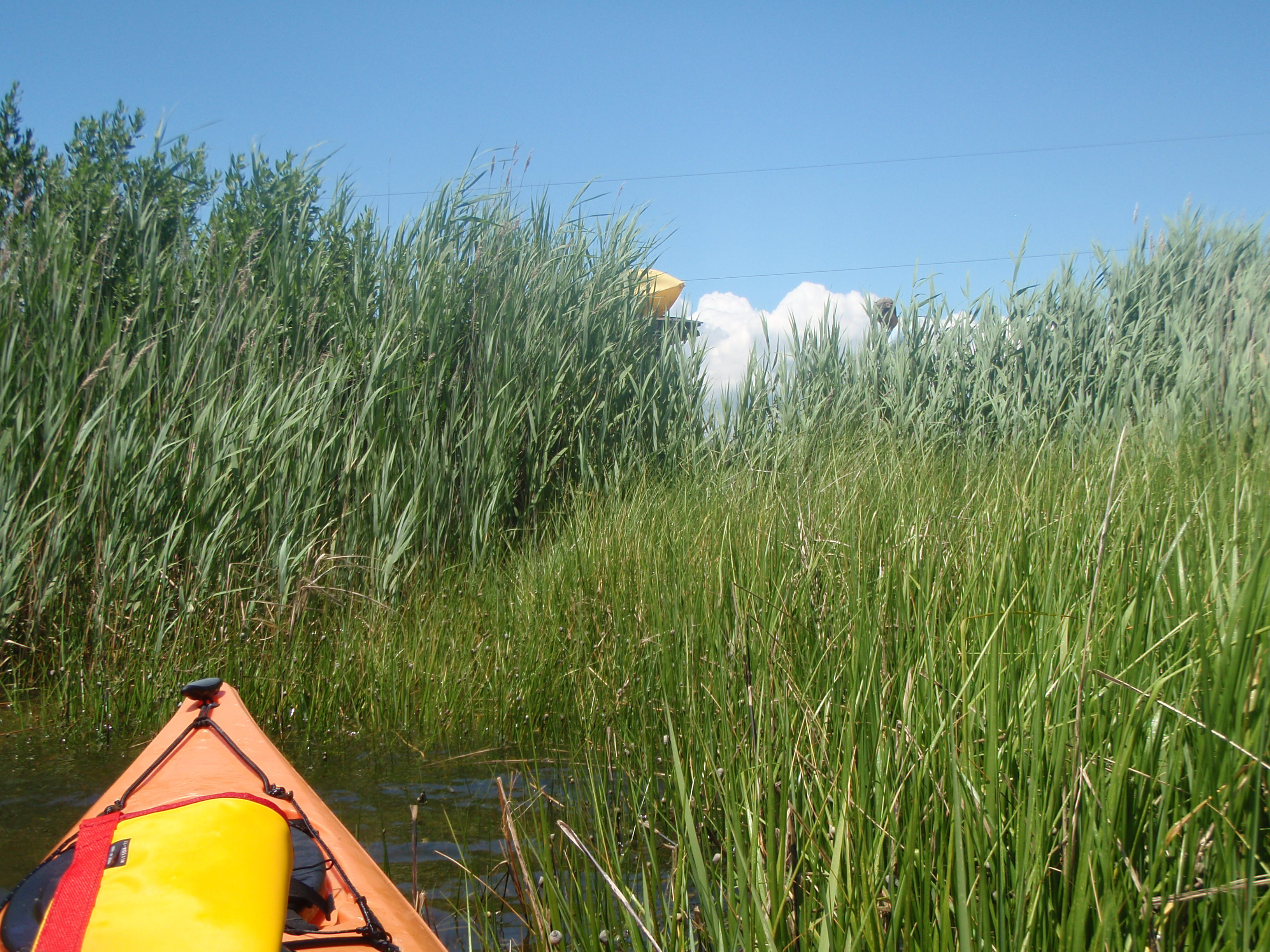
One of the cool things about Assateague is that they have campsites that you can kayak to.  The last people I saw on this trip were on their way back from a campsite.  However, even though these people were the last people I would see, I still had 10+ miles to cover at that point!

OLYMPUS DIGITAL CAMERAA little further down the bay, I finally spotted some ponies!  When I am driving on Assateague I get annoyed because they cause traffic jams and mobs of silly tourists.  But for some reason when I see them in a remote part of the island, it’s really exciting.  There were a bunch of them chilling in the marsh but as I got closer to snap some photos, they slowly moved inland so my pictures aren’t that exciting.

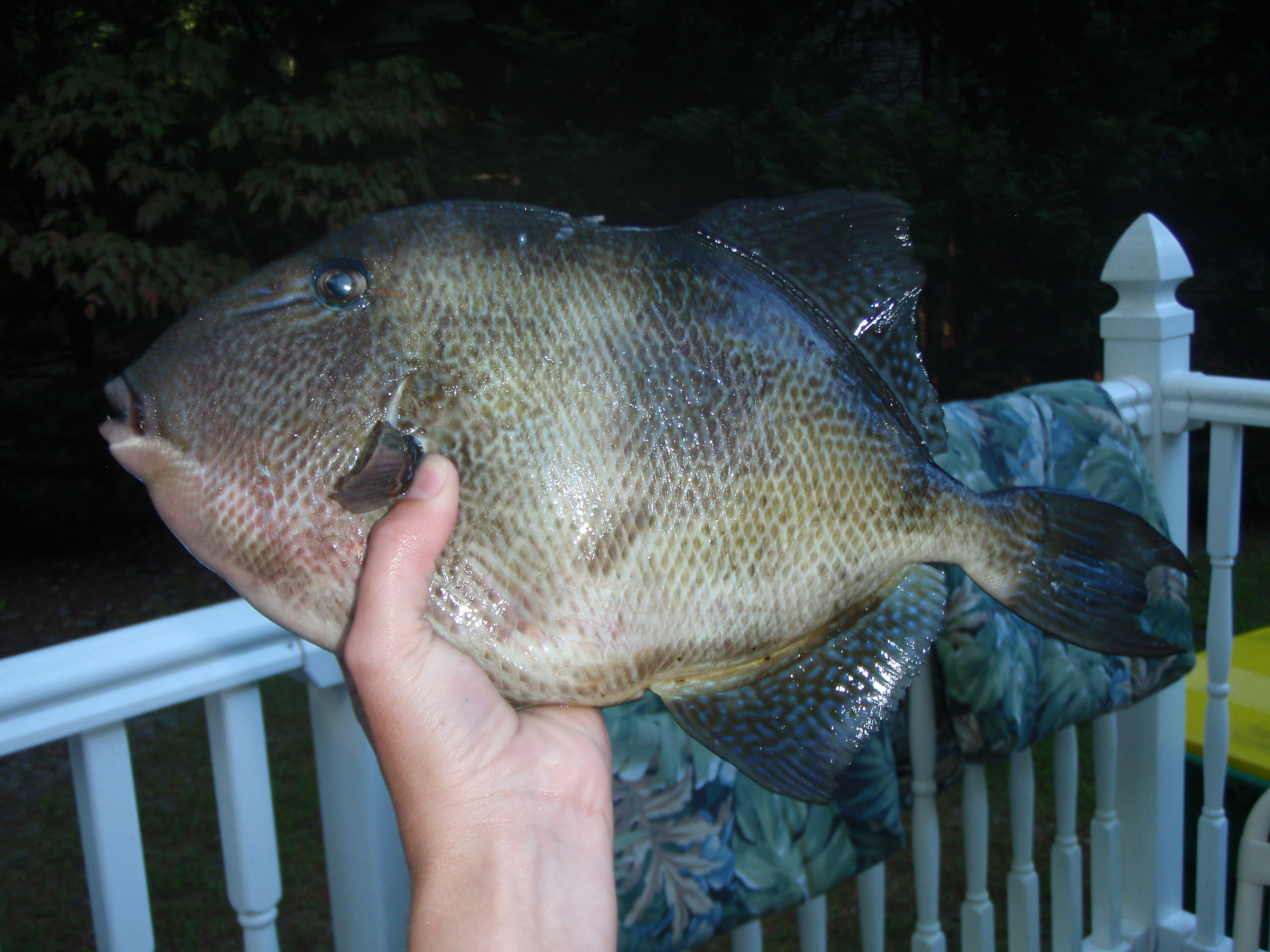
I took a quick break to eat a sandwich before heading straight across the bay to Truitt’s Landing.  I had it in my head that I was not far from the finish line.  I simply had to paddle across the bay, right?  No. Wrong.  I had to use all the energy in my body and all the motivational thoughts in my head to complete this last section of the trip.  The first mile wasn’t so bad (I saw huge jellyfish and a giant sting ray!) but the last 5 miles or so were complete torture.  My arms weren’t just tired, I was in pain.  When I finally made it next to land, I was extremely relieved.  However, I pulled out my phone to check the map and realized it was just a little marsh island and that I still had another 2+ miles or so to go!

The last stretch was killer.  I was talking to myself, singing songs, anything to motivate myself and not give up.  Even when I saw Brian’s car at the landing, I was 3/4 of a mile away!  When I FINALLY pulled up at the landing, I almost started to cry.  Not sure if it would have been tears of joy or tears of sheer pain, but I was able to keep my composure.  My arms were so sore that I had to sort of roll and shimmy out of my kayak, instead of my normal hoist and hop out!

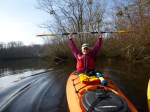
I had plans to go to the gym the next morning.  That sure as hell didn’t happen!  But no big deal because seriously, look at this path on the map!  Sooo incredibly proud of myself.  16.5 miles completed in 5 hours and 11 minutes.  Not bad.

And you know what?  Not only was this the longest trip I’ve ever completed, I’ve now officially completed the seaside coast of Maryland in my overall goal of paddling around the entire peninsula.  Sweetness.


Leave a comment

Williamsville, DE to Ocean City Inlet

OLYMPUS DIGITAL CAMERAToday, August 25, 2013, I paddled from the MD/DE border to the Ocean City Inlet.  Brian dropped me off at the Bayside Community’s “The Point”, a section of the Bayside development that has not yet been developed, except for a kayak storage area, a screened-in pavilion, a fishing pier, and a boat ramp.  This is so close to the Maryland border that I think I only took about 5 paddle strokes before I was in Maryland waters.

Today’s path was probably the most boat-traffic-heavy stretch that I will encounter.  You’ll notice in the map below that I stayed close to land as much as possible.  However, the first stretch was pretty quiet as I paddled around some marsh islands, away from the boats and jet skis.  Even though the hustle and bustle of Ocean City was not far to the east, the marshes and wooded islands of the Assawoman Bay seemed like a world away.  There were even old hunting shacks and duck blinds (something that I would think to be in only remote areas of Delmarva) that I didn’t expect to see.

OLYMPUS DIGITAL CAMERA  OLYMPUS DIGITAL CAMERA

After I passed the undeveloped marsh islands though, I kayaked passed the Lighthouse Sound golf course and several giant mansions; quite a change in scenery.  I then paddled underneath the Route 90 bridge and stopped at the Island of Wight Wildlife Management Area.  I was exhausted and needed a lunch break!

I continued on across the mouth of the St. Martins River.  There was quite a bit of boat traffic so I paddled as fast as possible to cross the channel and get close to land again.  It’s funny though – when I’ve kayaked in Talbot County, all the boaters slow down when they see a kayaker.  Here however, nobody slowed down.  But I’m not sure if I’m upset about that or not.  Although I appreciate the courtesy when someone slows down, I also enjoy paddling through their wakes!

Anyway, my next encounter with boat traffic was an annoying one – jet skis.  Ugh.  I hate them for many reasons.  It appeared that a jet ski rental company had “reserved” part of the bay to bring all of their customers.  It was marked with buoys and there were at least 15-20 jet skis zipping around in a gazillion different directions.  And right in the middle of my intended path.  These people clearly don’t own a jet ski (hence why they are renting) and most likely have no idea what they are doing.  This is why I’m terrified of jet skis.  To keep safe, I paddled around the buoys to stay out of their way, but I was still a little on edge, wondering if some idiot was going to leave the designated area.

Portage across the marsh

Portage across the marsh

I finally made it passed the jet ski zone and headed through a small marsh creek that was supposed to lead me to the next portion of the bay.  However, I took a wrong turn and just found a dead end.  I didn’t feel like back-tracking so I just decided to portage (it was only about 15 feet, not bad).  It was at this point in my journey that I really started getting tired, but just in time, because the outgoing tide really started to flow and helped to carry me through the rest of the journey.

OLYMPUS DIGITAL CAMERAI finished the trip by passing Hooper’s Crab House, underneath the Route 50 bridge, passed Stinky Beach and finally met up with Brian, who I found fishing around the docks, just inside the inlet.  I stayed with him for a few minutes as he fished, but I was exhausted, and all I wanted to do was get out of my kayak!

I then paddled into Sunset Marina and completed my 12.8 mile journey!

AND Brian caught 2 triggerfish for dinner!

OLYMPUS DIGITAL CAMERA     OLYMPUS DIGITAL CAMERA

Here’s the path I took:


Leave a comment

George’s Island to Queen’s Sound

It’s been exactly one year (to the day!) since I completed the first leg of my overall goal.  After today’s leg, I’ve paddled just over 66 miles in 20 hours and 18 minutes.  I’m just about 10% complete (don’t forget the overall goal is to paddle around the entire Delmarva peninsula).  Today I paddled from George’s Island landing in Stockton, MD to Queen’s Sound landing which is along the Chincoteague causeway.  My first border crossing!  And another cool thing – I finished the first leg on June 24 last year at Queens Sound (but I obviously came from the opposite direction this time).  None of these coincidences were planned either.  I just realized as I was looking at my records a few minutes ago.

IMAG1227I drove to George’s Island landing, just east of the tiny town of Stockton.  This landing is probably the most gorgeous landing I’ve seen yet.  I love driving down a back road, usually wooded with a house here and there, and then all of a sudden, the landscape opens up and you’re right on the waterfront.  This landing overlooks Chincoteague Bay, Assateague Island way off in the distance, and a few islands (I’m thinking one of them was George’s Island at one point).  Before I took off, I snapped a few photos at the landing, just because this spot was so… the word enchanting comes to mind, but I feel like a nerd using that word.  But whatever, it was enchanting.  There was a man fishing from the bulkhead that even tried to convince me to buy the house that was right on the water.  Tempting at $200k but probably not the best investment with the increase in strong storms we’ve been seeing.

The first 7 miles of this 8.6-mile trip were lovely.  Even though I was paddling directly into the wind, it was pretty easy.  Much easier than yesterday’s paddle when I was paddling into the wind at an angle the whole time.  I took a quick break on a spit of land near Greenbackville, and another break at the Captain’s Cove development.  Brian was going to pick me up when he was done work so I sent him a text to let him know I’d be at the landing in about an hour and a half.

The last stretch of the paddle was tough.  Not as rough as yesterday’s paddle, but it was definitely not as lovely as the first couple miles of this trip.  I took my time paddling into the wind, careful not to wear myself out.  I was only moving at about 2.5 mph, but I was making headway and feeling pretty good.  It wasn’t until I had about a mile left that I hit a shallow spot.  So shallow that it turned into a mud flat.  Ugh, portage.  It was nice to give my arms a break and use some other muscles, but holy cow, trudging through the mud and dragging my kayak behind me was way more exhausting that paddling against the wind!

I did however get to see some cool stuff in the water.  Lots of crabs (thank goodness for my closed-toe Tevas), anemones, and a terrapin!  Since the water was so shallow and I was not in my kayak, she was easy to spot and easy to grab!  I kept her just long enough to snap a photo and let her continue on her way.  This sort of cheered me up and made me stop bitching at the mud flat for a few minutes.

FINALLY I got into water that was deep enough to paddle again!  The last mile or so was exhausting, but I finally made it under the Chincoteague bridge and completed the paddle at the boat ramp at Queen’s Sound landing.  I wish I had more pictures to share with this post, but somehow I deleted all but one of them.  None of them were life-changing, earth-shattering shots, but it would have been cool to show some of the sights and the terrapin!

Take a look at my path.  If you zoom in enough on the section between the causeway and Captain’s Cove, you’ll see the line is not as smooth.  This is where I had to portage across the mudflat.  Not fun 😦


2 Comments

Guardshore to Saxis

I have to say that after this paddle, I am extremely happy to be on solid ground again.  The weather forecast said winds were out of the south at 10 mph.  It was more like out of the southwest at 20 mph.  My arms feel like Jell-o, I’m sure my shoulders will be sore tomorrow, and I can feel phantom waves when I close my eyes.  On the bright side, I feel extremely accomplished after battling the wind and waves for just over 9 miles!

Brian paddled near Deal Island yesterday when I was at work and caught 4 good sized speckled trout.  Because the fishing was good and I wanted to complete another leg, we decided to head to the same general area, only this time a little further south from where he had fished.  He dropped me off at Guardshore landing, just outside Bloxom, VA.  I like this area a lot because of how remote it is (although not having a cell phone signal is a little disconcerting).  For 90% of the trip I did not pass one house, boat, power line, or really any sign of life — no birds, no turtles, no jumping fish — just marsh grass and waves.  Lots of waves.  It was so choppy that I was getting a little seasick.  Plus it didn’t help that Brian wanted to fly through all the back roads to get there and I was already feeling slightly carsick.  Ugh.

With a slight threat of thunderstorms, I didn’t want to mosey around in the marsh and explore much.  I was pretty set on paddling a straight shot, getting a workout, and getting off the water before any afternoon storms started to brew.

Here’s the path I took; notice the long straight-aways across open water – not my favorite type of paddling, but good exercise:

I did take a break about half way through the paddle, just to get off the water and cut down on my nausea.  I even portaged across the marsh a little ways, just to continue the journey but savor a few moments on land.

I took a video to show the choppiness, but I’m not sure it really does a justice.  Either that or I’m just a wimp.

Choppy Chesapeake from Laura Baldwin on Vimeo.


I was pretty stoked when I was entering a small creek and getting out of open water.  I could also see some houses in the town of Saxis so I was relieved that the worst was behind me.  Or so I thought.  For whatever reason, paddling in that creek was probably the most difficult paddling I have ever done.  It was like the wind was being funneled through the creek which made it nearly impossible for me to make any headway.  I was literally grunting and yelling out in pain as I paddled against the current.  In the middle of my little temper tantrum though, a sign of life — a family in a small boat, setting out a trot line.  I can’t imagine what they thought of me if they heard me over their little motor, but they just smiled and waved, and I did the same.

I finally rounded the last bend and came up to the town of Saxis.  It is a teeny tiny waterman’s town in the middle of nowhere.  I love these little desolate Chesapeake towns.  It’s like rewinding 50 years and you can just feel that Chesapeake culture by looking at the town and the landscape.  I can’t really explain it, but I’m sure some people would concur that there is just something special about them.

I wasn’t quite finished the trip though because I told Brian I would meet him at the end of Saxis Road, which was just around the bend and then another half mile or so.  At least, according to the map on my phone.  As I passed the last little crabhouse, Brian pulled up in his car and honked at me.  I figured he was just waving and saying he saw me, he was off the water, and he’d meet me at the end of Saxis Road.  The last mile of the trip was very rough, but actually really fun.  The wind was at my back and I was able to ride several waves as they pushed me towards the end.

Then the phone rings.  It’s Brian: “Where are you?! I thought you were getting out at the landing! I pointed to the landing when I saw you, where did you go?!”  Umm… to the end of Saxis Road, like I told you to begin with.  “You passed the end of Saxis Road!  That’s where I saw you!  Where am I supposed to pick you up now?”  Umm… no I didn’t pass the landing.  My GPS says it’s right around the corner from where I am now.  You’re supposed to meet me there.  “I don’t understand where you are! Why did you keep going?  Do you want me to leave Saxis?  Because I’m leaving Saxis now.”  This argument went on for a few minutes.  I finally hung up and finished the trip.  Turns out, there is no public landing where I finished.  After a little more confusion, Brian found me and I was able to find a spot to get out near his car.  It was definitely no boat ramp or kayak launch, but it worked.

OLYMPUS DIGITAL CAMERA

Can you see his kayak on top of his car between the grasses?

Once I was on dry land and about to collapse with fatigue, the argument continued.  Turns out, my map had road names that did not match the road signs.  So what we thought was a miscommunication was really an error on the map.  Frustrating.  But don’t worry, even after a stupid argument, the wedding is still on 🙂

Oh, and when we got home, we saw that there was a small craft advisory in effect.  Oops.


Leave a comment

Cedar Island to Folly Creek

Continuing from the previous blog post!  Brian and I camped on Cedar Island but instead of returning to Wachapreague with him, I continued up north toward Folly Creek.  Before packing up camp though, I was able to capture some cool sunrise shots — not something I’m usually up early enough to see 🙂

OLYMPUS DIGITAL CAMERA  OLYMPUS DIGITAL CAMERA

I knew I had ground to cover (or water, whatever) and Brian was only planning on fishing and heading back to Wachapreague.  I didn’t want to keep him waiting forever at the Folly Creek landing so I paddled hard and got a workout (I also wanted to complete this leg before the tide started going out).  The winds were dead calm and the water was like glass which made for a really peaceful paddle.  Sometimes I’m really amazed at how silent the world can be when you’re that far away from civilization.

OLYMPUS DIGITAL CAMERAAs I paddled northward, the old Coast Guard station on the north end of Cedar came into sight.  I believe it is pretty much abandoned now but might be owned and used by a sportsmen’s club of some kind now.  I did not paddle to the station though.  I veered off into a creek that led to the west a little bit instead.  This may have been a mistake though.  I had Google Earth on my phone to help me navigate through the marsh creeks, but I STILL got lost!  I had to stop several times and stand up on my kayak to try and see where I was headed — the right way, or up a dead end.  I probably hit about 3 or 4 dead ends and had to back track several times before I was able to find the main channel again.

I finally completed this 9-mile stretch at the Folly Creek landing.  I finished literally minutes before the tide changed and minutes before Brian pulled up in the parking lot.  PERFECT timing to say the least.  Unfortunately, my phone died only 20 minutes or so before I finished so I was not able to record the exact path that I took.  Had I not gotten lost in the marsh, I would have had time to record the whole thing!  Anyway, here’s the path I took up until that point:


4 Comments

Wachapreague to Cedar Island

P1010943It was Memorial Day weekend and we decided we wanted to get away from the crowds.  Brian and I headed to Wachapreague, VA on Sunday with way more gear than we normally bring for a kayaking trip because this was our first attempt and camping by kayak!

Our goal was to reach Cedar Island before low tide so that we weren’t paddling against the incoming tide.  We reached Cedar in just under 2 hours.  There were a good number of daytrippers on Cedar so we went a little further and explored Dawson Shoals and the north tip of Parramore Island.

P1010957

Brian had been out this way for work back in March and he was amazed at the geographic changes that had occurred to the islands   in just 2 months.  The southern end of Cedar Island had eroded away and Dawson Shoals had increased in size.  Although I didn’t know what it had looked like before, I am still always intrigued and amazed at the dynamics of barrier islands.  You’ll see in the map that it appears we kayaked straight across land, but that is now water (gives you some idea of the change).

I stopped tracking our path at this point so I could power off my phone to save battery.

We spent maybe 2-3 hours on Parramore; Brian fished and I explored.  We are technically not supposed to be on Parramore Island (it’s regulated by the Nature Conservancy, but Brian sometimes has work out there so I felt entitled) so after the tide started to come in, we headed back to Cedar Island to set up camp.

OLYMPUS DIGITAL CAMERAIt took a little strategizing to find the perfect spot.  If we camped right on the beach, we were afraid the tide was going to come in too far.  If we camped too far inland, the bugs were TERRIBLE.  We walked up the beach a little ways, but we didn’t want to go too far north or the people staying at one of the houses (there are 3, I think 2 of them are abandoned) could see us and we weren’t totally sure we were allowed to camp there.  So we sucked it up, put on some bug spray and set up camp above high tide and slightly in the bushes.  However, once we started a fire, the bugs weren’t so bad and it ended up being quite pleasant.

I’ve only camped on a beach once and it was terrible – so windy that our tent stakes were pulled out of the ground and our tent started to blow away.  This was WAY better.  There was no wind and the temperature was perfect.  We couldn’t have asked for better weather.  And the STARS WERE AMAZING!  There were so many stars visible that I couldn’t identify constellations (something I’m pretty good at) because there were so many extra stars from what I’m used to seeing back home.

Next blog post will pick up the next morning!


Leave a comment

Winter Paddling in Snow Hill and Assateague

I’ve been wanting to try paddling in the winter for a while now, but I never had the proper gear to go – until Christmas.  Santa (aka Brian) brought me a wet skirt and neoprene gloves to get me started.  Then I stopped in Survival Products (in Salisbury) to check out their kayak clothing.  Well it was clearly my first visit to that store because they had nothing but kayaks and wood stoves.  And no clothes except for a half price, “farmer Jane”, perfect-size-for-Laura wet suit.  I love the thrill of finding a good deal!

I guess I’m exaggerating when I say winter paddling.  It was almost 60 degrees on both Saturday and Sunday this weekend, but the water temp was in the 40s so still pretty chilly.  On Saturday we leisurely paddled the Pocomoke River, launching in Byrd Park in Snow Hill.  Check out our path:

The best thing about this paddle was how calm it was.  I haven’t paddled water like this in a long time; made for some great photos.  Although Brian didn’t catch any fish and the wildlife sightings were minimal (a few buffleheads and a few eagles), it was SO nice to get outside in the middle of January.  And the highlight of this trip – the goats.  Yup, found 2 goats on an island.

On Sunday we headed out to Assateague from South Point Rd.  The tide charts said low tide was around 2:30 so we had plans to do a bit of clamming.  We arrived at the launch and it was far from low tide.  Just when I think I have figured out all the quirks about tide cycles, we get it completely wrong.  Needless to say we didn’t collect any clams, but it still turned out to be an adventure because of the fog!

I hate to say it, but I actually forgot my phone on this trip.  Brian had his GPS though so navigating through the dense fog wasn’t really an issue, except for the fact that it was really quite creepy.  Not being able to see land in any direction is unnerving.  We only lost sight of land for about 20 minutes but that was plenty!  Because I forgot my phone, here’s the path I think we took:


Leave a comment

South Point Road to Ocean City Inlet

Yesterday’s paddle was simply a warm-up for today!  Today was also much more enjoyable than yesterday.  I started out at South Point Road Landing (which is off 611, the road that takes you to Assateague).  Brian dropped me off around 10:00 and I was to meet him near the Route 50 bridge where he would be tautog fishing all day.

The first 2 miles were a little rough.  Although I had a nice tail wind (12 mpg SSE), it tossed me around quite a bit.  If it was summer time, I would have had fun riding the small waves and being rocked around.  However, the threat of capsizing and hypothermia freaked me out a bit so I decided to paddle close to the shoreline.  However, after about 2 miles I rounded a small point of marshland and the wind seemed to be affecting me much less.

Once the wind died down I was able to relax and enjoy my surroundings a little bit more.  Here’s a quick recap of the wildlife I spotted today: horned grebe, brant, bufflehead, canada goose, pony, common loon, ghost crab, green crab, and various gulls and shellfish.

After crossing under the Assateague bridge, I pulled up to an old state-owned boat launch.  This particular launch has a crabbing pier that we used to go to when my family vacationed to this area when I was a kid.  I even remember a time when I was about 10, we were all crabbing off this pier when some girl asked my Dad if she could borrow his pliers.  Or maybe a knife, I don’t know.  Of course he said yes, she took them, and then proceeded to throw them in the water.  Yeah, not a great story, but for some reason that story stuck with me.

I took a break to stretch my legs and wandered into the Assateague welcome center which is new and really fancy.  Almost too fancy.  It’s a park people, not a museum.  But don’t worry, I won’t use this blog to express my feelings about the National Park Service….

After a quick snack I made a bee-line to the island.  I headed straight towards a large sand over-wash that looked like it could’ve happened during Hurricane Sandy.  I am always fascinated with barrier island migration, plus a fresh over-wash makes the perfect kayak landing!  I was tempted to take a long walk on the beach but low tide wasn’t too far off and I wanted to reach my destination before the tide changed.  I just wandered around for a few minutes, took a few pictures, and continued on.

As I pushed northward, I had to stop and be a complete tourist because, well, PONIES!!  Yes, I stopped to look at the ponies.  I even snapped a few photos.  Ugh, I was being the exact person I complain about in the summer.  At least I wasn’t stopping any traffic!

After another mile or so the water began to get really shallow.  Like 4 inches shallow.  I really wanted to paddle along the shoreline of Assateague but that was not going to happen.  Even after I altered my course slightly to the west, it continued to be shallow.  So shallow that I came to an island that was surrounded by a giant mud flat.  I was starting to get warn out and I really didn’t feel like paddling around it so that called for another portage adventure.  Luckily the mud was pretty hard and it was pretty easy to walk across, dragging my kayak and all my gear behind me, but anyhow, I was quite winded by the time I reached the other side.  I’d say it was at least 100 yards (but I’m a really bad judge of distance).

I stuck close to the marked channel for the last stretch of this trip.  I didn’t spend much time sightseeing as I was getting close to the tide change and I didn’t want to get stuck  paddling against the incoming tide.  I could not however, miss the incredibly gaudy and huge houses along the shoreline.  At first when I see these houses I think “wow, I wonder what these people do for a living that they can afford that” and then I quickly think “really?  do you really need a house that looks like a castle with palm trees? palm trees in Maryland? really?”

I was always a bit nervous about paddling near an inlet so I took my time and stayed focused on boat traffic as I passed by the Ocean City Inlet.  It wasn’t bad.  I’m glad that I paddled this stretch in the off-season though.  I can’t image what it would have been like at the height of the season.  Although I’ve driven over the Route 50 bridge and visited the amusement parks at the boardwalk many times, it was weird to see it all from this angle.  This will probably be the only time I take pictures of roller coasters and ferris wheels from my kayak!

I concluded my 11 mile journey at the Homer Gudelsky Park, or as the locals call it, “Stinky Beach”.  It was perfect timing because Brian was running out of bait and was just about finished fishing for the day.  Here he is, my knight in shining armor.  Or more like, my silly fisherman in tacky yellow plastic!  And it was the perfect end to my day because he caught dinner!  A 17″ tautog 🙂


And here it is!  Check out my path:


Leave a comment

George Island – Truitts Landing

I have definitely been lazy as far as this kayaking blog goes, but I finally got back out on the water today, November 11.  Today I headed to Chincoteague Bay with Brian.  He dropped me off at George Island Landing which is just east of the tiny little town, Stockton, MD.  I headed north, my destination being Truitts Landing which is near the town of Girdletree, MD.

I was amazed at the clarity of the water today.  Even when I was in 4-5 feet of water, I could still see straight to the bottom.  I’m not sure if that was because I was paddling in a less developed area?  Or maybe because the angle of the sun in the fall is different than what I’m used to?  It was surprising though, considering the amount of rain we’ve had with Hurricane Sandy and the last nor’easter.

Another thing that I found interesting was how far Assateague Island looked from where I was paddling.  I knew from looking at Google Earth that is was nearly 5 miles away, but still, it just seemed weird.  Here I was paddling in a coastal bay and it just seemed like the barrier island should have been closer.  There were quite a few islands between the mainland and Assateague.  Some of them even had old, abandoned houses or hunting shacks on them which was cool to see.  I decided to go slightly off course to check one of them out.  The closer I got, the nicer the house looked.  And by the time I was less than 100 yards away, I realized it was really well maintained and there were people in the yard!  I don’t know why, but this was unexpected to me.  Of all the little houses and shacks I’ve seen out on marsh islands, none of them are maintained and actually have people living in them!  Maybe it was George of George Island Landing?

I finally found Brian (the fishing was not good) and reached Truitts Landing in just under 2 hours, covering 5.22 miles.  Check out my path:


Leave a comment

Isle of Wight WMA

On October 1st I launched at the Isle of Wight Wildlife Management Area which is located off Route 90, heading into Ocean City, MD.  I was under the impression that this piece of land was an island.  Hmm… not so.  The launch is located on the south side of Route 90 and from there I started out going east.  I looped around the “island” and was back where I started in about an hour.

There was one minor snag in this trip – a need to portage.  As I began to realize that this piece of land was not an island, I was already a mile and a half into my trip and I did not feel like turning around.  I paddled right up next to St. Martins Neck Road and got out.  After waiting for what seemed like forever for the traffic to die down, I was able to awkwardly carry my kayak across the street and place it into the water on the west side of the road.  A few people driving by stared at me with curiosity as they drove by so I was a little embarrassed, but hey, it got me where I wanted to be a whole lot faster!

Unfortunately I did not take any photos on this trip.  It was kind of a spur of the moment outing and there wasn’t anything worth taking photos of anyway.  Except my ridiculous portage adventure!