laura paddles delmarva

Circumnavigating 600 miles of Delmarva's shorelines


Leave a comment

Stemmer’s Run to Grove Neck

I was able to paddle 8.8 miles today, but only 4.1 really counted towards my circumnavigation goal. I always like to paddle a one-way trip, rather than an out-and-back, but sometimes I can’t avoid the out-and-back due to geography and the lack of someone to shuttle me, or safe roads to ride my bike on.

Last year I headed up to the upper shore and paddled from Still Pond Station to Betterton Beach, and then paddled a 4-mile round trip from Betterton to a peninsula called Grove Neck and back to Betterton. You can see that trip here:

Today I paddled to Grove Neck from Stemmer’s Run boat ramp, located about 4 miles to the north. 

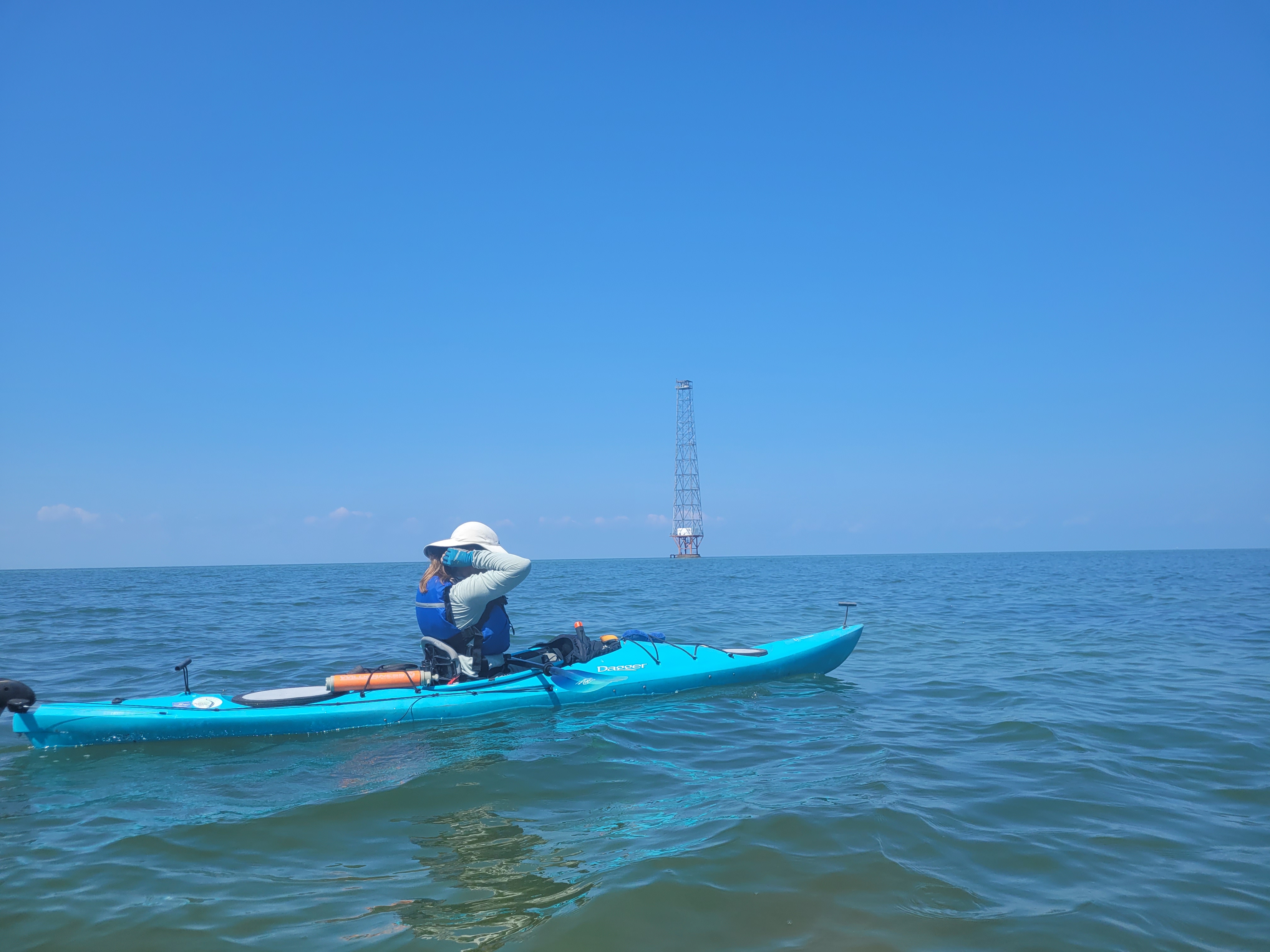
I had some commitments in the afternoon (Patrick got to meet his 1st grade teacher!) so I hit the road just after 5 a.m. to head up to Cecil (!!! first time paddling in Cecil!) County. I got on the water around 7:30 and started down the shoreline. Winds were near calm and the water was flat.

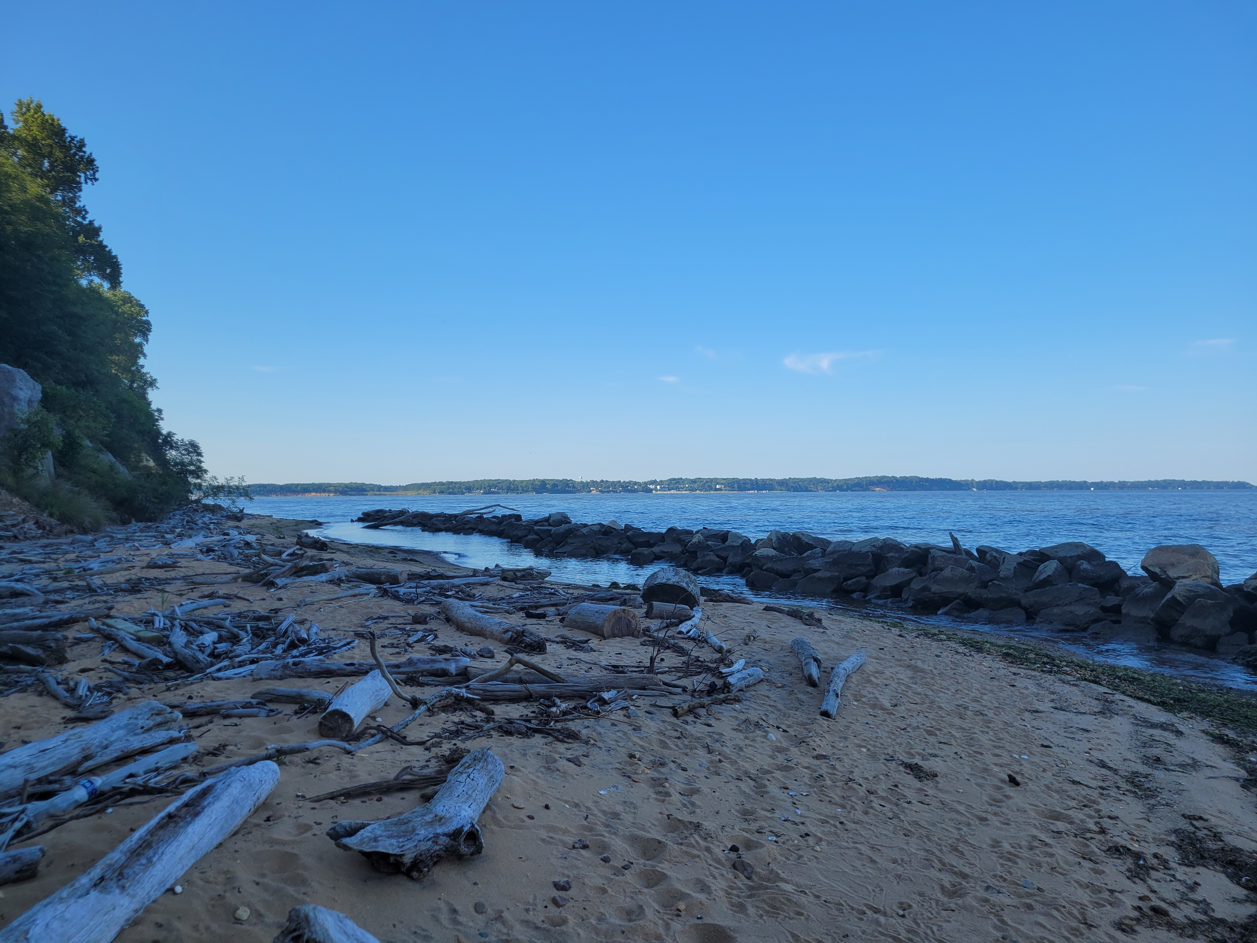
One thing I noticed as soon as I launched, was that there was a LOT of grass in the bay. Rafts of grass were floating about, sometimes completely engulfing the crab pot buoys! I’d imagine the local watermen may have had a hard time locating all of their pots because their colorful buoys were covered in dark green grasses!

The calm winds didn’t last though. What little wind there was, was coming out of the NE and I didn’t realize it at first, but the Elk Neck/Turkey Point peninsula was providing shelter from the wind when I first launched. But the further south I went, the more fetch there was for the wind to create some waves coming out of the NE. 

The last half mile before I reached the point along Grove Neck where I head left off last year, was, well, a little nerve-wracking. I wasn’t in any real danger, and I definitely have more confidence since taking a women’s sea kayaking course in June (run through Cross Currents Sea Kayaking – check them out!), but the turbulent water, coming from an awkward direction, made me nervous since I was paddling alone this time.

I successfully made it to the spot where I ended last year, right near a property where the landowners somehow installed a concrete boat ramp at the bottom of their VERY steep descent from the house to the water. I can’t imagine backing a boat trailer down that thing!

And although there were some steep cliffs along the edge of Grove Neck, there was a small beach right by my turnaround spot, allowing me to get out for a minute to stretch and catch my breath (the beach was also covered in that grass).

The return trip was a lot less stressful going into the wind. Some people may think paddling against the wind would be more difficult, but when a wind is coming from behind at an angle, maintaining direction and stability is a little more challenging. When I paddle INTO the wind, I can see every wave coming and sail right over them. And just as expected, once the elk neck peninsula was between me and the direction the wind as coming from, I noticed calmer waters as I headed back north.

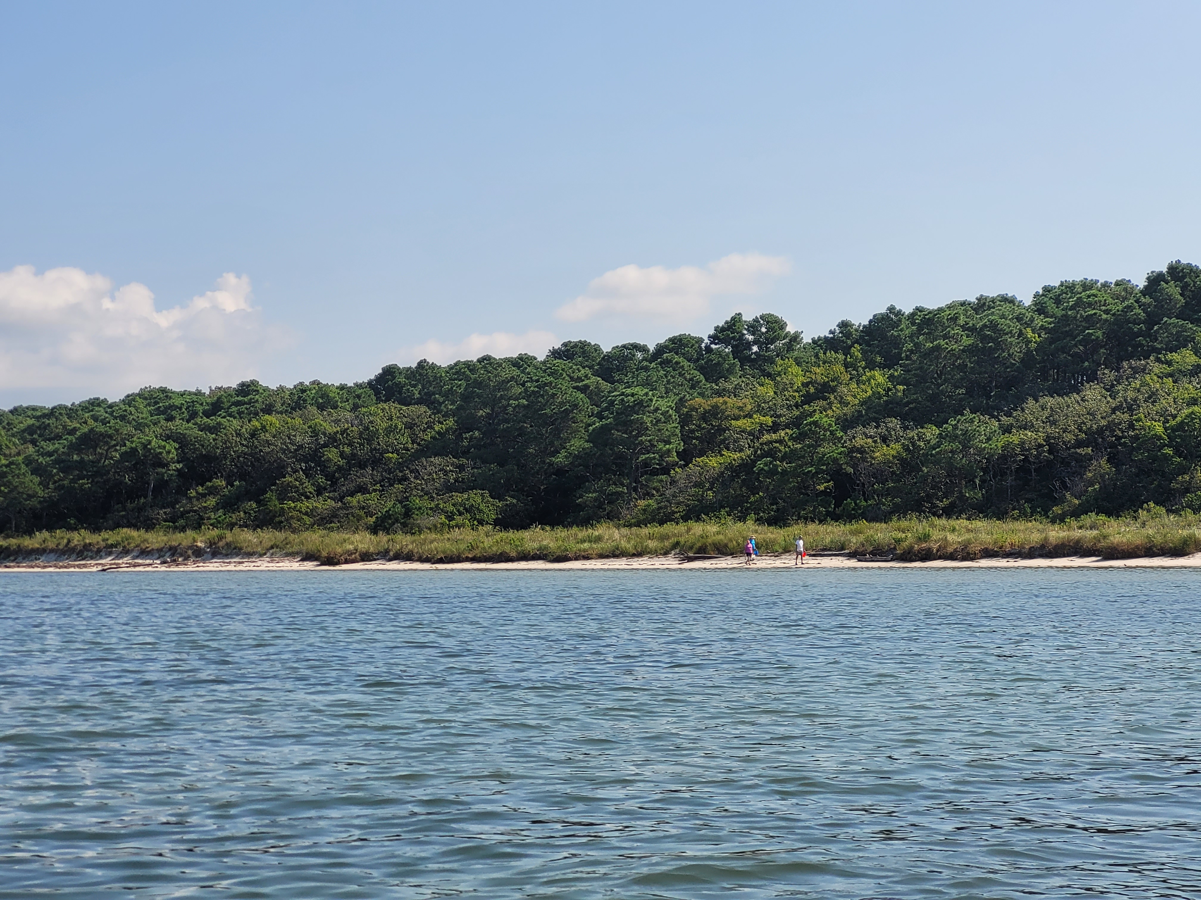
On the way back, I decided to hug the coast a little more than I did on the way down. I saw on the satellite images that there was a small marsh creek and some beaches off to the east that I wanted to explore. I paddled into the calm waters of the creek, but unfortunately, the beaches were covered in “no trespassing” signs. I obeyed orders and never got out on the beach, and instead, headed back to the boat ramp to call it a day.

One thing that I noticed on the way back, and completely missed on the way out, was that you can see the Turkey Point Lighthouse from here! It may have just been a white speck amongst trees, but it was still cool to see a lighthouse while paddling. And I don’t normally get excited for bald eagle sightings (they’re like any other ol’ bird nowadays), there were TONS of them around! Adults, juveniles, everywhere. It was kinda cool.

Here’s the path I took today, both to and from Grove Neck. Just 52 miles left to my goal! (scroll down for a few more photos too)


1 Comment

Lambert Shellfish to Morley’s Wharf

I’m closing in on completing all the shorelines around the Virginia portion of Delmarva! Today’s paddle was on the lower shore, Chesapeake side, where there are very few public access points. For years, I wasn’t sure how I was going to complete this section without paddling some 25-30 miles in one day. I had searched for Airbnb properties to rent, but most were way out of my price range.

Luckily, through my work with Virginia Water Trails, I got the opportunity to tour an oyster farm in Machipongo, located at the mouth of Hungars Creek, about halfway between Morley’s Wharf and Cape Charles. The owner, Alex, welcomed me back to launch my kayak there, so today I did just that!

I also had a paddling buddy today, my friend Lisa, who paddled the stretch from Oyster to Red Bank with me about two years ago. We left Berlin around 6:15 this morning and headed straight to Lambert Shellfish, which was about an hour and 45 minutes away. We unloaded our kayaks and gear and then drove to Morley’s Wharf. I had pre-arranged a shuttle through a local company called Wave Riders, so we left Lisa’s truck at the boat ramp and our driver picked us up right on time and took us back down to our kayaks.

We launched right near some of the long lines of thousands of oysters (read more about this oyster farm here!) and started our journey north. Not 5 minutes after we launched, we started spotting tons of stings rays and schools of stripers. I couldn’t believe how clear the water was and how well we could see into the water – it also could have been my new polarized sunglasses 🙂 The bay bottom was covered in some kind of sea grass, and between the sting rays, the stripers, needlefish, and crabs, the bay felt so healthy and full of life! And as we gazed around, the various shades of turquoise colors in the water and the white sandy beaches made me feel like I was somewhere in the Caribbean – it was breathtaking.

Despite the calm winds and beautiful weather, we barely saw any boat traffic for almost the entire trip. And although we did see a few families enjoying the beaches in front of their bayfront homes here and there, this part of the bay felt like a hidden gem.

I guess one reason we didn’t see many boats was because of the shoals. It was low-ish tide when we paddled through, and in some areas we had to strategically maneuver around so we didn’t run aground. There was only one point where I needed to get out and drag my boat a little, but I wasn’t complaining – the scenery and the opportunity to stretch my legs was perfect.

As we continued on up the coast, we saw a nice variety of houses, along with a wide variety of shoreline protection techniques. Rip rap, bulkhead, two-tiered bulkhead, groins, breakwaters, and natural shorelines. Our favorite to paddle by is of course natural shoreline. Not only is it the most environmentally friendly and aesthetically pleasing, it also absorbs any wave energy. In previous posts I’ve talked about how I hate paddling by bulkheaded land if there’s any breeze, because the waves just bounce off the wall, making for an odd, bouncy current that jostles my kayak around in unpredictable ways. I call it the “backslosh.”

An interesting feature of this trip was the giant tower just offshore from Silver Beach. We had to do some research later and found it to be a navigation aid to freighters headed for Baltimore – very cool!

Right before we headed into Occohannock Creek, we took a quick break on a rugged beach. We spotted what we think was an eagle nest, as well as fresh deer tracks that led right into the water – bummed we may have missed a swimming deer sighting! We also collected a huge amount of plastic debris in less than 10 minutes, which Lisa stowed away in her hatch to dispose of later.

While the wind and tide were helping us the whole way today, as soon as we turned into the creek, it seemed like the wind shifted and we were paddling directly against it. I also didn’t feel fatigued at all until I spotted Morley’s Wharf in the distance. It’s something about seeing the finish line that always makes me tired, particularly when it’s a good 1.5 miles away still!

Once we were off the water, we packed up, and celebrated our 14.2 miles with a stop at the Great Machipongo Clam Shack. This place is a gem – not the tourist trap I always thought it was. I’ve been to the clam shack three times now and have never been disappointed by their fish and shrimp tacos. I also love how it was originally a McDonalds, but has been converted into the clam shack for the last 25 years. Oh, it’s also for sale, so if anyone is looking for a new venture, maybe this is your chance!

I’ve now paddled 542 miles of my ~600 mile goal. Here’s the path we took today: