laura paddles delmarva

Circumnavigating 600 miles of Delmarva's shorelines


1 Comment

Port Mahon to Collins Landing

I am happy to report that I paddled with a GROUP of people on my most recent trip! The sections that I have left in the upper Delaware Bay have always intimidated me. Tidal currents can be very strong, and the area is very remote, so I was on a mission to find other experienced paddlers to join me.

I recently attended a women’s sea kayaking course through Cross Currents Sea Kayaking. The instructors were awesome! If you ever have the chance to take a course with Paula Hubbard, Marilyn Cooper, or Sammantha Magsino, do it. I learned new techniques, refined some techniques, and learned how to connect with other paddlers like me. The whole course was a big boost of confidence.

Shortly after the course, I posted in the Chesapeake Paddler’s Association facebook group, looking for others to paddle with. Only two weeks later, and I found myself planning a 16.5-mile stretch in the Delaware Bay with four other kayakers, all who are more experienced than me. They evaluated charts and max flood times, and decided which direction to paddle and when to launch on our selected day (July 22).

With my busy mom schedule, and all of my busy mom friends, I’m used to it being VERY difficult to align schedules to do anything fun. But the stars really aligned on Saturday and I was thrilled that even the weather and air quality were shaping up to work out in our favor.

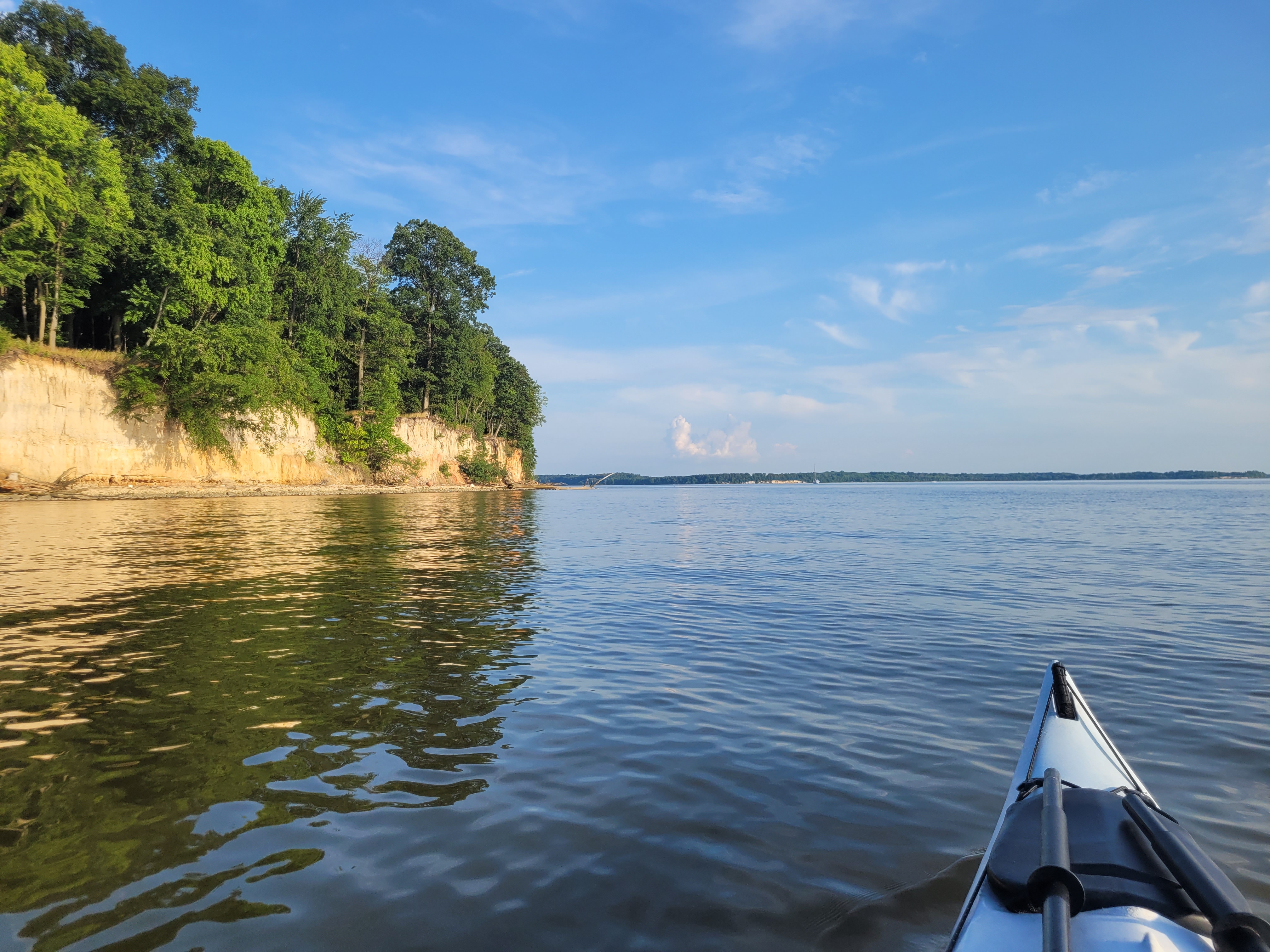
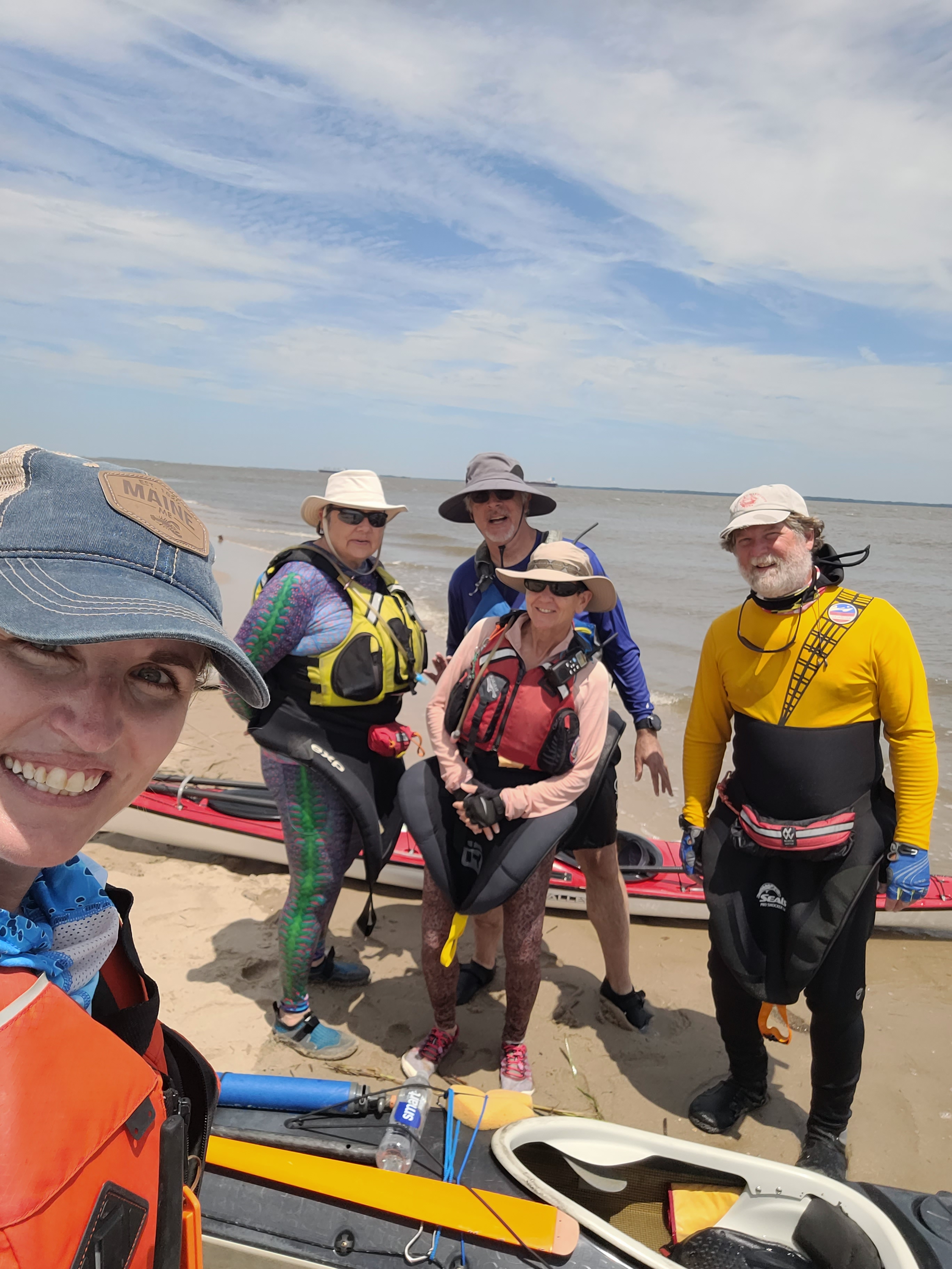
I met up with Mike, Samm, Adam, and Gail at the Port Mahon boat ramp at 7:30 on Saturday morning. I had met both Mike and Samm before, and I was excited to paddle with all of them. We unloaded our kayaks and gear, and then did the car shuffle to leave 3 cars at Collins Landing. We launched around slack tide and started our northward journey. The last forecast I looked at indicated that the winds would be 5-10 knots out of the NW, but it seemed like it was more of a northerly wind, closer to 10 knots. In other words, it was a little choppy and we were paddling directly against it. I appreciated Mike asking me shortly after we launched if I was okay with the conditions. I said I was fine because I was with them! If I had been paddling alone, I probably would have bailed in those conditions. Not because I couldn’t handle it, but just because I wouldn’t have felt safe paddling alone.

Because it was choppy, I opted not to take my phone out to take photos while we were paddling, but I’ll do my best at remembering and describing what we saw.

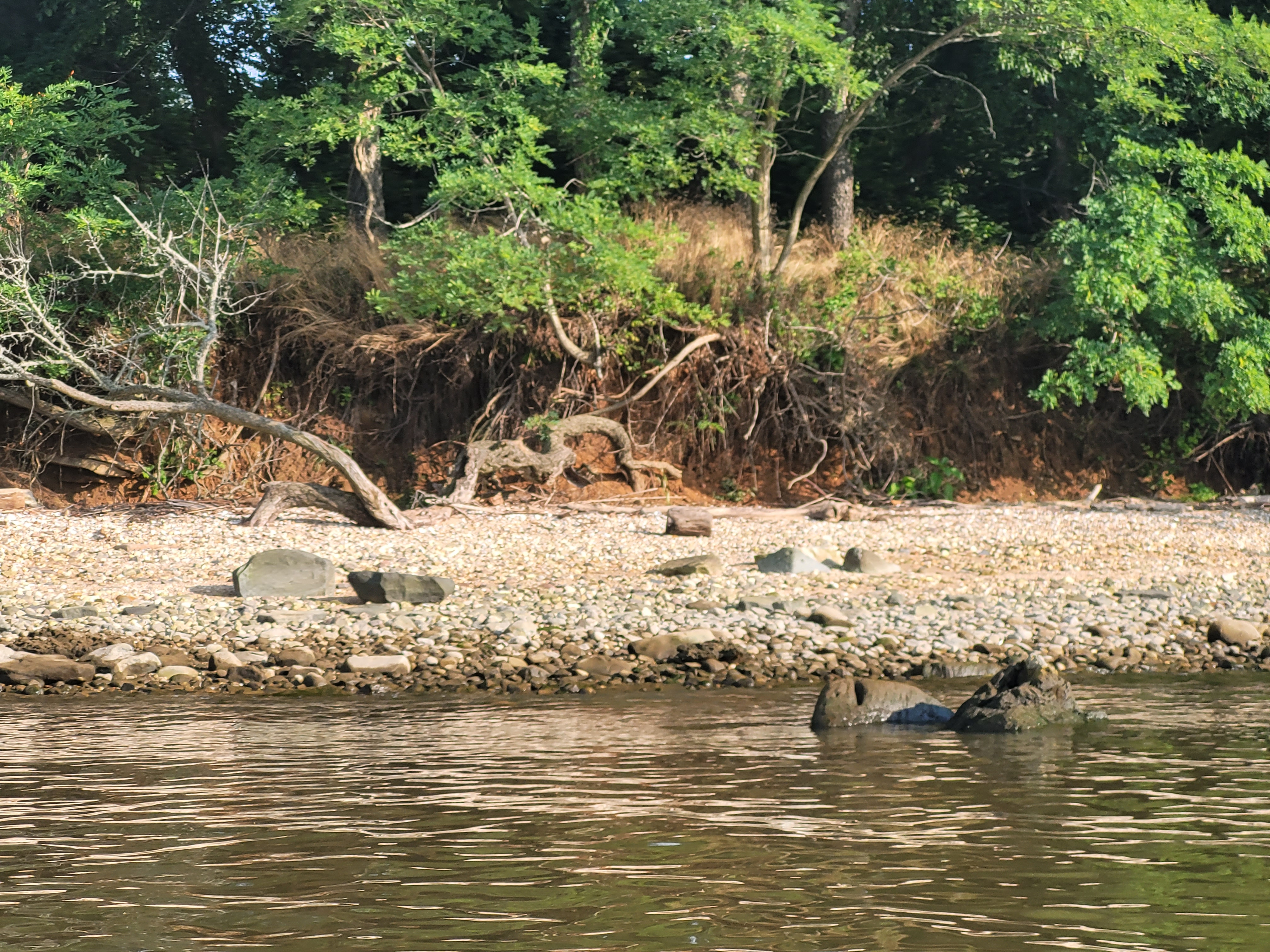
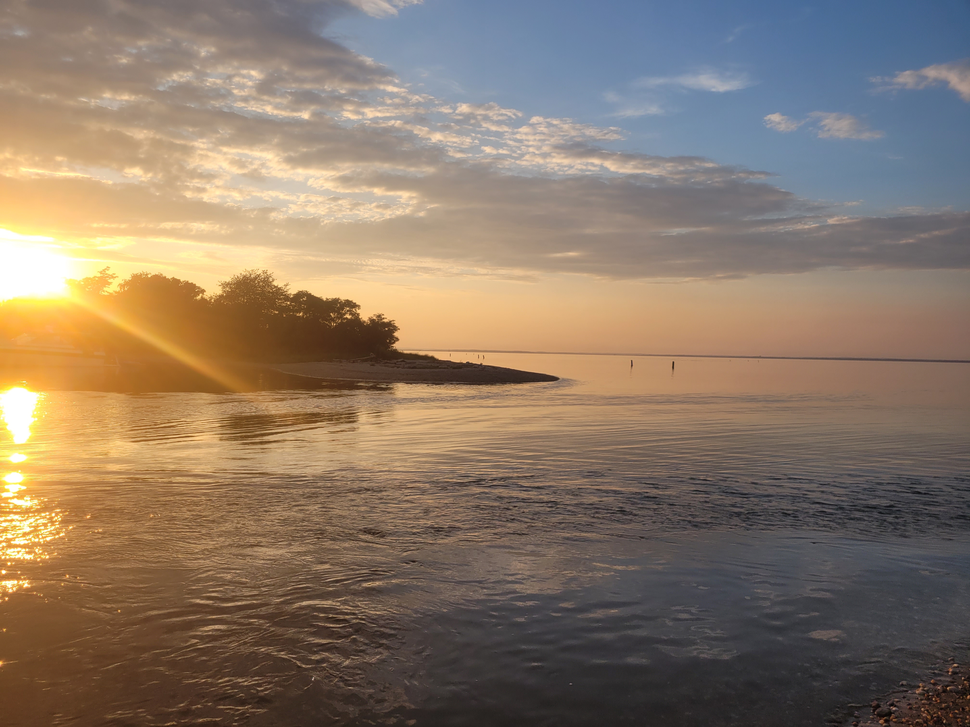
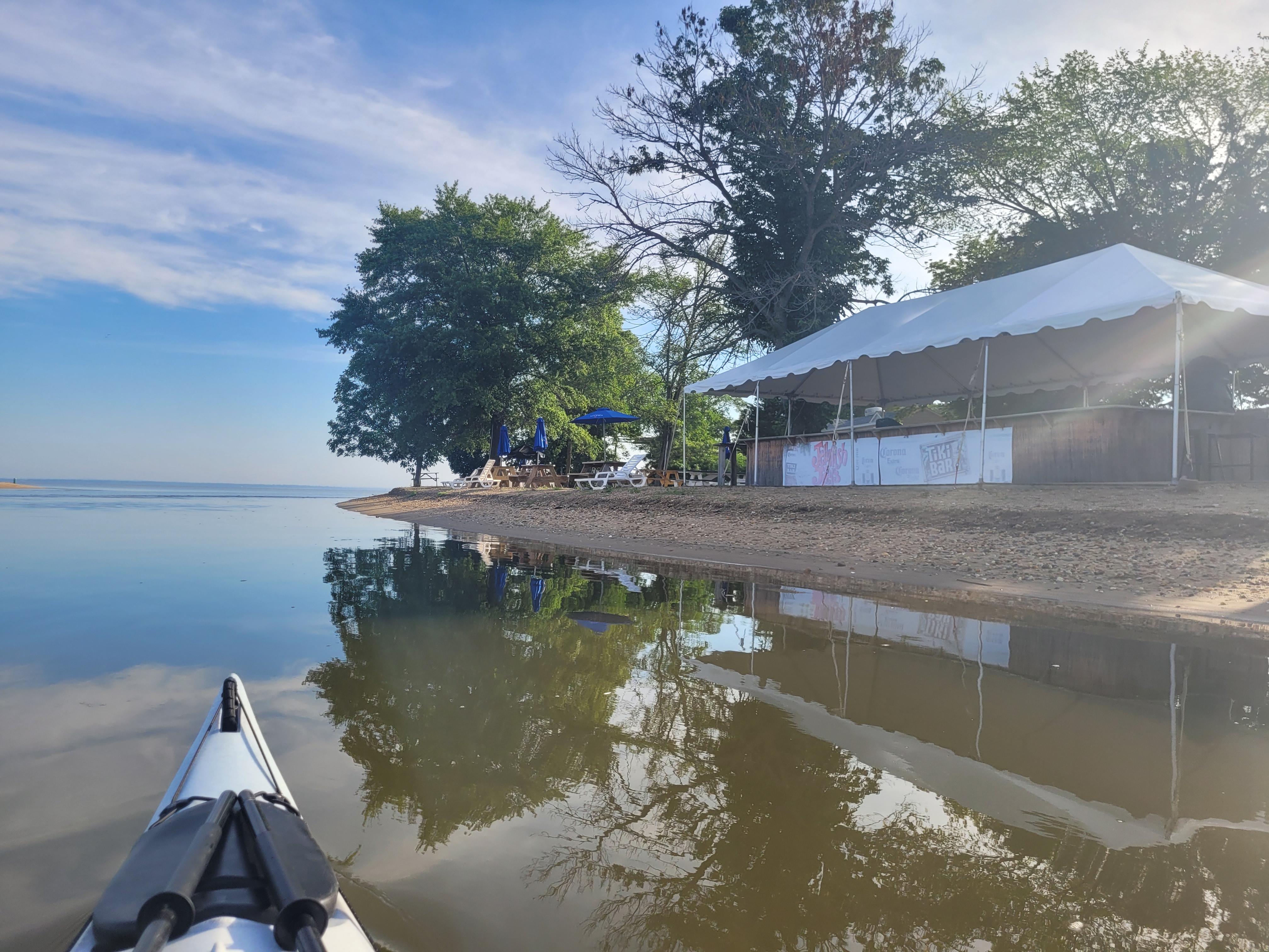
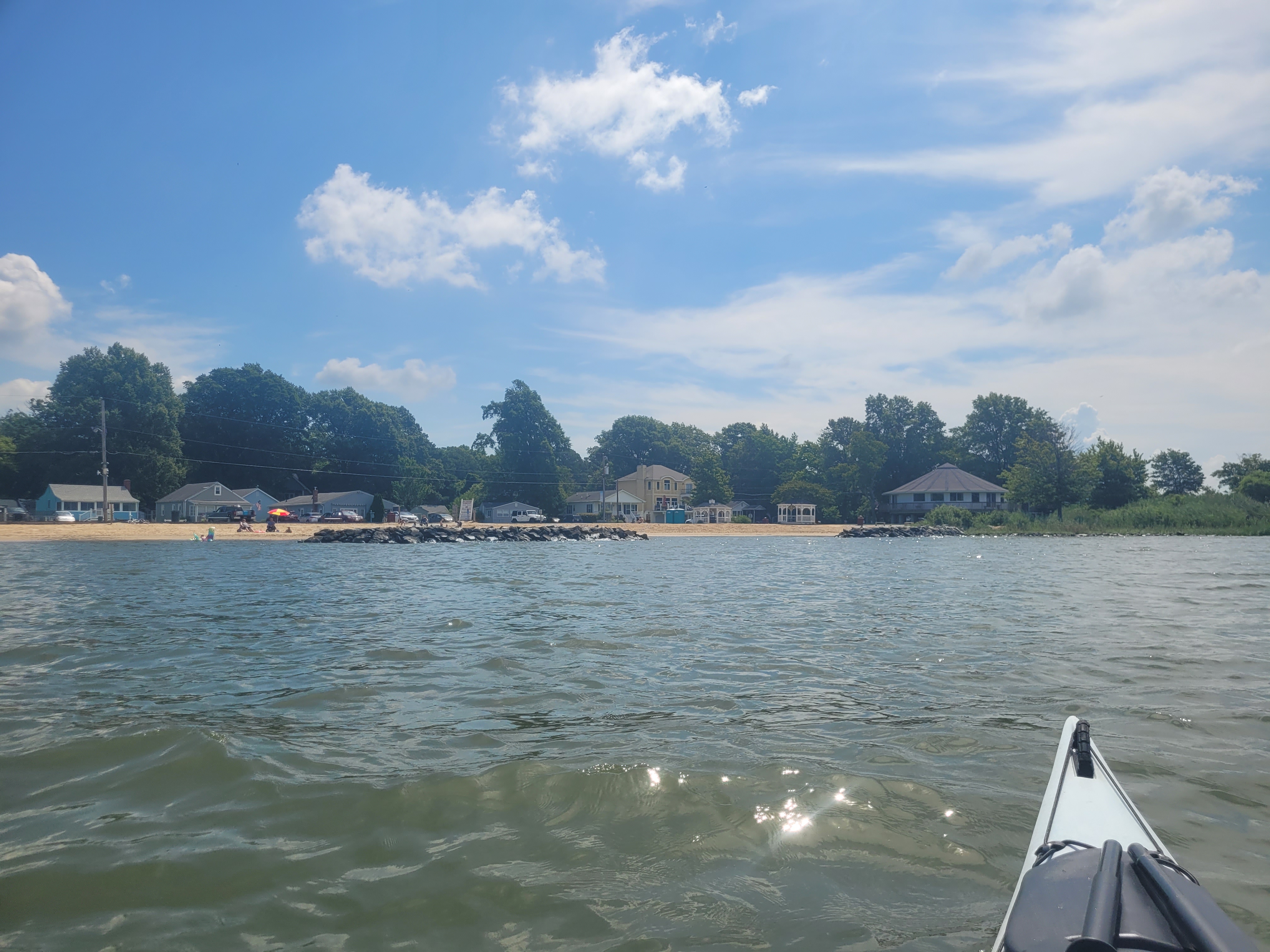
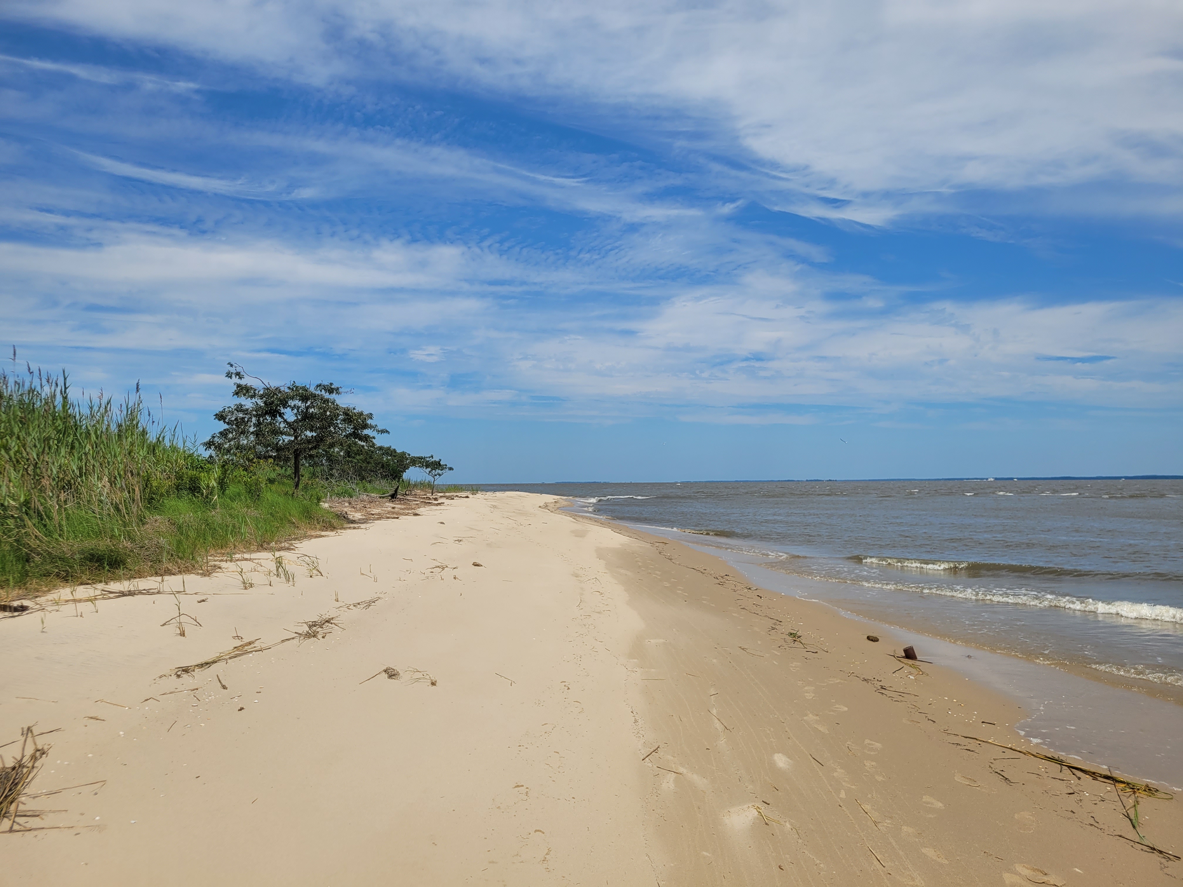
Aside from passing the tiny village of Woodland Beach, I think the entire 16.5-mile journey was along undeveloped shoreline. I don’t remember seeing a single structure. There did appear to be remnants of structures, like a pile of broken concrete slabs and another 50-yard wall made out of large concrete blocks, but that was seriously it. We saw a handful of eagles, a sting ray, and of course some horseshoe crabs, but wildlife seemed scarce as well. But it was beautiful. I always say the Delaware Bayshore is Delaware’s most underrated and under-appreciated region.

Another interesting thing to note about this trip was the occasional small, standing wave, or small sections of waves that were breaking differently. There are several creeks that feed into the bay, so our assumption was that there were some small shoals or sand bars just outside the mouth of the creeks that caused this. Between the headwind that was opposing the tide, and the shoals underneath, it kept things interesting. Samm even commented that the conditions were perfect for keeping things fun and interesting, but not too challenging – I agreed.

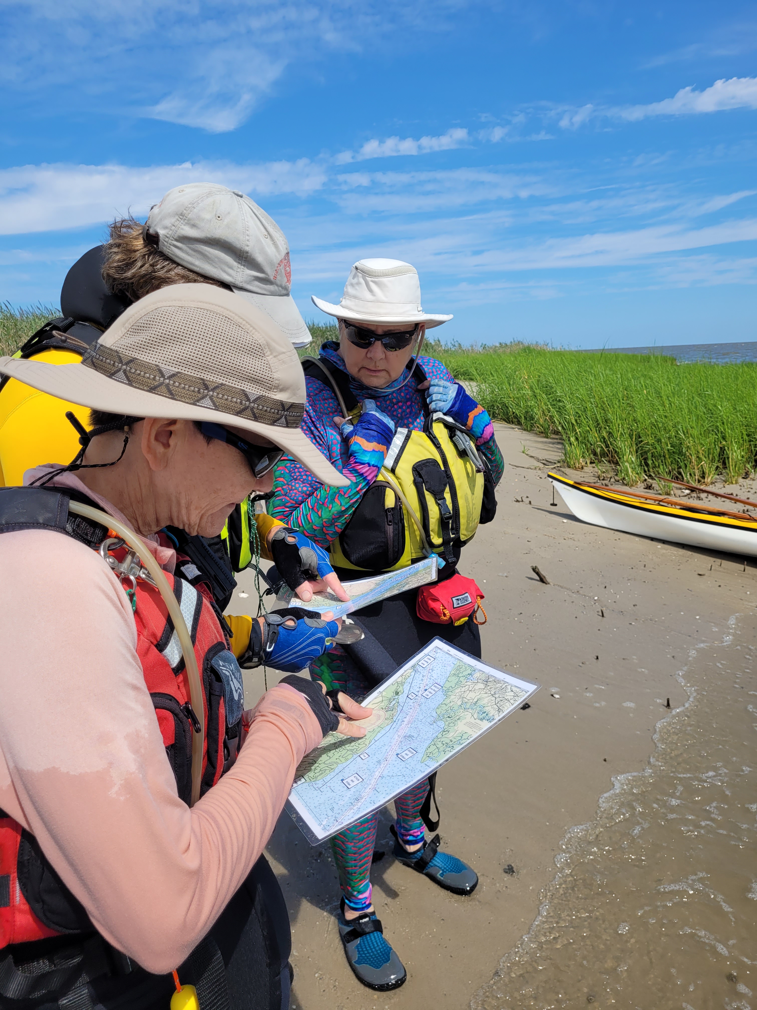
We stopped at two different beaches to stretch, eat lunch, and check out the charts that Samm and Mike had brought. I learned some navigation skills years ago when I worked on boats (you know, which actual maps and a compass), but I haven’t really used those skills while kayaking, so I enjoyed looking at their charts and figuring out our location. From now on, I plan on bringing a laminated chart with me when paddling new areas. I’ve become too reliant on my phone to navigate these days!

I’d say somewhere around the 14-15 mile mark, I was beat and ready to be done. I kept up with the rest of the crew, but I was really starting to feel it. My arms (and my neck… strange?) were getting sore. Also around the 14-15 mile mark, Mike asked me if I wanted to practice some rescues since I don’t get the chance to very often. While I so appreciated the offer, and practicing rescues is always a good thing, I declined the offer because I was wiped. Gail also chimed in and said she was ready to be done since she had a long drive home. Hopefully I’ll get another chance soon to practice rescues!

When we finally pulled into Collins Landing, I looked at Strava and saw that we had completed 16.6 miles. It did take us 6 hours, but that included some beach breaks and paddling against the wind the whole time!

Adding such a long stretch to my map later that night made me feel so accomplished! I had stressed about the upper Delaware Bay portions, but now I’m excited to go back and finish soon. Here’s the path we took:

Finally, I am so grateful to Mike, Samm, Adam, and Gail for making the trek out to the Delaware Bay and paddling with me. I hope to paddle with them again soon!


Leave a comment

Upper Chesapeake Part 3: Ingleside to Rock Hall

The last planned leg for my little Kent County getaway was just a 6.5-mile stretch from Eastern Neck National Wildlife Refuge (the launch site is known as Ingleside) to Ferry Beach in Rock Hall. When I checked the weather before going to bed the night before, I saw there was a 20% chance of storms starting at 8 am, and since the 20% chance the day before turned into a huge downpour, I took it seriously. I set my alarm for 5:30 in an attempt to paddle and be off the water by 8 am.

Luckily, when I check the weather again in the morning, the storm window was pushed later into the afternoon. I decided to go back to bed until 7 since I was still exhausted from the day before. AMA and I got to have coffee together before I packed up and headed out, and she agreed to meet me at the beach in Rock Hall around 10:15.

I headed down to the refuge and launched at Ingleside by 8:30 am. There was absolutely no wind and I cruised through this stretch very quickly. I wasn’t too sore or tired from my 20 miles the day before, only my hands hurt a little from gripping my paddle all day.

I again saw an interesting variety of houses, dodged a few work boats, and pulled up on the beach in Rock Hall just before 10:15. Another perfect timing.

I didn’t take many photos on this leg, probably because I was kind of over taking photos since I took so many the day before. I didn’t see much out of the ordinary, except a cool RV campground that was right on the water and a good handful of bald eagles.

I paddled 6.5 miles in an hour and 40 minutes – that’s 3.9 mph, a RECORD average speed for me! Here’s the path I took:

Once I got to the beach, I locked my kayak to the same gazebo. AMA and I then explored Eastern Neck National Wildlife Refuge by foot, but the bugs were out in full force so we cut our visit short and headed to lunch in Rock Hall! After lunch it was time to load my kayak, say goodbye and head home.

I felt so very accomplished as I drove home. The unpredictable weather had me worried I wasn’t going to complete all the miles I wanted to in this trip, but somehow I made it work! I logged a total of 27 miles, connecting legs I had previously completed at Eastern Neck NWR and Still Pond and Betterton Beach.

I am also SO GRATEFUL to have company on this trip, and a free shuttle service so I didn’t have to ride my bike or do out-and-back trips. It really was great to spend some one-on-one time with my aunt, catching up on life and reminiscing about years ago. I’m sure my mom was looking down and smiling 🙂

I have now paddled 510 miles of my ~635 mile goal! I’m now setting a goal to finish before my 40th birthday. Less than 4 months left!


Leave a comment

Upper Chesapeake Part 2: Still Pond to Fairlee Creek

After AMA and I checked into the Airbnb, we decided to take a stroll into downtown Chestertown. I wanted to put off paddling another leg until 5 or 6 pm since there was a chance of pop-up storms in the afternoon, so we had some time to kill. We walked out the front door and it started drizzling. Our Airbnb host offered us umbrellas so we took her up on the offer.

We walked about 100 yards down the driveway and into the street and it began to DOWNPOUR. We quickly decided to head back to the house and just chill out. Good decision. It poured for a good half hour and thundered a little. I was glad I chose to wait a while to paddle!

While we were in the house just chatting, I finalized my plan for my sunset paddle. I would drive up to Still Pond Station Park, launch, and paddle down to Fairlee Creek, this time ending on the beach at the restaurant I had seen that morning, thus avoiding the strong currents and cutting my paddle short by about a mile. AMA agreed to meet me at the restaurant beach around 8 pm.

I had already paddled north out of Still Pond Station last year, so I knew what the launch looked like. My plan was to check the radar one more time before I launched, just to be sure all the storms were gone for the day, but I had zero signal. I did my best to analyze the clouds and listen for thunder, and all seemed well so I began unloading my kayak. Holy COW it rained a lot earlier! I must’ve had two gallons of water in my cockpit! Luckily, I had my bilge pump handy to get the water out before launching.

While it was absolutely beautiful paddling into the sunset, it was also HOT! I was paddling directly into the sun and sweating more than I did during the peak heat of the afternoon.

I didn’t let the heat get to me too much though. I rarely paddle at sunset. In fact, I rarely even SEE the sunset! Ever since I had Patrick, it’s always dinner time, homework time, bath time, bed time… some kind of TIME that doesn’t free me up too often to see the sunset. So needless to say, it was a real treat to paddle at sunset.

The earth science nerd in me was intrigued by the size of the pebbles and rocks on the beaches I passed on this trip. Actual rocks and pebbles, not sand and marsh mud like the lower Chesapeake. The further up the bay, the larger the rocks and sediment!

Another notable thing from this trip was the number of sting rays I saw! I didn’t count, but it was in the dozens. I saw their wing tips breaking the surface, and sometimes they splashed around. In fact, one of them splashed so close to my kayak that I screamed! I had flashbacks to my encounter near Mockhorn Island back in 2015 when I stirred up -what I think was- a sting ray in about 6 inches of water. That one actually smacked the hull of my boat!

The first half of this trip was pretty chill and I felt like I was making good time. But as I rounded a point of land and realized that Fairlee Creek was still a good 4 miles away, I felt run down. I was ready to be done. I paddled about 3 miles across open water, and if you have read prior blog posts of mine, you know I hate open water. It’s boring and it feels like I’m making no progress because there’s no benchmarks or stationary scenery to judge my progress. But I’m here writing this post now, so clearly I made it to Fairlee Creek without any issue.

As I rounded the last little corner of land, I saw the restaurant (vacant – it is closed on Wednesdays), the beach, and AMA sitting at a picnic table. Again, good timing.

Here’s the 8-mile path I took:

I pulled up onto the beach right before hitting the weird currents, and snapped a photo of the sign warning people of the strong currents!

Now, AMA greeted me and explained that the restaurant was actually part of a private, gated yacht club, and a nice man let her in once she explained why she was there. All good, right? Not exactly. I then asked her, “how will we get back in when we return with my car to pick up my kayak?” Welp, that was the golden question neither of us had the answer to. I assumed everything would be fine and another nice person would let us back in, so I went ahead and locked my kayak to a picnic pavilion. I considered carrying my kayak outside of the gated area, but it was about a half mile walk – way too far to drag a kayak!

As we got in the car and started heading out, we stopped and asked a maintenance worker if he could let us back in when we returned “in about 20 minutes.” He agreed to stay a few minutes past the end of his shift to let us back in. Perfect.

Aaaannnd not perfect. We exited the yacht club, I opened google maps, and realized Still Pond Station (where my car was still parked), was 25 minutes away! It was almost 8:30 p.m. and we wouldn’t even be back until almost 9:30! We decided to press on, thinking “oh we’ll figure this out somehow.”

AMA drove me back to my car and followed me back to the yacht club. The gate was locked without a soul around. I called to see if they had any after-hours phone number, but couldn’t get ahold of anyone. I really didn’t want to leave my kayak there overnight because it would mess my plans up for a morning paddle. I seriously considered trying to carry it the half mile. We decided to walk around, in hopes of finding help. LUCKILY a nice man that was living on his boat was throwing something away in a dumpster near the front gate. I ran over to him and explained our situation. He agreed to grab his gate key and let us in. Thank goodness! I offered him money but he refused. We drove down to my kayak, got it loaded, and headed back to Chestertown.

By the time we got to Chestertown it was just after 10 p.m., we were hungry, and everything was closed for dinner. We ended up getting salads and snacks from Royal Farms and heading back to the house. After dinner and a shower, I slept so well that night!


Leave a comment

Upper Chesapeake Part 1: Fairlee Creek to Rock Hall

I finally got to log some miles in 2023! But before I get to that, a quick life update. I left my nearly 17-year career with Delaware State Parks back in February! For the last 10 years, I managed the Indian River Life-Saving Station Museum and all the interpretive programming at Delaware Seashore State Park. Making the decision to leave was hard (I literally went to therapy over it), but it was the right decision. My side-hustle has been growing and I was eager to start the next chapter. But I owe my passion for paddling all to that first summer I interned at the park in 2006, when I led kayak ecotours 4 days/week all summer long.

I’m now totally self-employed and it’s amazing! I make my own schedule and now I have so much more time and flexibility to do things with my family and to do things for ME! Like leaving town for two days to log some serious mileage.

Up until mid-June, I really hadn’t spent ANY time in Kent County, MD, but I took a women’s sea kayaking course in June off the Sassafras River. I spent the weekend in a tiny town called Kennedyville and enjoyed the rolling hills and rural scenery for two days. Spending that weekend inspired me to paddle more legs in the upper Chesapeake, but since it’s nearly 2.5 hours from home, it made more sense to do an overnight trip and paddle several legs, rather than driving up there 3 separate times for day trips.

I was so lucky to have a buddy join me for the non-paddling portions of my trip – my Aunt Margaret Ann (a.k.a. “AMA”). She was so kind to drive over from the western shore to shuttle me between paddles and keep me company at the Airbnb I booked in Chestertown. It was also really fun to catch up – something we don’t do nearly enough!

The first leg I paddled was the longest – a 12 mile stretch between Fairlee Creek and Rock Hall. I go up on Wednesday morning at 4:30 to drive up to Fairlee to launch. I arranged for AMA to meet me in Rock Hall around 11:30 a.m. so I would have a ride back to Fairlee.

I launched just before 7:30 and the winds were totally calm. Paddling up Fairlee Creek was like paddling on a mirror and effortlessly gliding through the water. But as I got closer to the mouth of the creek and into the bay, I noticed the incoming tide was RUSHING through the small inlet. It wasn’t choppy, but I could see some wacky little currents. I powered through with a little moment of panic when I thought I was about to fall in, but the funky currents didn’t last long, and before I knew it, I was in the calm waters of the bay. I glanced behind me at the restaurant at the mouth of the creek and it had a giant sign that said “NO SWIMMING. STRONG CURRENTS.” Yes, that sign would be correct. No way would I go swimming there, paddling was hard enough!

Since Kent County has a bit more elevation than most of the Delmarva peninsula, I was expecting to see some small cliffs most of the way, rather than marshes. While this was accurate, I was also not expecting to see as many beaches as I did! I even pulled over on a beach to take a 30-minute call for work! Yes, it was most definitely private property, but I stayed below the high tide line, so technically I wasn’t trespassing.

Another thing that struck me as interested was the number of cool houses along the way. Lots of variety in architecture, from rustic, overgrown bungalows to giant mansions with manicured lawns. Or as AMA describes them, “conference centers” LOL! I also spotted this cool old watch tower. Not idea what/who would’ve used it, but it was cool looking.

As I closed in on Rock Hall, I felt pretty accomplished. I haven’t paddled many long distances yet this season and I wasn’t even all that tired. I felt like I could’ve kept going on south to Ingleside. But since I made arrangements for AMA to meet me, and there were pop-up thunderstorms predicted for the afternoon, I stuck with the original plan to end in Rock Hall.

Here’s the 12.6-mile path I took:

Once I pulled up on “Ferry Beach“, AMA pulled in shortly after – perfect timing! I loaded my paddle, PFD, and other accessories into her car, and locked my kayak to one of the gazebos on the beach. From there, AMA drove me back to Fairlee Landing so I could take my car back down to Rock Hall to grab my kayak.

We had a leisurely afternoon exploring the Rock Hall area and grabbing some lunch. After that, we headed to Chestertown to check into the Airbnb. It was a newer listing so it was super affordable and the hosts were lovely. AMA and I had the entire upstairs of an 1870s historic home. It was two bedrooms, bathrooms, and sitting area, with a tiny glimpse of the Chester River through the trees, all for $100/night ($180 with airbnb and cleaning fees). Not bad!

See Part 2 for the next leg I completed that evening!