laura paddles delmarva

Circumnavigating 600 miles of Delmarva's shorelines


Leave a comment

Happy Campers Farm to Ragged Point

Last Wednesday, while at work, I checked the NOAA marine forecast and realized “whoa, like, the Chesapeake is predicted to be flat calm? Topping out at 5 kt winds? Must. Go. Kayaking.” I STILL have vacation time to burn even after my 2-week staycation, so I figured, why not? I have a conference call at 3:00 but I’ll be home in time for that. Nothing else pressing at work. I submitted my leave request and my supervisor approved it no problem (I mean, he’s a surfer, he gets it when the conditions are just right!).

Back in August, when I was planning out future legs of this journey, I was totally perplexed by how I was going to paddle from Cambridge to the southern tip of that peninsula in Dorchester, Ragged Point. It’s a 23 mile stretch with no public landings or boat ramps anywhere along the way to break up the 23 miles. And I really have no interest in paddling 23 miles in one day. Nope.

And then that’s when I had a brilliant idea – AirBnB! I hopped on and started searching for waterfront properties for rent and I kid you not, I found a wonderful spot that was EXACTLY halfway between Camrbidge and Ragged Point. Like down to the 0.1 mile. I messaged the hosts, told them about what I was doing, why I wanted to launch at their house, and that I’d even pay a fee to launch, even if I didn’t book their (very adorable) guest house. Lisa promptly replied and was more than happy to let me launch there – for free! How perfect! I told her I didn’t have an exact date in mind, since I very carefully watch the weather forecast, and that whenever I chose to paddle, it wouldn’t be much notice. She said she understood and said that was totally fine.

So that was back in mid-August when I made contact with her. And then on Wednesday last week I decided the conditions were just right to paddle that portion of the bay, so I sent Lisa a message on Wednesday morning. Within minutes she replied, said I was good to go, and that was that. I had a paddling plan for Thursday!

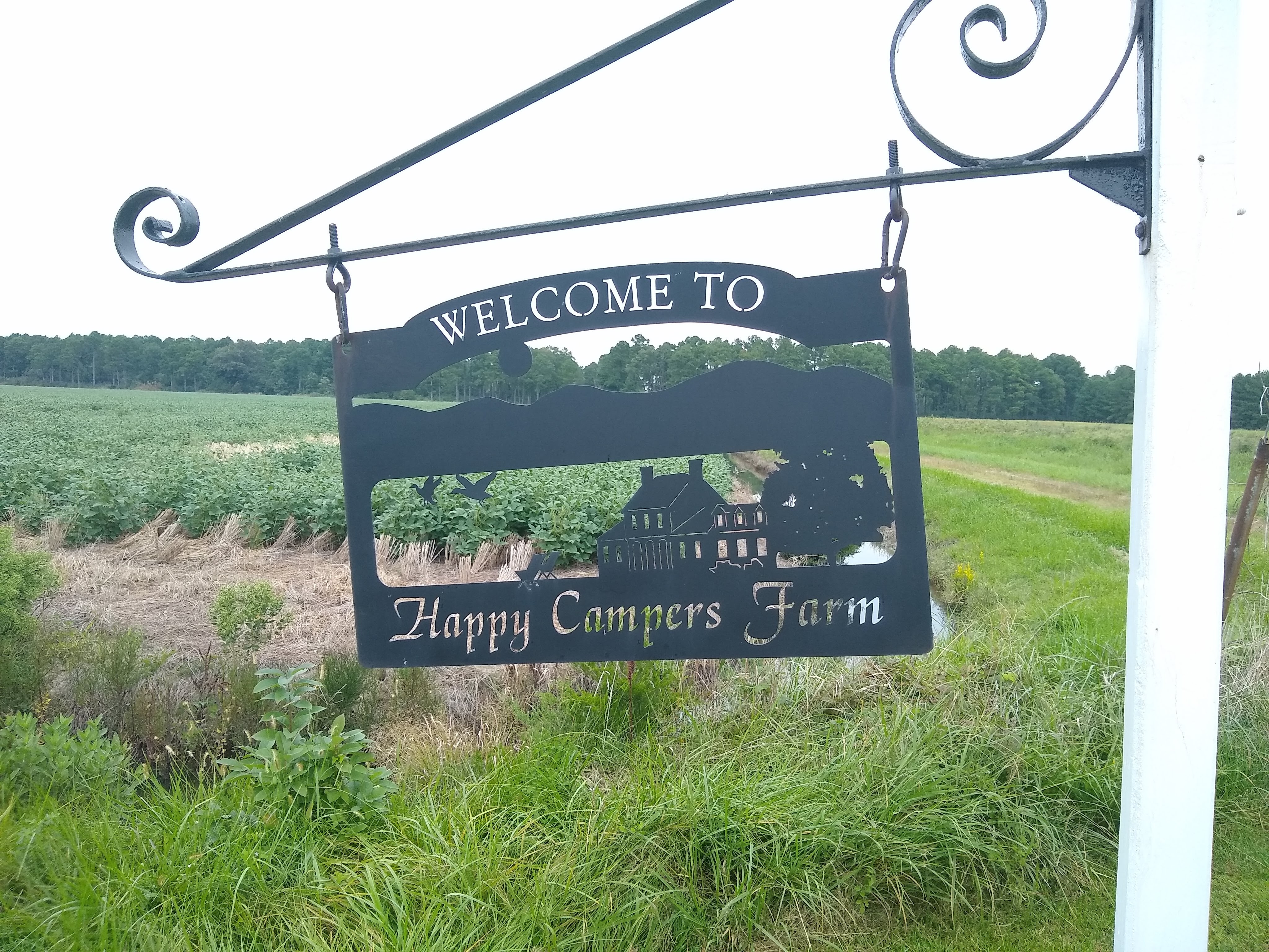
The AirBnB property is called “Happy Campers Farm” and I arrived there a little before 8:00 on Thursday morning. Here are some photos of their guest house:

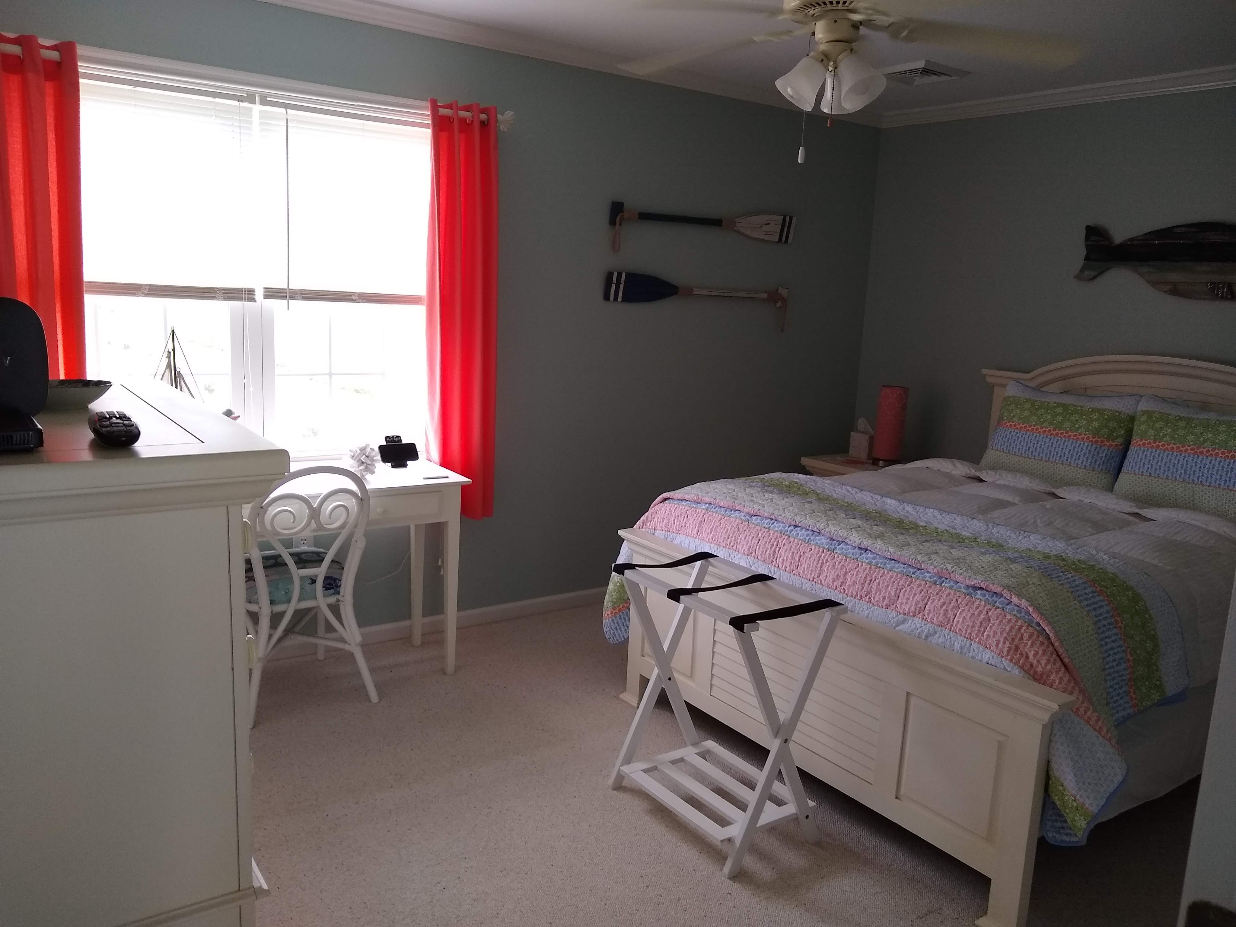
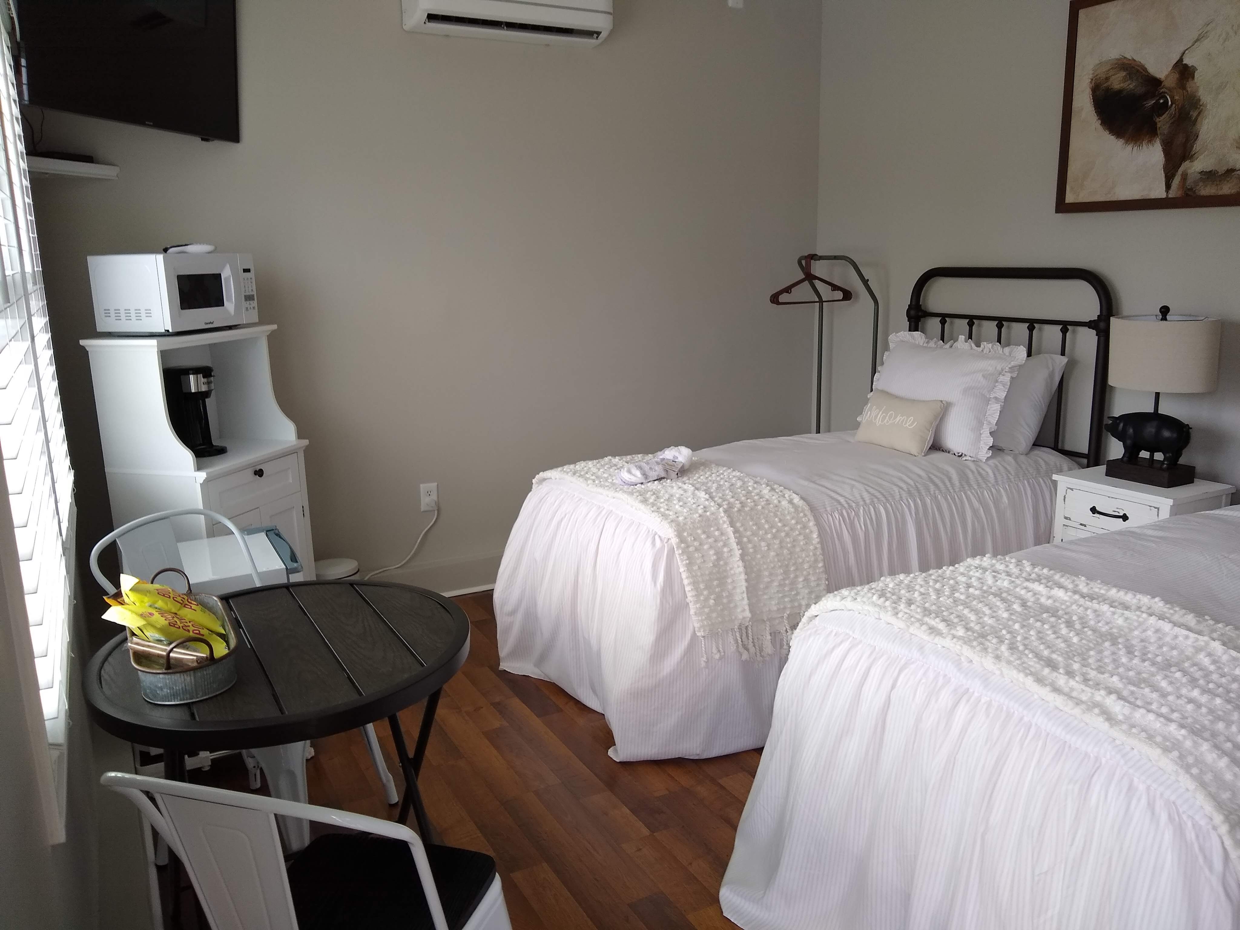
You can check out their listing here: https://www.airbnb.com/rooms/17871330?source_impression_id=p3_1601156285_DqF69C9bIcpSbPS%2B

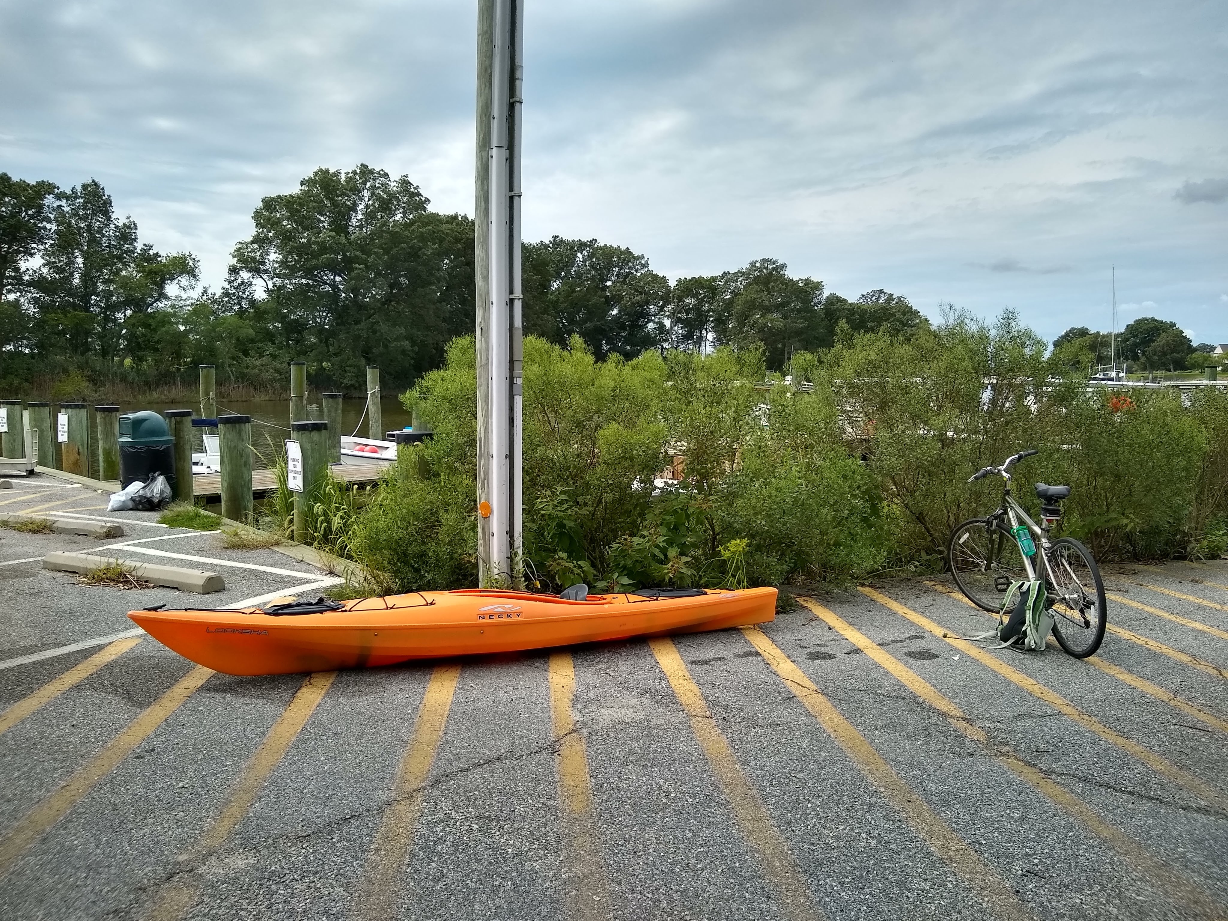
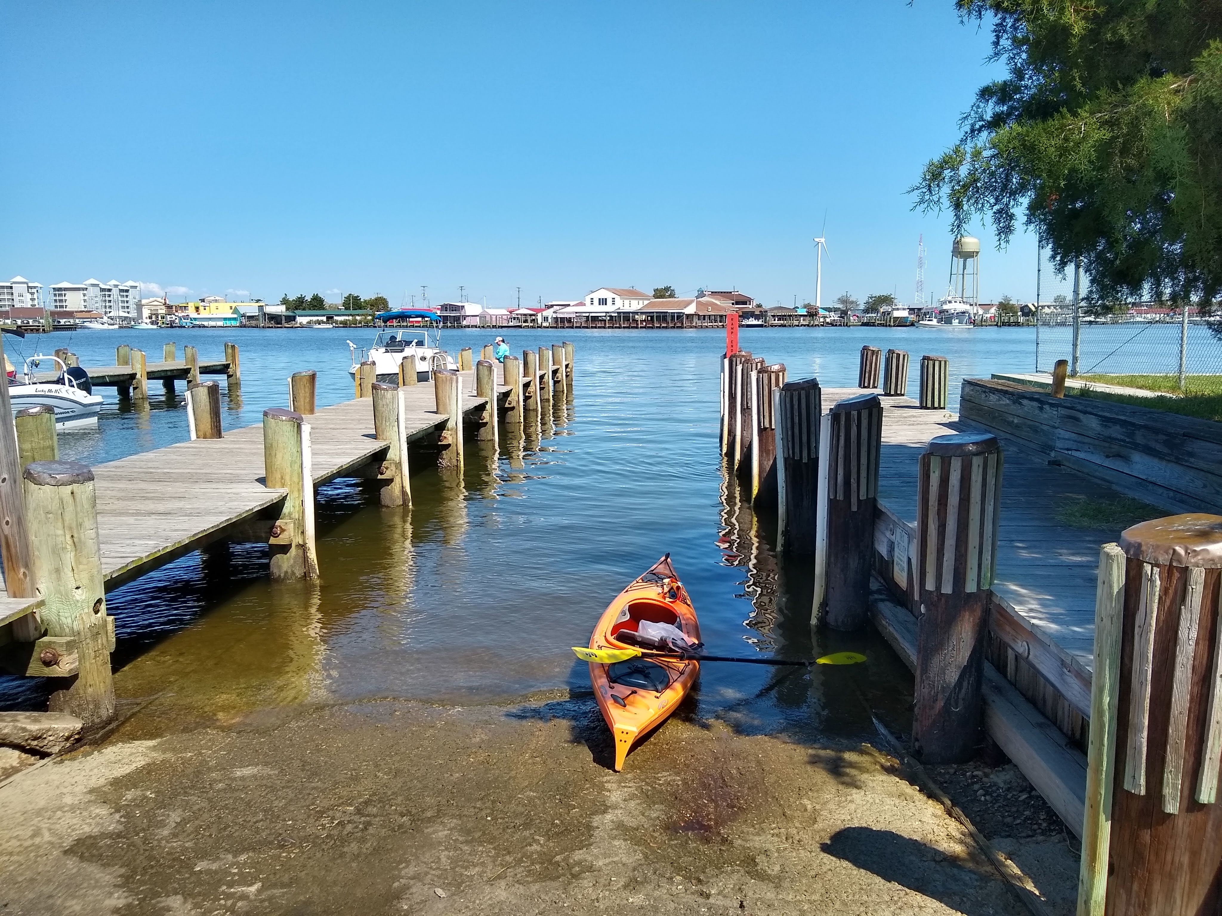
After chatting with Lisa for a bit, I unloaded my kayak and drove down to the Ragged Point boat ramp. From there I unloaded my bike and rode back to Happy Campers Farm. I left my bike in their driveway and headed out on the water.

Almost immediately I encountered a common loon, first one I’ve seen this season! And the coolest part? It made a super loud tremolo call. If you don’t know what a loon sounds like, google/youtube it. It’s pretty recognizable. It’s also a common bird call you hear in movies, as well as in the intro of Mickey Mouse Clubhouse…….. #momlife.

my best attempt at catching “silence” in a photo

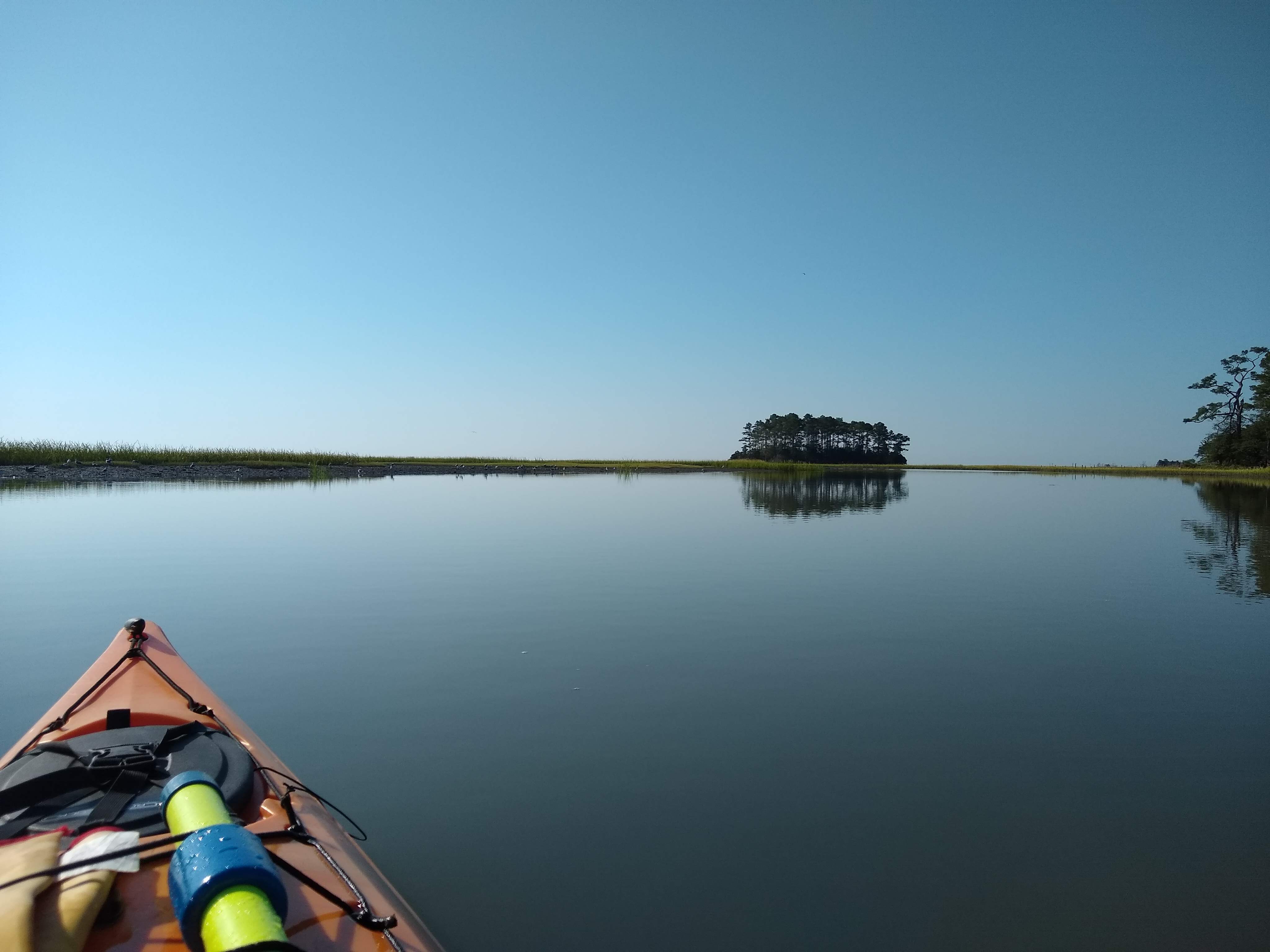
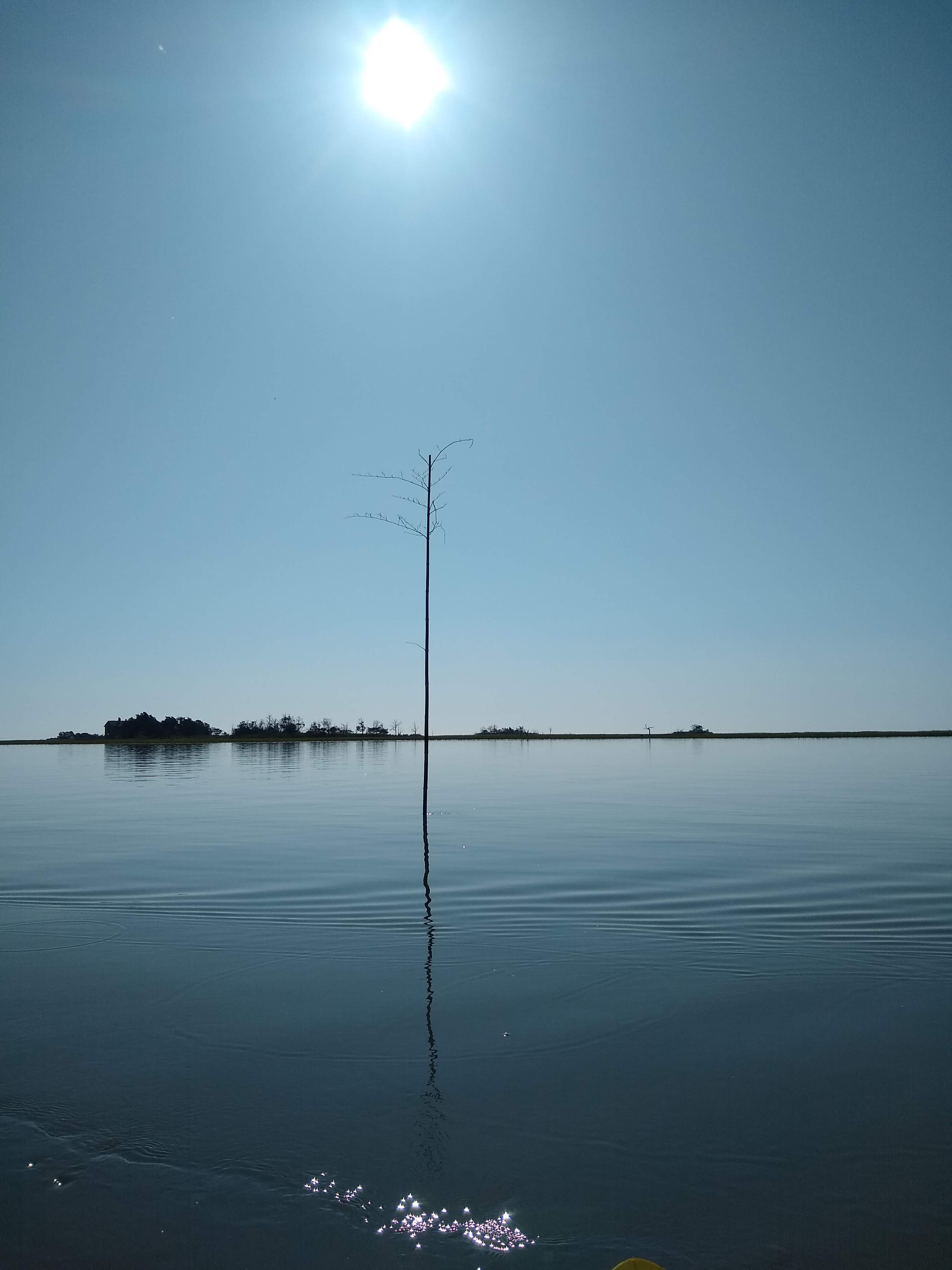
It was pretty much overcast the entire time I was outside today, so none of my photos turned out super well, but the few that I did take, really seemed to capture the overall feeling of the day: quiet. The calm water was so calm it had an eerie feeling to it. And there were times I stopped paddling just to listen to the silence. There really weren’t even many boats to disrupt the peace. The silence was almost deafening at times.

Another notable thing on this trip was the huge number of eagles I saw! Sometimes I could spot up to a dozen of them at one time! I’ve seen plenty of eagles over the years and I don’t even really get excited to see them anymore, but I’m pretty sure this was the most I’ve seen on a kayak trip before (although I used to see 25+ circling around when I worked on Poplar Island).

terrible photo of the rowboat

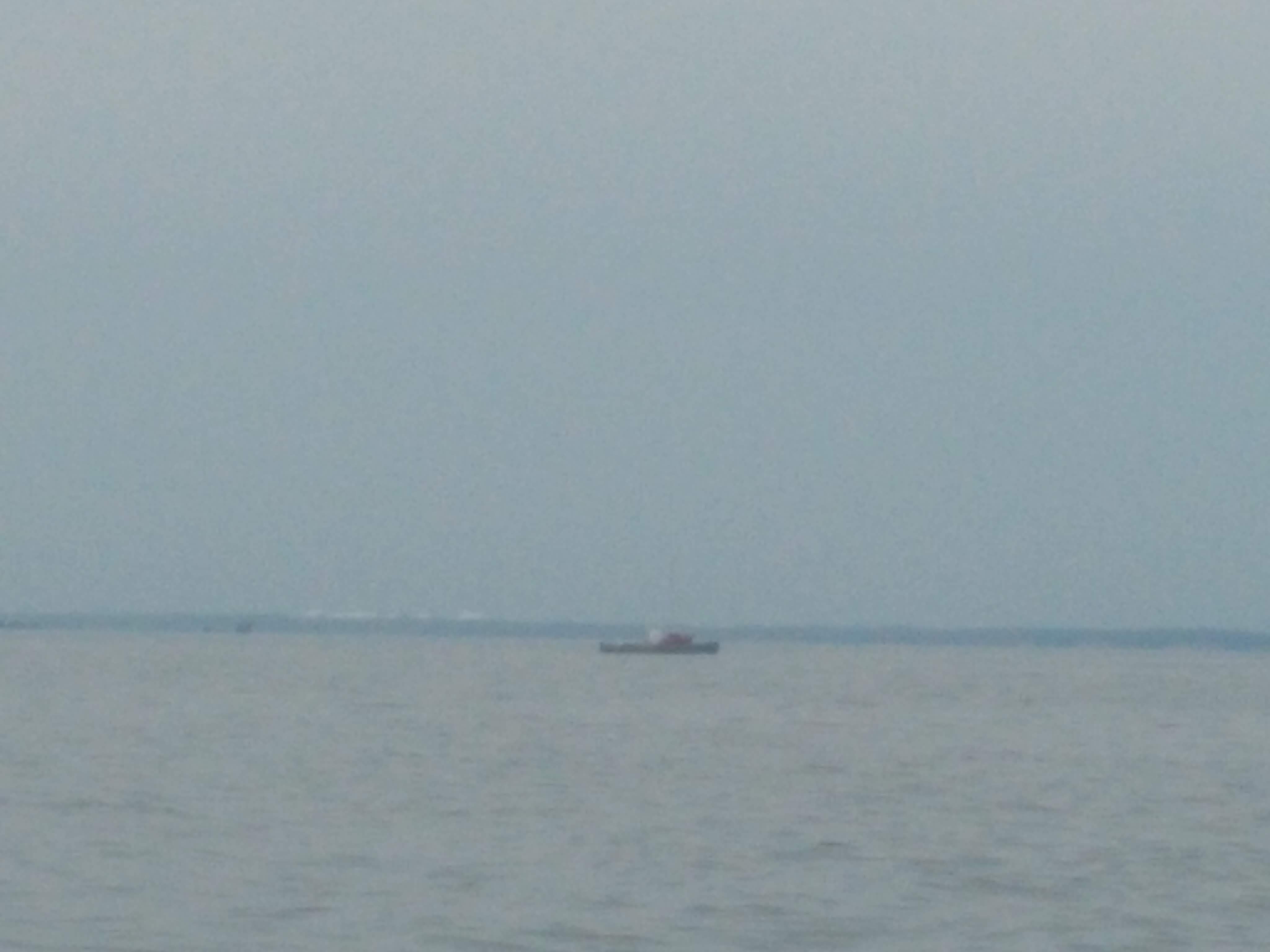
As I rounded the second point and started heading SW, what little wind there was actually did help push me where I needed to go. As I paddled toward Ragged Point, it was so calm that I saw a few other kayakers (believe it or not, other kayaks is a rare sight for me), and a rowboat! A single man in what appear to be a rowboat that had a mast, but no sail. I stopped to wave, he waved back, but we weren’t close enough to talk. I was very curious though. Who just has a rowboat anymore? And he was headed out into the open bay?! Very interesting.

The last interesting wildlife sighting was fish. Giant, jumping needlefish! I tried to get a video, but failed in my attempt. But dude, these needlefish were at least 8 inches long and I saw one jump clear out of the water like 3 times! Who knew needlefish could jump?

Anyway, here’s the path I took. Gives you a good idea of where the AirBnB is located:

As I paddled up to the boat ramp, I was tired and ready to be done, but at the same time, I had a moment where I just wanted to stay on the water, because as soon as I packed up, I was headed back home and back to the real world. Plugging away at this kayaking goal seems silly at times, but it is a much needed escape from the noise and stresses of everyday life. The Baldwin side of my family is going through some pretty tough stuff lately, and being able to do something for me, if only for a few hours here and there, goes a long way in my well-being.

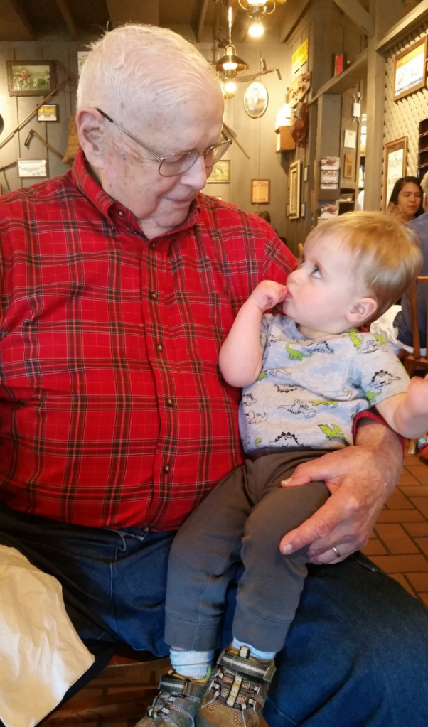
I started writing this blog post yesterday, and I am finishing it today. Between starting and finishing, we lost my grandfather. My Pop Pop was 92, and wow, what a legacy he’s leaving in my mind. Fell head over heels for my grandmother in high school, had a successful career working in the railroad industry, raised 4 successful boys, watched 8 grandchildren grow up, and even got to experience life as a great-grandfather to 2 great-grandsons. I was lucky enough to see him just a few short weeks ago when I showed him photos of Brian and I taking Patrick kayaking. He enjoyed the photos, but then very seriously told me, “don’t you be taking any chances with that boy!” It seems only fitting that the last piece of advice my Pop Pop gave me was somehow related to both parenting and kayaking in the same comment!

Photo of Patrick and his “G-Pop” back in April 2017


Leave a comment

Crocheron to Frog Point

Well folks, this might be my last post for a good chunk of time. Staycation is ending soon and the weather forecast until then is looking far from stellar. But that’s okay! Things aren’t totally crazy at work, and it’s not out of the question for me to take a random day off (or even just an afternoon!) to go paddle. I love September paddling so much!

So yesterday, I paddled from Crocheron, the southern tip of Dorchester County, to Frog Point, the southern tip of Elliott Island. This was yet another gap in my map that had been stressing me out for a while! The 4-mile stretch of open water scared me, so I thought I’d launch from Elliott Island (McCready’s Point) last year, but the roads leading to Elliott Island we flooded with high tides. I had been trying to time a paddle from McCready’s Point with low tides on the roads, but it just wasn’t working out. I also considered paddling from Crocheron the McCready’s Point and back to Toddville and biking back to Crocheron. But then I still had to do a 12 mile out-and-back from McCready’s Point down to Frog Point. My head was spinning trying to select the perfect and safest itinerary.

However, once I completed the 6+ mile stretch of open water from Crisfield to Saxis the other day, I knew I was capable of doing an out-and-back paddle from Crocheron, across the 4 miles of Fishing Bay, around the corner to Frog Point (where I had paddled to some 3 years ago), and return across the 4 miles back to Crocheron. The weather forecast was 5-10 knots from the east, with 1 foot waves, so it seemed pretty ideal.

I left the house around 7 a.m. and headed for Crocheron. I had also been stressing about the potential of flooded roads down to Crocheron, but it was only a quarter moon, so it couldn’t be that bad. I chose to not even look at a tide chart and just bite the bullet and do it! Luckily, I only had to drive through an inch of water for 100 feet or so – not bad! Although I’m stressed about climate change, sea level rise, and land subsidence, it’s also fascinating to see it happening right here on the eastern shore – right here in our own backyards. Sad, but fascinating.

Whenever I drive to a boat ramp that’s far off the beaten path, it feels like I’m driving to the end of the earth. Cell signal gets spotty, roads get narrow, and I have fleeting worries of getting a flat tire and getting stranded. I also wonder what the few locals in these areas think of me. I definitely stick out in my Subaru and kayak on top. I’d definitely fit in more if I drove an old, rusty Chevy pick-up 🙂

a little foamy at the launch!

I arrived at the Crocheron boat ramp (with no flat tire – yay!), and was able to launch just before 9 a.m. Crocheron has jetties or breakwaters just outside the little harbor there, and as I approached the opening in the jetty, it was then that I realized just how choppy the water was! It was definitely 10 knots, and at least 1 foot waves, likely more! For a brief moment I second-guessed paddling out across the bay, but man, how defeated I would feel if I did that! I drove nearly 2 hours, to what felt like the end of the earth, to not go paddling? I geared myself up and paddled through the jetty opening. Although there were some white caps, the wind was coming directly at me, which I prefer, rather than at a funky angle where I constantly have to correct my direction.

After about a half mile, I got into a good groove and felt pretty impressed with myself at how strong I felt, cutting into that chop! In the distance I could see the treeline on the eastern shore of the Nanticoke River, but I couldn’t quite make out the marsh shoreline of Elliott Island. Because I was too far away, I wasn’t 100% sure what direction I needed to go, and it was a little too choppy to take the phone out and examine the GPS track (I mean, I knew to go east, but I like to be more precise than that). As I got closer and closer, I could finally make out some marsh and realized I was slightly off course. I made a minor adjustment and started heading straight for Frog Point. Thank goodness I was only slightly off! Last year when I paddled west from Crocheron, I added nearly 2 unnecessary miles to my trip!

land ho!

I was so excited to finally be up next to land again. It wasn’t as choppy, and I felt safer being close to land. But OMG the FLIES!! Green heads, black flies, probably 18 other species… all that have a vicious bite! I had to break out the DEET. I hate chemicals, but the essential oils weren’t going to cut it this time!

Once I got the fly situation under control, I continued paddling alongside the marsh until I rounded Frog Point. I DID pull out the GPS this time to make sure I “connected the dots.” Once I turned around to head back to Crocheron, the wind was helping to push me so I cruised back out to the open bay. As soon as I hit the open bay though, the wind nearly died out completely! What the heck, wind? I was counting on you to assist!

Oh well, no wind was probably a good thing in the long run, so I continued on. I was about a mile into the 4 mile stretch of open water, when a waterman abruptly switched his direction and started heading straight toward me! For a moment I panicked and started furiously paddling to get out of his path, but then I realized he was waving and trying to get my attention. I stopped paddling and he turned off his engine. “Hey! Are you okay?!” he yelled.

I told him I was fine and gave him a thumbs up. His boat drifted a little closer and we were able to carry on a conversation. “I saw you paddling that way, and now you’re paddling this way, and I just thought – is she lost?!” I explained what I was doing, and then he and his son onboard explained how choppy these waters can get and that I needed to be careful. I thanked him for the advice and assured him I select my paddling weather very carefully! They were very sweet – told me I was in 12 ft of water, offered me a bottle of water, made sure I was okay, and even offered their cell number in case I needed help! I told him I had a VHF radio so I was prepared in the unlikely event of an emergency. He was impressed. “Good for you! Well we’re on channel 72. You just call us on 72 if you need anything!”

the Michael Joe from Crapo

Of all the watermen I’ve encountered over the years, this was a first. So very sweet of them. I do think he thought I was mildly crazy, but he’s probably right, hah! So anyway, next time you’re out in the Fishing Bay area, be sure to wave to the Michael-Joe from Crapo, MD – nice guys!

Before long I was able to make out the Crocheron jetties. I paddled through the little jetty opening and finished my whole journey – 11.6 miles in 3.5 hours. Here’s the one-way path from Frog Point back to Crocheron:

heading through the jetties

Once I got off the water and loaded my kayak, I was feeling pretty accomplished. The drive I had stressed about, the remoteness of this paddle that I had had some anxiety about, and the 8 total miles of open water that scared me – I conquered it all! I was feeling pretty empowered with both my physical and emotional strength, and so I had to celebrate with another trip to Rise Up on the way home for a burrito and iced chai 🙂


Leave a comment

Crisfield to Saxis

For anyone that’s actually following my blog (you know, other than my mom), you’re probably wondering if I’ve gone absolutely crazy, or if I’ve quit my job. Well, I’m half way through a 2-week “staycation” and the weather has been ideal of paddling, so I have gone a little paddle-crazy, as I’m trying to take advantage of it all!

Yesterday I paddled from Crisfield, MD to Saxis, VA:

This stretch has given me a little anxiety as I’ve stared at the empty hole on my map and wondered how to conquer it. Is there a way to break it up? Can I really handle that much open water? I’ll need a paddle buddy or a ride; I can’t bike 41 miles after 12 miles of paddling. I scoped out a DNR-owned boat ramp on the north shore of Pocomoke Sound last year, and it seemed super sketchy, so I wasn’t all about using it as a half-way point. So how did I cover this leg?

Brian and Patrick to the rescue! We didn’t have any plans yesterday, and I couldn’t ignore the NOAA forecast of 5 knots and flat waves (like OMG it’s NEVER that calm), so Brian agreed to drop me off in Crisfield and then take Patrick kayak fishing around Saxis where I would meet up with them at the end of my trip.

Brian and Patrick dropped me off at Somer’s Cove where I had finished a trip over 6 years ago! I barely remembered what the boat ramp looked like. On the way to the the ramp, we explained to Patrick what was going to happen, and that Dad was dropping Mom off to go kayaking but that Mom would meet us later on. But still, as I paddled away from the ramp, I heard Patrick yelling “Mommy, what you doingggg?” LOL. Poor little dude. He’ll figure it all out in a few hours.

super calm waters!

Although the wind was super calm, I still had to deal with quite a bit of wake from boats passing by. Crisfield was hopping with boat traffic with the barely 80 degree weather. Once I got about 2 miles out from town, I was paddling along Cedar Island Wildlife Management Area and through a pretty marsh creek. Pretty until the flies set in. Yeah it’s great to paddle in little wind, but dang the flies are terrible when there’s no breeze. Every couple strokes I had to swat them. I must’ve been bit 25 times!

Another thing to note in the creek was a random guy on a boat that slowed waayyy down (honestly, I get annoyed when boats slow down for me – I can handle your wake, just keep going!). He slowed down enough to ask if I wanted to race! “I want to race you! You’ve got quite a wake behind you in that thing!” Before I could think of a witty response, his giant German shepherd started barking and going nuts. Not sure what that was all about, guess the pup didn’t feel like slowing down and chatting either!

Soon I spotted the open water (Pocomoke Sound) and knew the dreaded open water stretch was starting soon. Six miles across open water is just about the furthest I’ve ever gone and I was nervous about boat traffic and my own sanity. As I came out of the creek though, I didn’t see a boat anywhere, the water was still nearly flat calm, and I could just make out on the horizon where I needed to go. I did pull out my phone to make sure I was headed in the right direction though, just to be sure.

I started crossing the Sound by singing songs to myself to kill the time and not let my thoughts get to me (you know, those thoughts of ‘am I actually moving at ALL?”). For whatever reason I chose a few old summer camp songs, including 99 bottles of beer. You can make fun of me, but it killed the time and nobody could hear me anyway! Before I knew it though, I was nearly halfway across! 3 miles down, 3 to go. Still not a boat in sight, and the water was still flat calm. I really got into a good paddling groove. Was totally in the zone.

Another mile down, and I crossed the state line! How do I know? I crossed right near the state line marker! I didn’t even know there would BE a state like marker in the middle of the Pocomoke Sound – how cool! Had to take a selfie as it was a great visual milestone.

horrible photo of me, but had to post the state line marker!

A little bit further and I started to make out more shorelines of Saxis, and before I knew it, I spotted someone in a greenish/gray kayak with a white paddle! Must be Brian and Patrick! It was right around this time that the wind picked up too. Paddling got a bit more challenging, but probably more so because I was tired. When I was finally in earshot of my boys, I waved and called out to them. Patrick had a HUGE smile on his face and seemed somewhat surprised to see me. “Mommy, where’d you goooo?” I turned around to point to the other side of the Sound and realized you couldn’t even see it! I completed just over 6 miles of open water, and 11 miles total.

I paddled with Brian and Patrick for a short distance, but they ultimately decided they were done, so we all got out together at the boat ramp in Saxis. I felt pretty satisfied that I had finally conquered a stretch of this journey that I has spent too much time stressing about. But the best part of the day? Brian and Patrick caught dinner – speckled trout! I don’t have a photo of the trout, but here’s a photo of the little striper they caught and released:


Leave a comment

Red Bank to Quinby

Love this photo captured by my friend Kim!

On Thursday, September 3, I paddled from Red Bank, Va to Quinby, VA, but luckily this was another trip with a paddling buddy! This was one leg of my journey that I was a little nervous to do alone, so I took it upon myself to find someone that could paddle along with me. Shout-out to BAD – Badassawoman Adventures of Delmarva, a group of outdoor adventure-minded woman on the eastern shore.

This meet-up style group has done some cool events in the last year or so, but COVID sort of put all of those events on hold for the last couple months. The facebook group however, remains somewhat active, so I stepped out of my comfort zone and posted in the group that I was seeking a paddling buddy to come with me on some of the longer, remote locations. Within a day of posting, Kim commented that she was interested in coming with me at some point.

From there I monitored the forecast, selected a potential day to paddle from Red Bank to Quinby, and Kim was all in! I was stoked to paddle with someone for a change, particularly since I so enjoyed paddling with my sister the day before. My only concern was… how serious was she? I’ve had people tell me in the past they want to paddle with me, but 11-12 miles is a bit much for a beginner. I certainly don’t want to be a snob, but I also don’t want to venture out, only to have to rescue or tow someone!

When we met at Quinby Wharf, I was instantly relieved when I saw she came with a nicer kayak than mine (fiberglass Perception), bilge pump, GPS, etc. I just thought to myself, “shew, she’s legit. She’s probably more experienced than me!” From there, we threw her kayak on top of my car, and headed to Red Bank. I was not familiar with Red Bank at all, except that a local ESVA aerial photographer frequently posts photos of the marsh creeks around it, and has mentioned time and time again that it’s one of his favorite places to photograph. Once we launched and started heading down the creek towards the bay, I totally understood why – the twists and turns of the creek, the wide open vistas of the bay – and it was especially gorgeous because there wasn’t a lick of wind and at times we couldn’t even quite tell where the horizon was between the water and the sky.

It really was great to have a paddling buddy on this trip. There were some long stretches that were more enjoyable with conversation, rather than being left to my own thoughts and surroundings, if that makes any sense. We paddled out of Red Bank Creek, across the mouth of the creek that leads to Willis Wharf, and up along the edge of Upshur Neck. The wind was so minimal that it looked like we were paddling towards the end of the earth at times.

The best part of the trip was a marsh creek that cut through a long point of marsh (and probably cut out 2 miles by going through the marsh, rather than around it). We weaved back and forth through the curves of the creek, admiring the birds around every bend. Kim has more experience birding than I do, and was able to identify just about everything we saw! My favorite sightings were about a dozen whimbrels and a black-bellied plover.

When we were about half way through the creek, we were actually able to identify where the tidal flow changed. For the first half of the creek, we were paddling against the out-going tide. It wasn’t super strong, but when we reached a point where we were paddling with the outgoing tide (leading out to another bay/inlet), it was a noticeable change. This might sound super boring to the average reader, but it’s these tiny observations that I get excited about! It makes me feel that much more experienced in understanding how tides work – something that consistently confuses and intrigues me at the same time.

When the creek finally opened back up to the bay, I could just about see Quinby in the distance. What I also noticed was a large mud flat in front of us! The water was pretty shallow, and I could see a coloration difference in the water ahead of us, and the brownish color signified a very shallow mud flat that would not be fun to try and paddle over. It may have only been a few inches deep! I interrupted our conversation, pointed out what I was seeing to Kim, she agreed, and we slightly altered out course to paddle around it. Success! We were in deeper water in a matter of moments, and we never ran aground or had to get out and drag out boats through the mud!

Before I knew it, we were rounding the bank leading into Quinby. I couldn’t believe how fast 4 hours went by! I truly underestimated how helpful it would be to have someone to paddle with! Thanks for a great day, Kim! Can’t wait for some more “B.A.D.” adventures!

We paddled 11.4 miles in 3 hours and 52 minutes. I’ve now paddled 363 miles of my ~650 mile goal 🙂

Here’s the path we took:


1 Comment

Broadway Landing to Crystal Beach

img_20200902_091859572
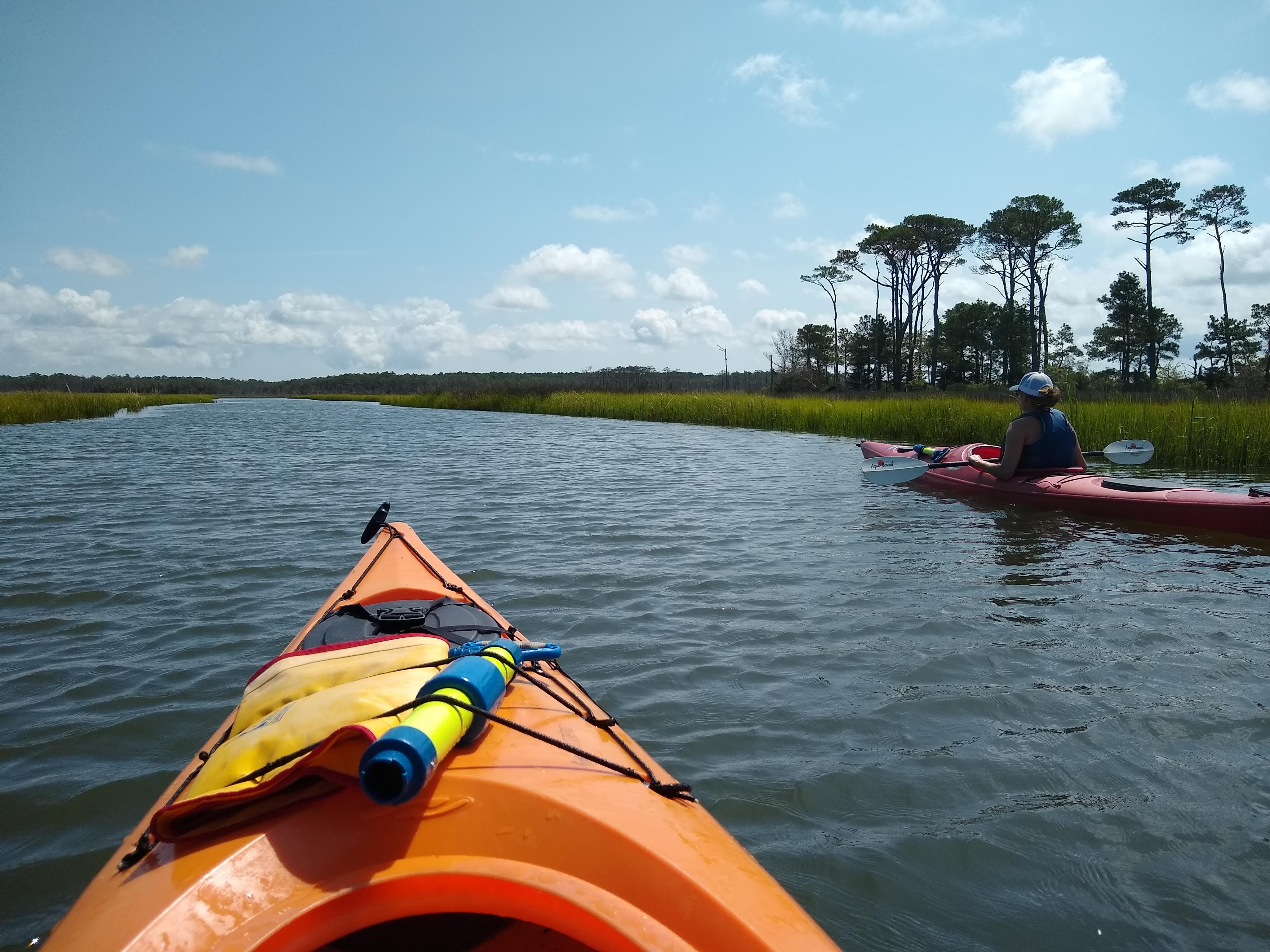
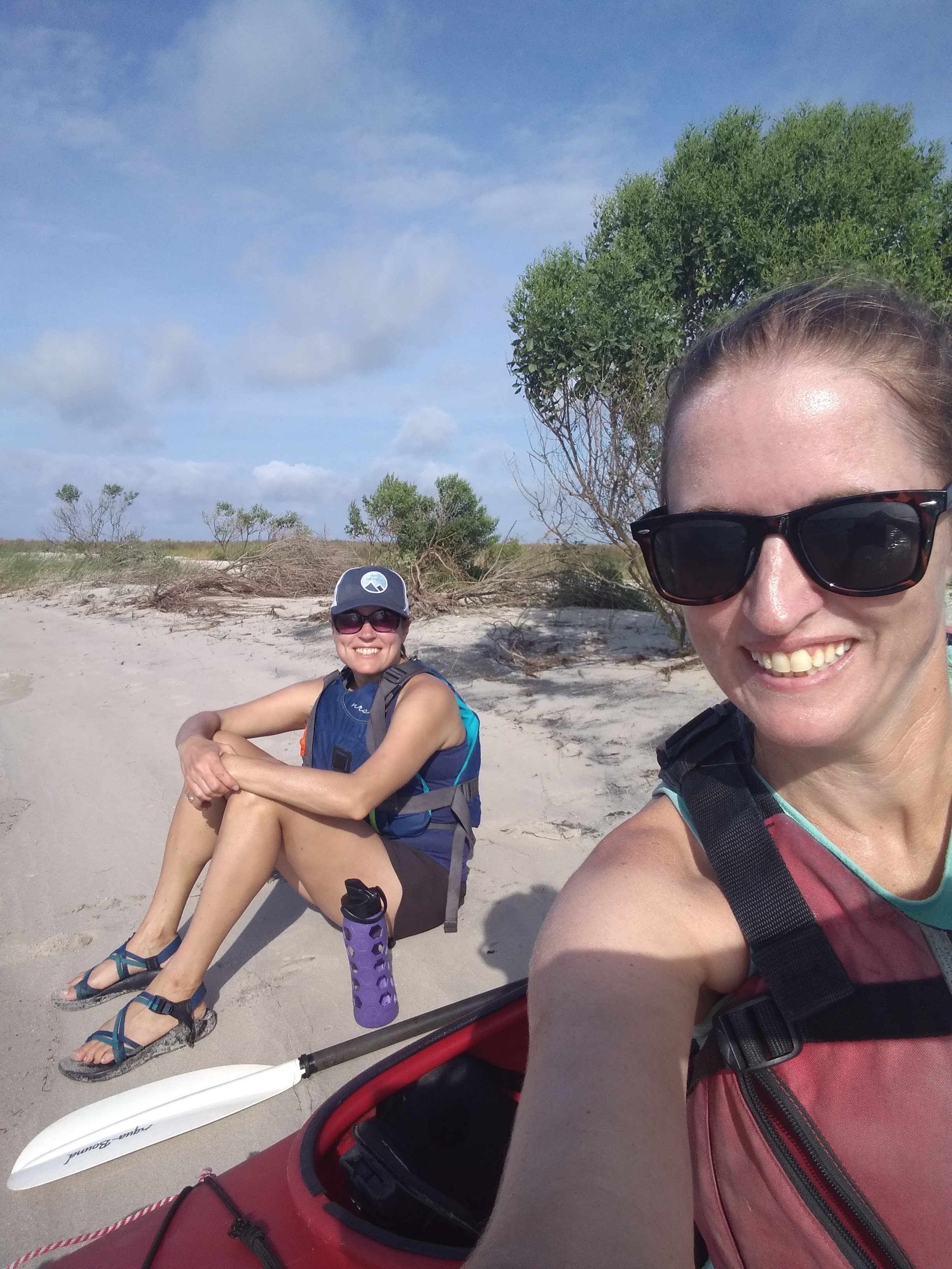
Today I had a paddling buddy! It was the first time in (literally) years that I’ve had someone paddle one of these trips with me. And who better to paddle with me than my very own sister, Julia!

I certainly wouldn’t take just anyone to come paddling with me, but even though Julia isn’t a huge kayaker, she does some pretty bad ass things like mountain biking, skiing, backpacking, and paddleboarding. Coming to visit the east coast from her very active lifestyle in Colorado seemed like a no-brainer that she could handle paddling several miles with me.

Since Brian’s kayak is super heavy and rigged for fishing, it wasn’t the best option for Julia to paddle, so we decided to rent her a kayak. Shout-out to Burnham Outfitters in Onancock for providing exactly what she needed, and arranging to meet us at the rental shop before business hours!

img_20200902_083936963_hdr
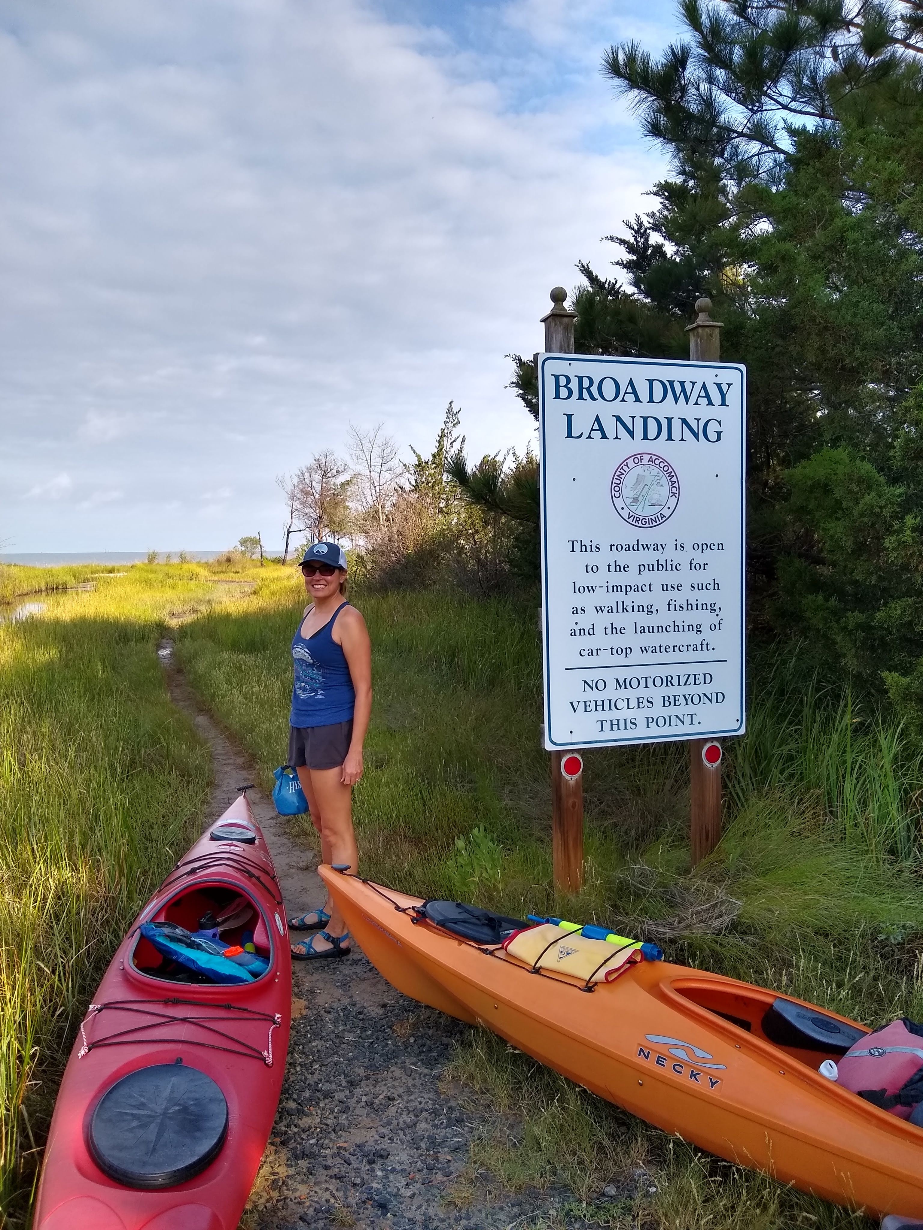
We launched from Broadway Landing which is just south of Onancock. The landing is for car-top vessels only and had room for maybe 2 cars to park. We did have to drag our kayaks a ways down the trail to get to the waterfront, and along the way, I saw some of the biggest fiddlers crabs of my life! I mean GIANT fiddler crabs. They were more like cellist crabs! Sorry, Dad joke 🙂

We launched and headed straight to the first beach we saw along the south end of the Parkers Marsh Natural Area Preserve. After sitting on the beach and admiring the view, we continued around the bend and followed the west side of the island all the way to the northern tip. The wind was coming directly out of the south so we really cruised along quickly.

img_20200902_100414850
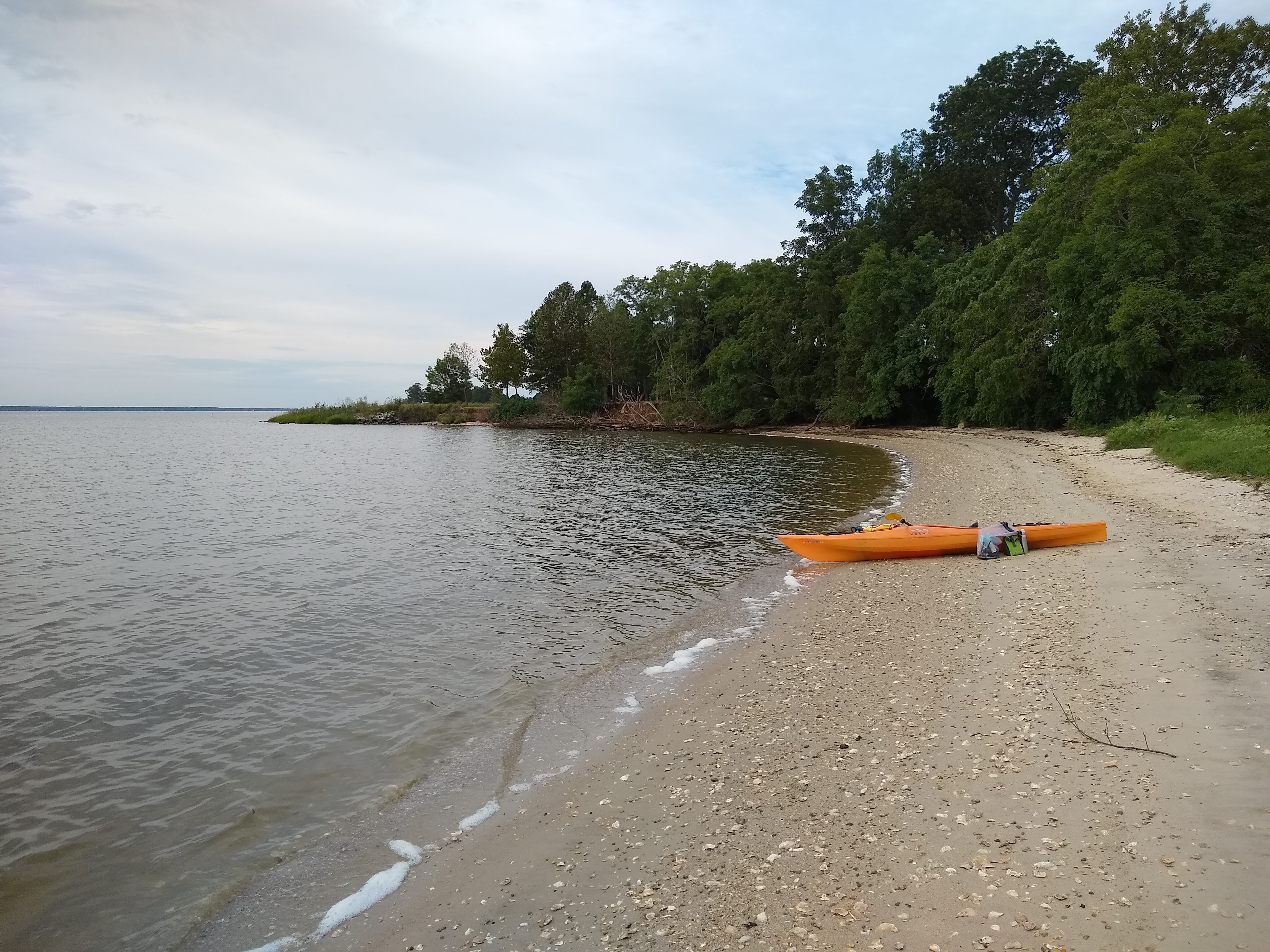
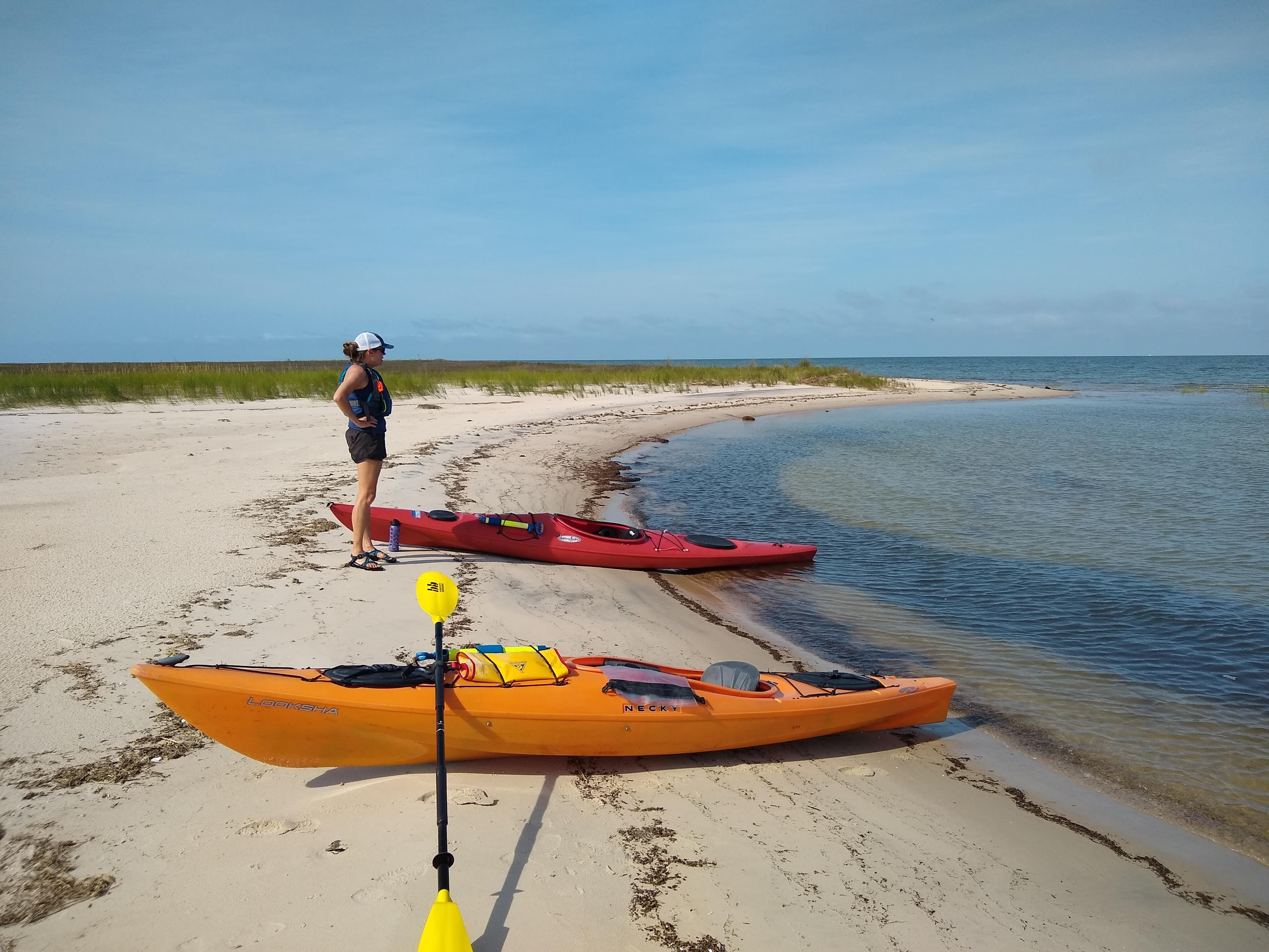
It was SO NICE to have a paddling buddy. Usually I think about paddling, what I’m doing, and my surroundings the whole time, but this time it was nice to catch up on life. Having conversations while paddling made the time go by so fast! Before I knew it, we had gone 3 miles. We stopped on a another beach to hang out for a bit, and then I pressed on to the northeast to “connect the dots” with a trip I completed back in 2015. Brian and I had rented a house for a long weekend on Crystal Beach back in the spring of 2015 with our friends Julia and Alex. Julia (friend Julia, not sister Julia) actually paddled a 9 mile trip with me that we arranged to end at the house we rented, so today I paddled back to that beach. img_20200902_111357197_hdr
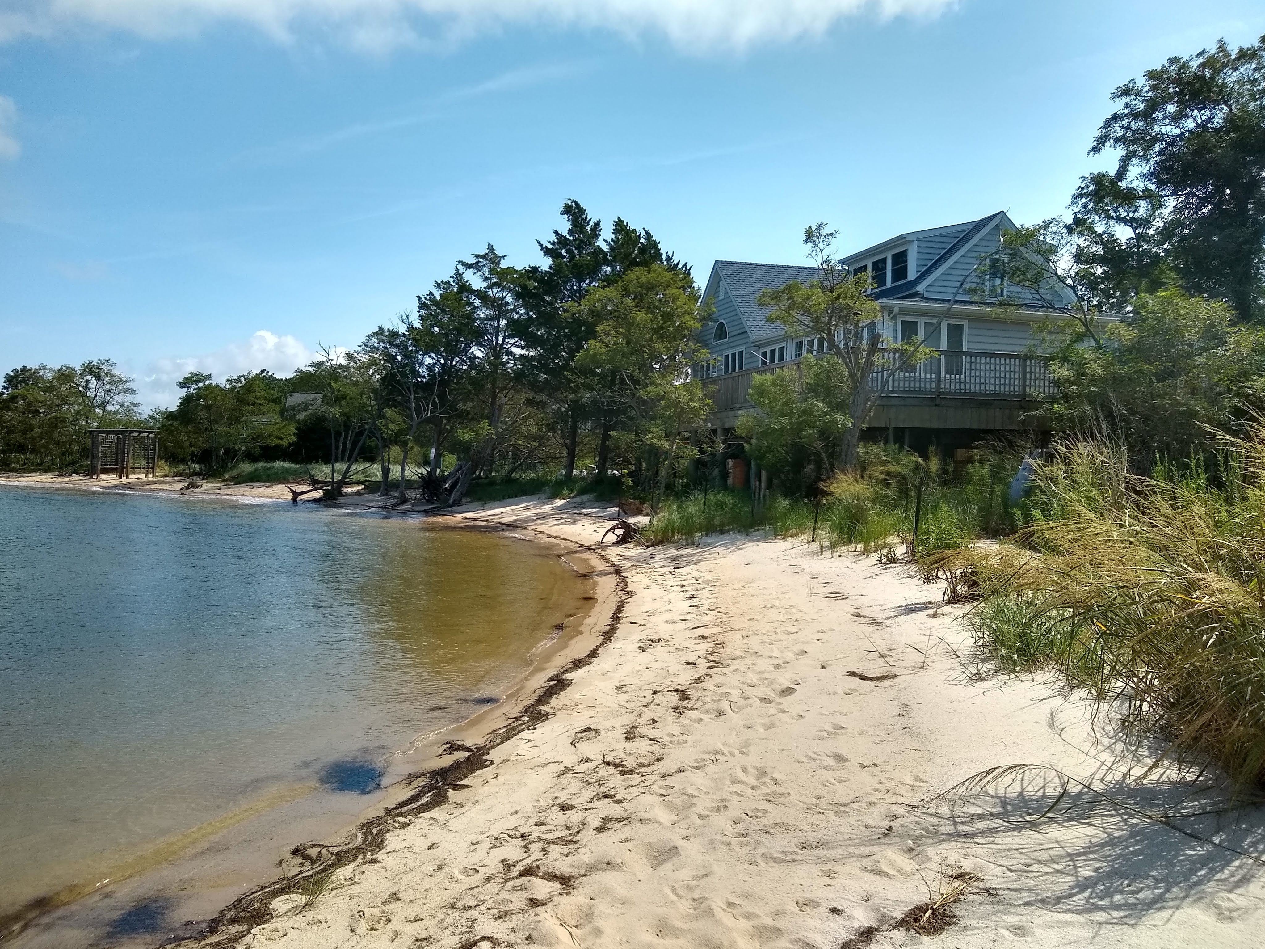
Since it was private property, and a dog started yapping at me, I was on the beach for maybe a minute before I decided to head back. Julia (sister, not friend) was hanging out on the northern shoreline of Parkers Marsh while I paddled to Crystal Beach. Once she saw me returning, she launched into the creek behind the island where we then met up to paddle together again.

I really liked this trip because we were able to do a loop, rather than an “out-and-back.” As we headed back south, we were able to paddle through some narrow marsh creeks (out of the increasing winds), rather than returning the way we came, directly into the wind and open water. The creeks were so narrow, I had to pull out my GPS twice to make sure we were going the right way!

When we came out of the creek and reentered the bay, the wind was coming straight at us, at about 10 knots. I was mentally preparing to struggle, but it really wasn’t that bad! Julia kept up with me beautifully and we conquered the 2+ miles into the wind with little issue.

The tide had been coming in the entire time we were out on the water, so by the time we got back to the landing, I actually had a hard time finding the landing. The water had come up so far that it looked very different! Plus my car wasn’t exactly parked right next to the water, so there wasn’t much of a landmark to show us were to go. However once we did find the landing, we were able to paddle closer to the car than we would have several hour prior (since the tide came in so far, as it was a full moon).

My overall thoughts from this paddle: I love remote, sandy beaches, and I love having a paddling buddy more than I ever would have expected! Who wants to go kayaking with me now?!

A few more photos from today’s trip:


Leave a comment

Bellevue to Trappe

Before I say anything about today’s trip, let me just say that I absolutely sucked at taking photos today. Not only was it overcast and the photos I actually did take were blah-looking, I missed some of the best moments of today.  But anyway…

img_20200831_085403311

beach at Bellevue landing

I paddled from Bellevue to Trappe today. The 9.3 mile journey was relaxing for the first 2/3 of the trip.  I crossed the Tred Avon River, enjoyed gazing at the houses in Oxford, and there was just enough of a head wind to be mildly challenging and still enjoyable. I felt like I was getting a workout, but not over-doing it. Until I rounded a point of land and the wind came at me and an annoying angle, MUCH stronger.  For about a mile I really struggled. Not to the point where I had doubts I could do it, but to the point where I literally had to talk myself through it. I find that giving myself a pep-talk (out loud!) actually works. “Girl, you can do this. You’re crushing it. You’ve been in much worse conditions that this.” All that gobbly-goop pep-talk nonsense. It really works. I just make sure nobody is around to hear me 🙂  I did pass one waterman during that difficult stretch that waved to me, I waved back, and he probably had no idea I was struggling. Either that, or he thought I was absolutely insane for paddling alone in windy conditions.

After about a mile, I made a turn into the creek that leads to Trappe Landing. I just paddled out of Trappe Landing last Monday so it was all very familiar. I really like that little creek. There are some beautiful homes, deep water for multiple sailboats moving through, and everyone on passing boats always waves.

img_20200831_114619435_hdr

my trust light post

When I finally got to the landing, I began switching out my kayak for my bike (I had locked it to a street light post on the way to Bellevue earlier that morning). I got my kayak locked to the post and was organizing my backpack for the 8+ mile bike ride to Oxford, when that same waterman pulled up in his truck. “How far’d ya row today?” (I silently chuckled at his very Eastern shore accent and the term “row”). I proudly said “just over 9 miles.” He didn’t seem impressed. Did he not understand that that’s pretty good? He just said “huh, I saw you down there around the corner.” Yup, yes you did. What a deep and thoughtful conversation.

Here’s the path I took:


I then hopped on my bike and started heading to Oxford. I was very pleasantly surprised at how much I enjoyed this bike ride! There were hills! Actual hills on the Eastern shore. And almost all of them were downhill which was even better. The landscapes were a mix of woods and agricultural, and not as many houses as I expected. I saw a HUGE fox in a field (no photo), 4 turkeys crossed my path at one point (again, no photo, dang it), some cool whooly bear caterpillars, and about 8,423 grasshoppers. The sights and sounds reminded me of the scene at the end of The Shawshank Redemption, when Morgan Freeman gets out of prison and hitchhikes to the hayfield in Buxton. If it had been sunny, I would’ve felt like this was where that scene had been filmed.

I ended my bike ride at the ferry terminal in Oxford. It’s been about 10 years since I rode this ferry, so I was kind of excited to finish out my day with a quick boat ride, on the oldest, family-owned ferry in the country (it got it’s beginning in 1683!). The ferry took me straight to Bellevue where I parked my car several hours earlier. It was kind of bizarre to be on an outdoor boat ride and wearing a mask, which was required. Stupid pandemic! But whatever, it was just about the only time I needed to wear a mask today. That’s what’s so great about doing what I love – kayaking is very socially distant!

Oh, and I finished off the day with a delicious burrito and iced chai from Rise Up Cambridge!

img_20200831_141557451