laura paddles delmarva

Circumnavigating 600 miles of Delmarva's shorelines


Leave a comment

Bowers Beach to Port Mahon

After the 16 miles in the upper bay, I decided to finish out the last remaining stretch in Delaware the following day! My dad was again willing to come along for the adventure and drive my car to pick me up at the finish line. I couldn’t have done these final stretches without him.

After dropping Patrick off at the bus stop, my dad and I headed up to South Bowers Beach. The tide was still favorable for paddling northward, but I knew the wind was supposed to be a bit breezier than the day before. Brian had recently introduced me to the Fish Weather app, which has really detailed hourly wind forecasts. Based on what the app said, the wind was forecasted to be NE, about 8 mph, and that’s exactly what is was when I launched.

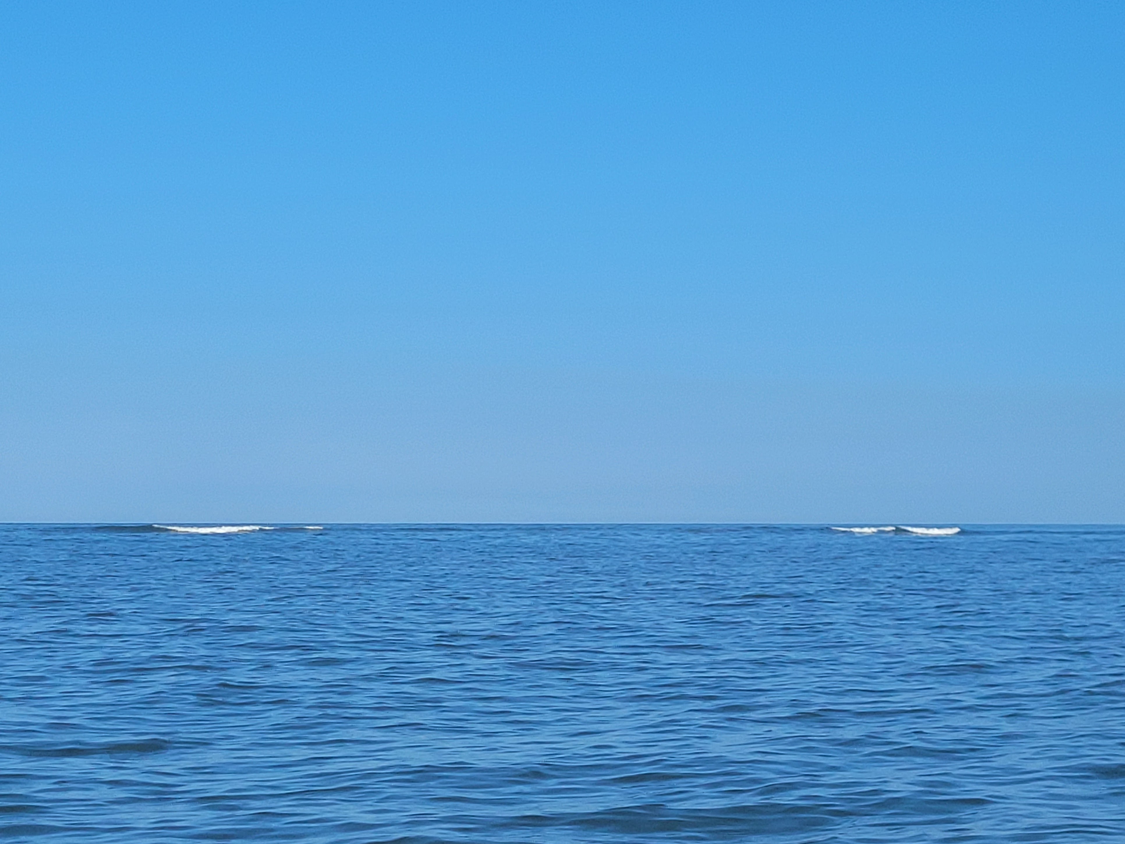
I had planned to hug the coast, but the first stretch would have been in a NW direction and that would mean the wind would be coming at me perpendicularly, which I hate. So instead, I headed due north, straight for the southernmost house of Kitts Hummock. Because the wind made the first 3 miles a little tricky, I didn’t take any photos.

My dad had planned to stop at the tiny village of Kitts Hummock to watch me paddle by, but I didn’t see him anywhere on the beach. I finally got to a spot where I could check my phone and I saw he had texted me 20 minutes prior, wondering where I was. I guess he was expecting me to arrive sooner, based on my super speedy rate from the day before! I replied, and shortly after, I saw him walk out on the beach. After a quick “are you okay” – “yes, I’m fine” conversation, I waved and paddled on.

There wasn’t a ton of scenery along this stretch, except the peaceful, undeveloped shoreline. But since I was so close to Dover AFB, there was plenty of aircraft to see! I wish I had been able to take some photos closer to Bowers Beach when they were REALLY low flying over me!

I arrived at Pickering Beach another 45 minutes later, where my dad also planned to stop and wave. As I approached the tiny beach village, I tried to see if I could spot him in the distance. He’s 6’5″ so I thought he’d be easy to spot. I knew he was wearing a light-colored hat and a darker shirt and thought the tiny speck on the horizon was him. And then I thought to myself, or maybe that’s an eagle sitting on a white post? And then I literally laughed out loud at the “is that my dad, or an eagle?” train of thought!

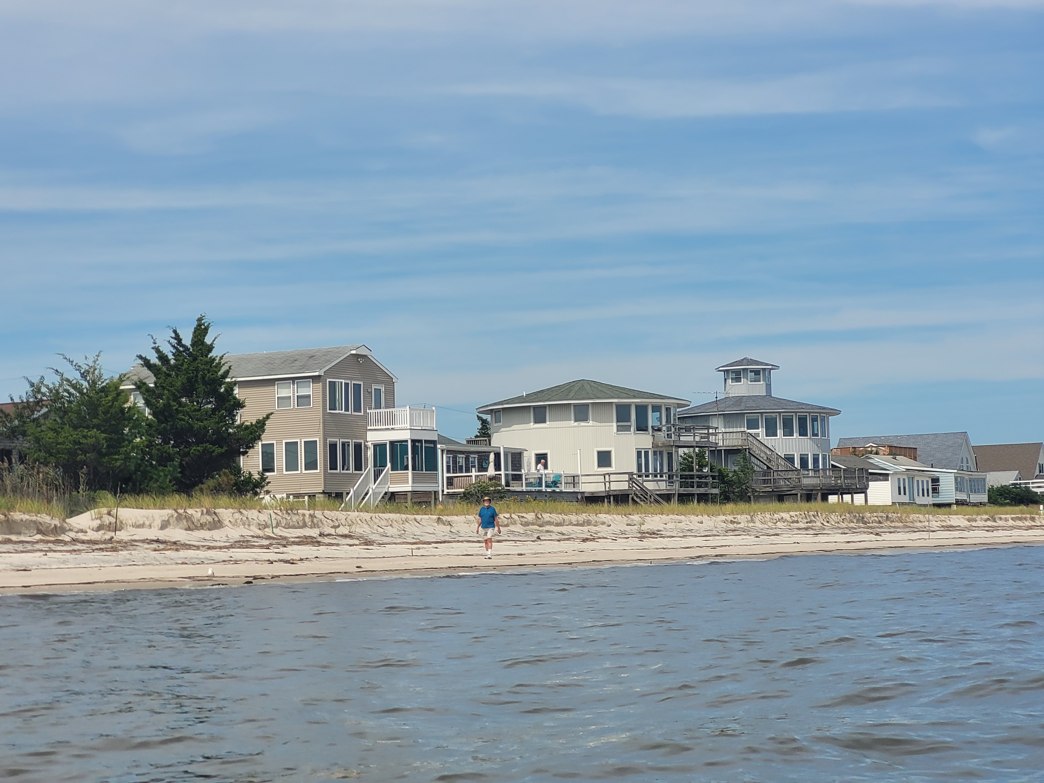
Turns out, it WAS may dad! Again, after a quick “are you okay?” conversation, I continued north. It was also around this point that the wind started to die out. EXACTLY what the fish weather app had predicted – yay!

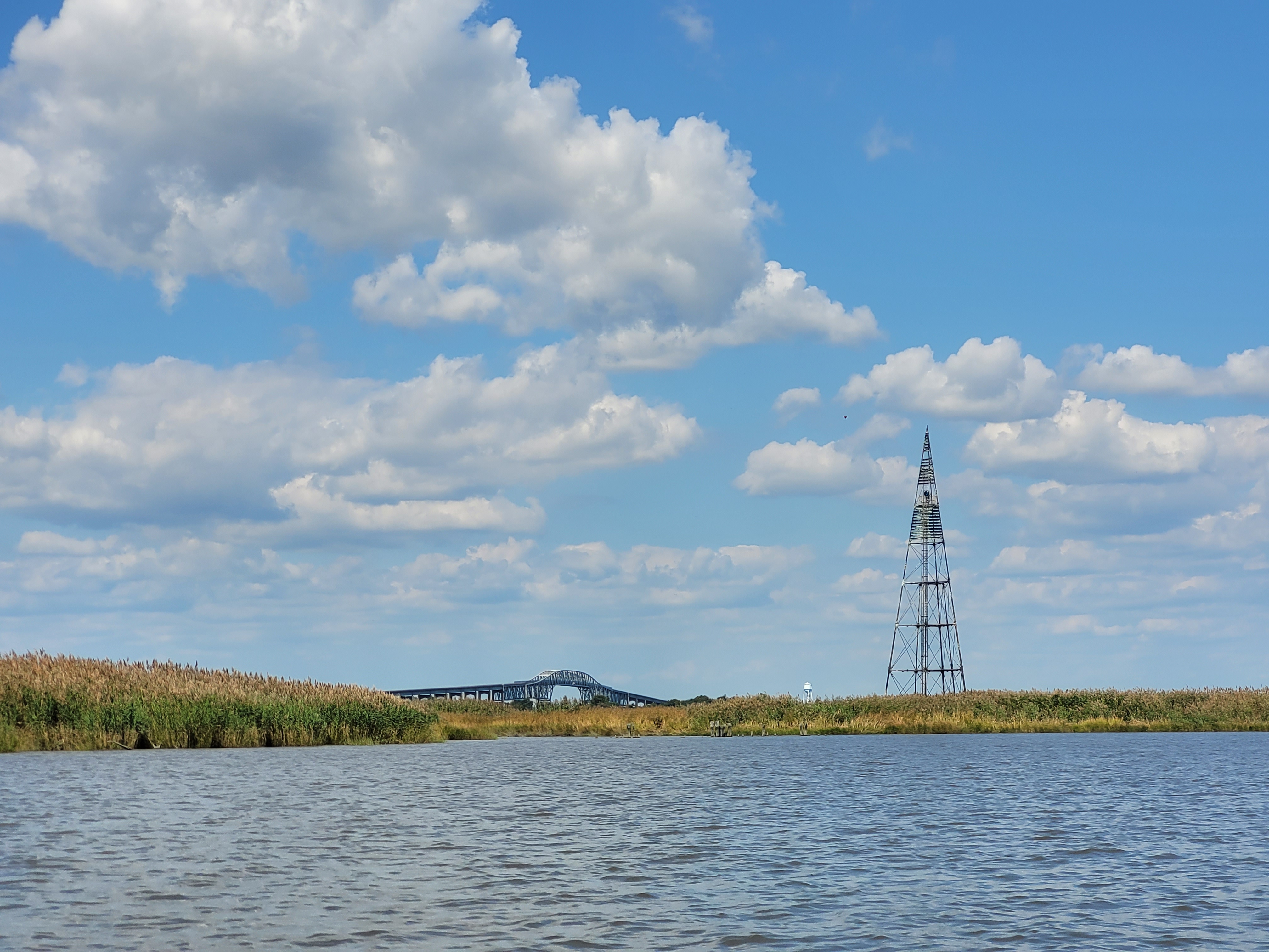
Somewhere between Pickering Beach and Port Mahon, which was completely undeveloped and a rugged shoreline, I spotted a few dump trucks flying down the coast! They weren’t directly on the beach, but just behind a narrow section of phragmites grass. I honestly thought this was all wild marshland, but clearly there was some kind of road that they were driving on, although I have no idea where they were going or what they were doing there. I guess it’s possible they were doing some maintenance on impoundments? I’m pretty sure that area is part of the Little Creek Wildlife Area.

As I approached Port Mahon, I was reminded of how sketchy this area can be. I have visited in the past by land, and there were questionable characters just sitting in their cars and I just felt uneasy. So needless to say, I was glad my dad was picking me up at the boat ramp, rather than me needing to bike back to the beginning or catch an Uber or something!

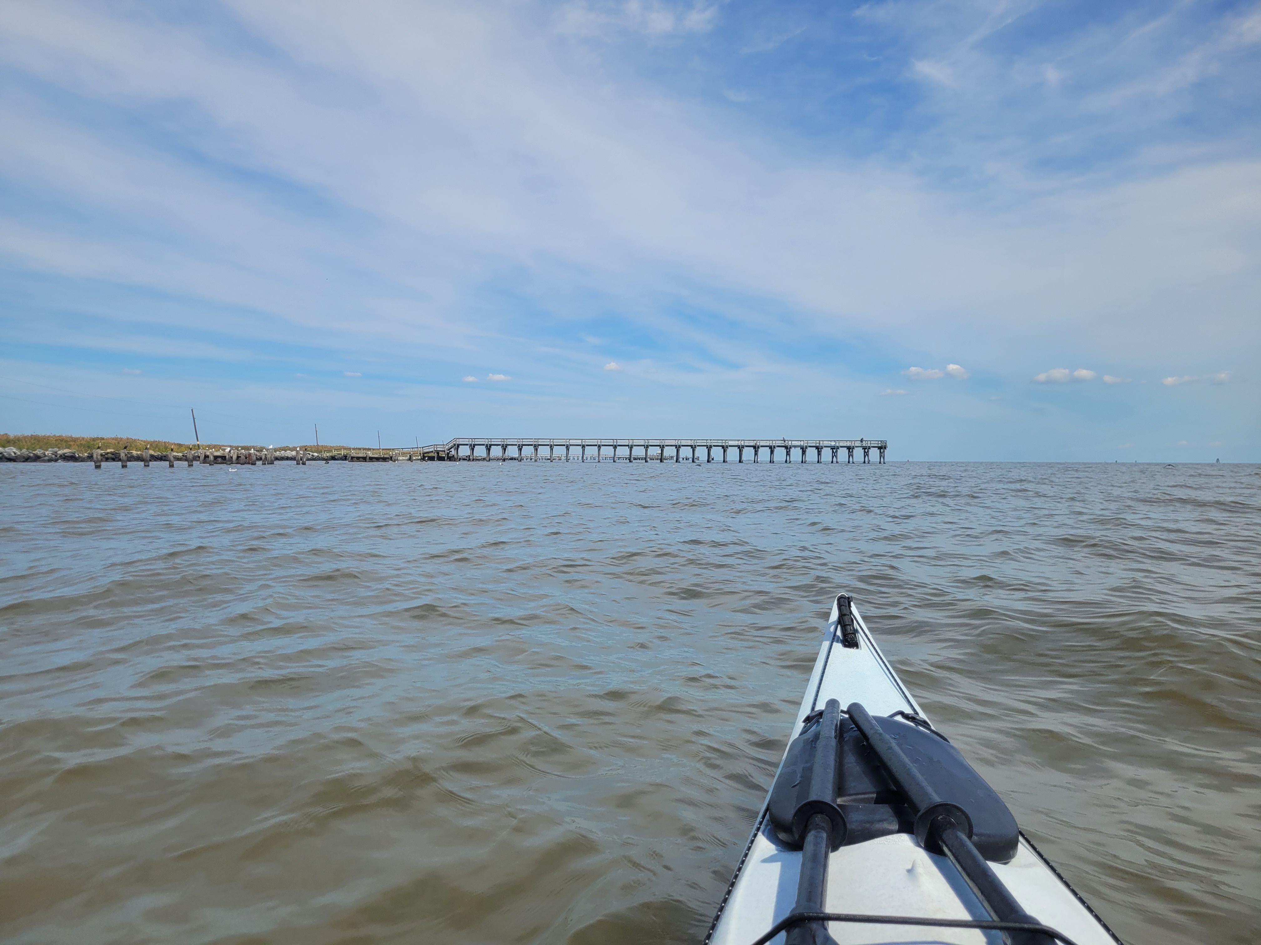
Once I was about to go under the fishing pier, two guys on the pier were waving. “Hey Laura!”

Huh? Oh right, my dad was probably on the pier not long ago, proudly explaining who I was and what I was doing.

“Your dad just texted you! He’s heading down to the boat ramp!”

Haha, I know. I got that text already. That’s my dad though; very thorough!

Then I spotted my car, driving away from the boat ramp towards me. I waved, my dad saw me, and turned around to head back to the ramp. I was only a half mile away from the ramp, but since the road runs adjacent to the shoreline, he drove at about 3.5 mph just to stay even with me for the last half mile. It made me laugh! It’s nice to know that no matter how old I get (gonna be 40 in a month!), my dad is still willing to go out of his way to make sure I’m safe. And I think he got a kick out of hopping from place to place to follow my journey today! And I know my mom was smiling down on us the whole day 🙂

As I loaded up my kayak on my car, the feeling of accomplishment was pretty spectacular – Delaware is COMPLETE! I now only have 15 miles left of my entire goal. I can’t believe this journey is almost over, having started 11 YEARS ago! I have about 10 miles left up in Cecil County, and 5 miles left around Kent Island.

We celebrated my accomplishment with a pizza at Frederica Pizza House on the way home.

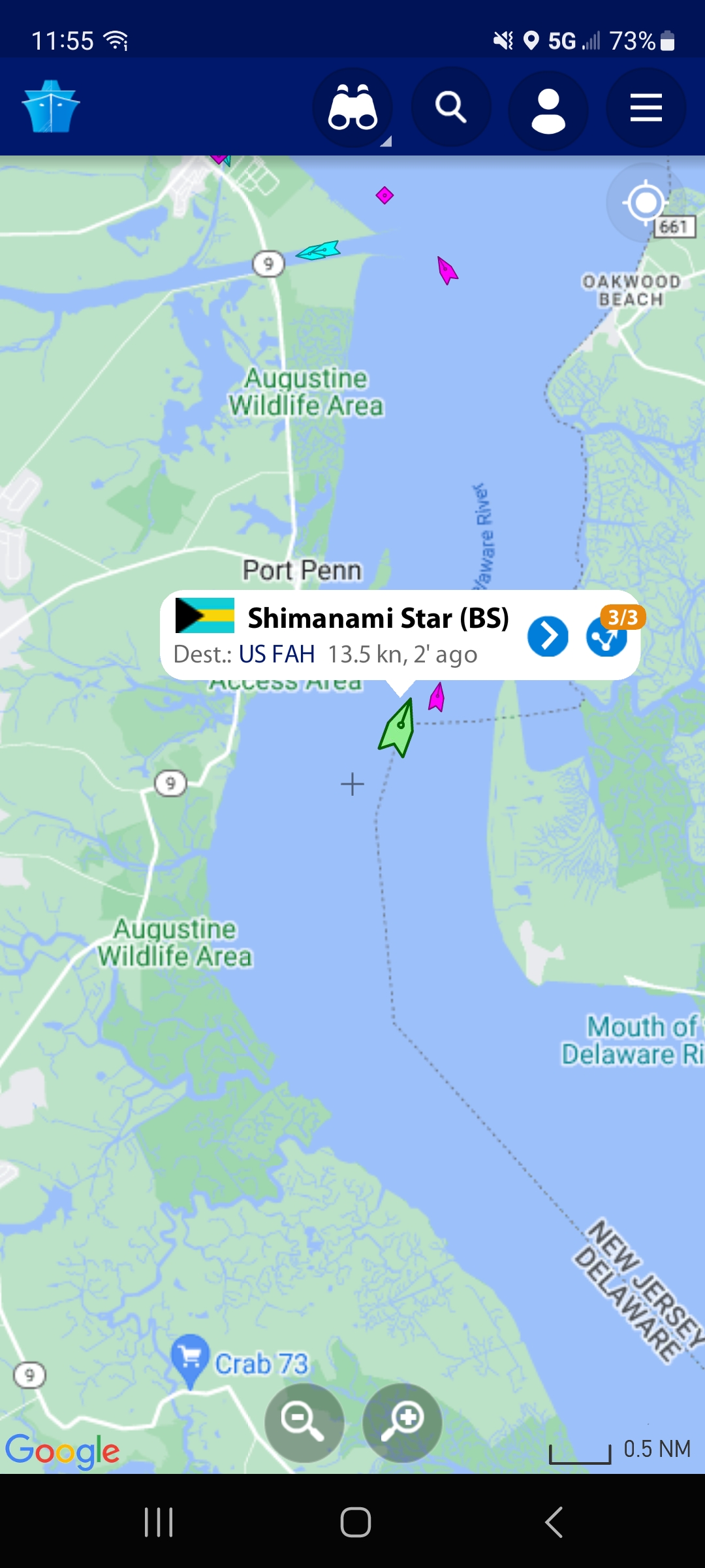
Here’s the map of my final leg in Delaware:


Leave a comment

Collins Landing to Delaware City

The 16 miles from Collins Landing to Delaware City had felt daunting to me for some time now. I know the tides in the Delaware Bay can be pretty strong and I’ve always been a little unclear on how the flow of the Delaware River affected the upper bay. And then there’s the C&D canal that probably makes the currents even more confusing.

But on September 20, I surprised myself and conquered it all! With the help of my dad 🙂

I recruited my dad to help me with some shuttles this week. My original plan for Wednesday was to paddle from Collins Landing to Augustine Beach, about 9.5 miles. Paddling all the way to Delaware City is more like 16 miles and that felt like a long, scary distance to do alone (plus crossing the mouth of the C&D canal alone sounded scary).

We got a pretty early start and drove the hour and 45 minutes to Collins Landing, which is within Cedar Swamp Wildlife Area. I chose this day to paddle because winds were minimal, and I was able to time the trip with the incoming tide.

As I was launching, some watermen were coming into the boat ramp and jokingly commented on how my vessel must not be bad on gas. I agreed and then my dad chimed in proudly, “she’s paddling around the whole Delmarva peninsula!” I don’t remember their exact reaction because I was already starting to paddle away, but it was a mix of surprise, awe, and well… confusion. Yes, some people think I’m crazy for doing this!

As soon as I rounded the corner of the marsh and into the bay, I had a lovely view of the power plant in New Jersey. It’s literally the only thing you can see on the NJ side of the bay for this entire stretch of bay. I remember seeing it when I completed the stretch from Port Mahon to Collins back in July, and thinking it was such an eyesore, but honestly, it grew on me as I paddled throughout the day. It was always in sight because it’s massive, and the steam just silently flowed gracefully out of it all day. Is it weird to say it was even calming?

On the Delaware side of the bay there was almost nothing to look at except rugged shoreline and phragmites grass and the occasional eagle. I did pass a strange… monument? It looked like a mini Washington monument on top of an old ferry piling, and it did have some words engraved on it, but I couldn’t get close enough to read it. I was told later by a friend that it marks the line between the Delaware River and the Delaware Bay. I also passed a LARGE electric line that appeared to start on the shoreline (or probably ran under water from the power plant?) and headed far inland.

I had a great cell signal for the whole trip. I was able to update my dad on my whereabouts with screenshots of my GPS location and he was able to time his arrival at the end point accordingly. But I still can’t believe how FAST I paddled! I averaged 4.3 mph which is like record speed for me! That incoming tidal current really was strong and I rode it all the way to Augustine Beach. It was honestly the easiest 9 miles I’ve ever paddled!

me, paddling into Augustine Beach, taken by my dad

When I arrived, my dad was chilling on the beach with his chair and umbrella. I was on such a high from such an enjoyable paddle that I told him I was considering paddling the remaining 6 miles up to Delaware City. We drove so far to get here, the wind was so calm, and the tide wasn’t supposed to change for a few more hours, I couldn’t pass up the opportunity to just get it done!

After a quick snack and hydration, and a quick call to Brian to see if he was available to pick Patrick up from the bus stop in the afternoon, I set out again and continued north. As I was launching from the beach, I saw a large ship heading up the bay from the south. I checked my Marine Traffic app to see what it was. It was the Shimanami Star, a bulk carrier from the Bahamas. As I write this three days later, it is now up the Delaware river near Trenton.

The next 3.5 miles flew by effortlessly. The tide continued to carry me up the bay. At times I felt like I didn’t even need to paddle.

And then came the mouth of the C&D canal. The spot I was anxious about. I turned my radio on to channel 16 so I could listen in on any communication happening between nearby boats. I also checked my marine traffic app again to see if any ships were headed up the canal or looking to turn into the canal. As I approached the southside jetty, I waited for a small recreational boat to come out of the canal. After that, it appeared that the coast was clear for me to cross the 0.3-mile canal. There definitely were some squirrely currents, but nothing I couldn’t handle. I just had to remind myself – “loose hips!” – something I learned from women’s paddling weekend back in June.

Then, out of nowhere, another boat was heading into the canal from the south. This guy must have been CRUISING because I had watched downstream and all around to see if any other boats might be approaching the canal before I crossed and I don’t think this one was anywhere in sight. I was over halfway across so I paddled like hell to continue on and get out of his way. He showed no signs of slowing down and I doubt he ever saw me at all. The wake that boat put out was massive too. I saw the giant wake heading toward me, and having never taken a wave from behind that large, I whipped around 180 degrees so I could take it head on. That wake was probably the largest wave I’ve ever dealt with to be honest. While I never felt like I was going to lose control, it still got my adrenaline pumping big time. Once the wake settled down, I spun back around and finished the canal crossing. I got safely north of the northside jetty and thought to myself, “damn, glad that’s over, I don’t need to do that again!”

I then gathered my composure and pressed on toward Delaware City. Before I got into town though, a spotted lanternfly landed on my kayak. We still aren’t seeing these down in Berlin, so I took a picture, and then promptly squashed it – kind of satisfying!

Having worked for Delaware State Parks for many years, I was somewhat familiar with the town and the smaller canal into town, since I had been out to Fort Delaware State Park several times. In fact, as I entered the little canal, a DNREC boat was leaving for the island. I waved excitedly as I saw two people in Delaware State Parks uniforms on the boat. I snapped a photo as I waved – they were probably wondering who this random girl was that looked so excited to see them!

A few minutes later, I was approaching the boat ramp and there was my dad, on the floating dock taking pictures. I felt SO accomplished! I had no intention of paddling 16 miles, and I could now say the upper Delaware Bay was complete! After I loaded up my kayak and changed into dry clothes, we enjoyed a nice seafood lunch at Crabby Dick’s in town.

Here’s my epic, solo journey on the map. If you zoom in far enough on the canal crossing, you can see the little zig-zag from where I dealt with that boat’s wake!


Leave a comment

Lambert Shellfish to Cape Charles

Today was a HUGE milestone! Maybe the biggest yet for my 11-year journey. Ready for it?

I am FINISHED paddling the shorelines in Virginia! Everything from Saxis, down around the tip of Wise Point, and up to Chincoteague and Greenbackville. And well, if we want to get technical, that line continues up to Kent Island and Bowers Beach, DE. I now only have 41.5 miles left to completely circumnavigate Delmarva, and I feel poised to finish this season, as long as the weather cooperates.

Just 3 weeks ago, my friend Lisa and I paddled a 14-mile stretch from Lambert Shellfish to Morley’s Wharf. Let me just tell you that I am SO thankful to have met Alex, the owner of Lambert Shellfish back in the fall of 2021 while I was doing some work for Virginia Water Trails. There are no public boat ramps between Morley’s Wharf and Cape Charles, so for years, I was perplexed as to how I was going to complete the 25-mile stretch (not a fan of paddling that far in one day). Alex was gracious enough to allow me to launch from his family’s property, not once, but TWICE, so I could complete this section of Delmarva. To read more about Alex and Lambert Shellfish, check out the blog I wrote back when I toured his facility. It’s a fascinating story about how he quit his job in Manhattan to move to the eastern shore of Virginia to start the oyster farm.

Now, as all of my blog posts seem to begin, I saw the marine forecast was calling for 5 kt winds from the SE and The Weather Channel was calling for “abundant sunshine.” I booked another shuttle with Wave Riders, loaded up my kayak the night before, and started my drive down to Machipongo at 5 a.m. the next morning.

The sun came up only 15 minutes before I arrived at Lambert Shellfish, and the bay had a gorgeous pink/blue glow to it. Winds were totally calm. It was stunning.

As soon as I launched, I again spotted a handful of small stripers in the shallow water (same thing happened when Lisa and I launched there a few weeks ago). There were also a number of fish jumping. Like 12″ bluefish! I think I even spotted a Spanish mackerel, which Brian confirmed was quite possible. And now he wants to launch there too, so he can fish! 🙂

This area seems to be packed with sandbars, which I noted in my previous post while paddling to Morley’s Wharf. Today was a higher tide and most of the sandbars were submerged, but still a few were above the waterline, allowing birds to hang out, like this great blue heron. For some reason I don’t see a ton of herons in this part of the bay. Usually, I have to be in a narrow creek to spot them, so this guy looked goofy to me, out enjoying the sandbar all by himself.

I had big plans on this trip to get out and explore Savage Neck Dunes, a state natural area preserve. Brian, Patrick, and I explored the trails back in early 2020 and I was stunned at the topography and massive dune system when we were there. But today I could not spot where the trailhead was, and I didn’t see any human footprints on the beach. I wondered if maybe it is currently closed to visitation, so I have a call into my contact at DCR to find out the scoop. I did land my kayak on the southern end of the property and walked a small stretch of the beach. There were TONS of fox and ghost crabs tracks, but no human tracks except mine.

The sandbars in this area seemed to continue all the way south, almost to Cape Charles. At times, I spotted larger waves (likely wakes from container ships) crashing into them. At first I was slightly alarmed at the possibility of a rogue wave coming at me (although I’m told there’s no such thing as a rogue wave!), but then I realized they were just more sandbars, ultimately providing protection for me and reducing the wave energy closer to shore.

As I approached the mouth of Cape Charles Harbor, I was also grateful for the breakwaters that are just offshore. This again protected me from larger boat wakes as I entered the busy harbor.

Cape Charles is interesting to me. On one side of the harbor, you have a gorgeous fishing pier, historic homes, and a quaint downtown. The other side is majorly industrial. Large machinery was moving sediment from barges into giant piles. A work boat was racing out of the harbor, and a handful of recreational fishing vessels were coming and going from the boat ramp.

When I arrived at the boat ramp, I was happy to see a kayak launching area, so I didn’t have to get in the way of several fishing vessels AND a USCG rescue boat. But I’m honestly not a fan of floating kayak launches. They seem great in theory, but it would’ve been way easier to just use the boat ramp. It was difficult to shimmy myself far enough onto the floating launch so safely get out, and once I was out, it was incredibly awkward getting my kayak out of the launch itself. Again, I was glad I wasn’t in the way of the boaters, but floating launches are not my thing.

When I finally got out, I felt SO accomplished. I’m officially finished paddling Virginia. But with one caveat. Brian thinks I need to paddle Fishman Island. This is the southernmost barrier island of the peninsula and it was not part of my original goal. I paddle INSIDE all of the barrier islands – not out in the ocean! But I told him I’d be up for the challenge if he went with me. He paddles and fishes Fisherman Island often, so he knows what to expect when it comes to tides, currents, and surf. If the weather works out, we may do this as part of our 10-year anniversary trip in early October. We’ll see though 🙂

I locked my kayak to a piling, ate some lunch at a picnic table, and before I knew it, my driver from Wave Riders was there to shuttle me back to my car. Long, tiring, but super productive day!

Here’s the 10.8-mile path I took today: