laura paddles delmarva

Circumnavigating 600 miles of Delmarva's shorelines


Leave a comment

The Stats & The Shout-Outs!

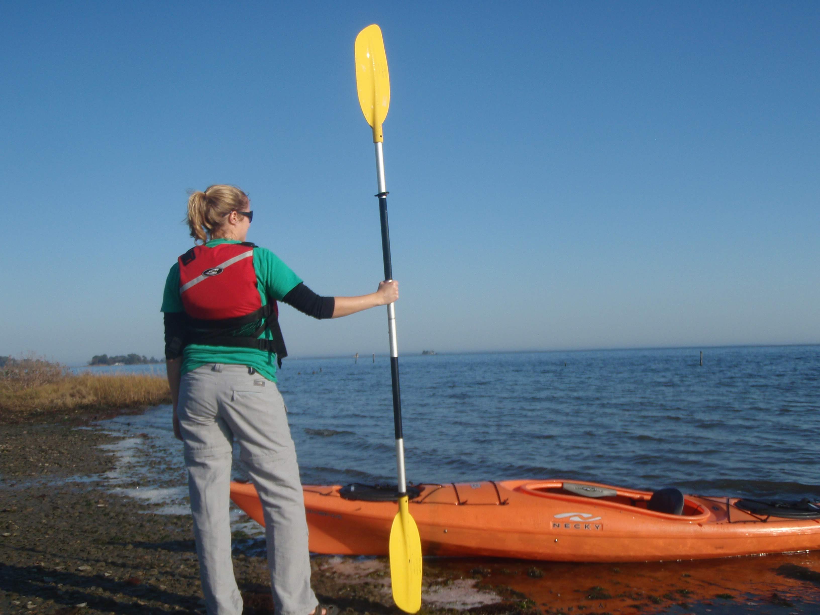
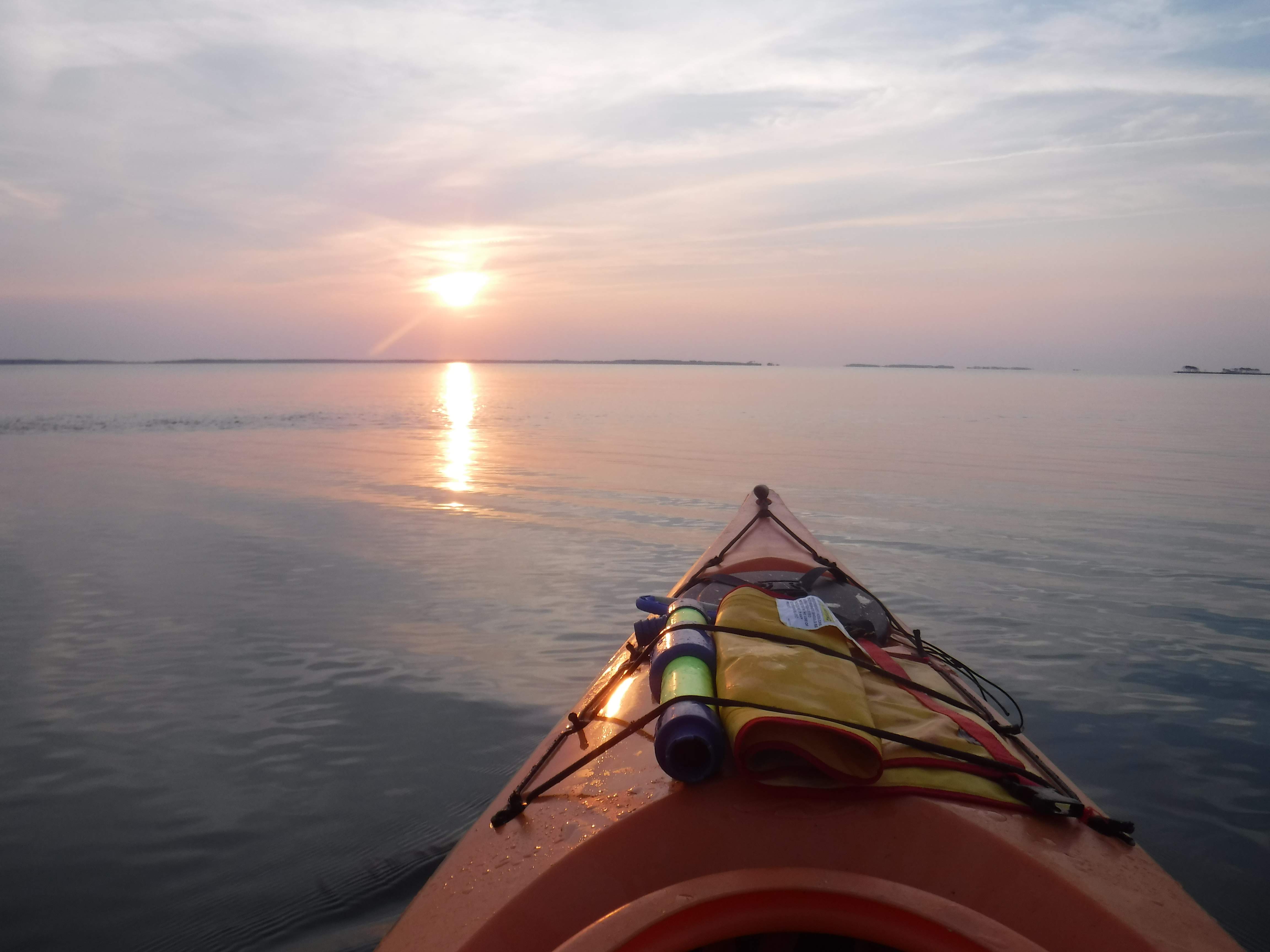
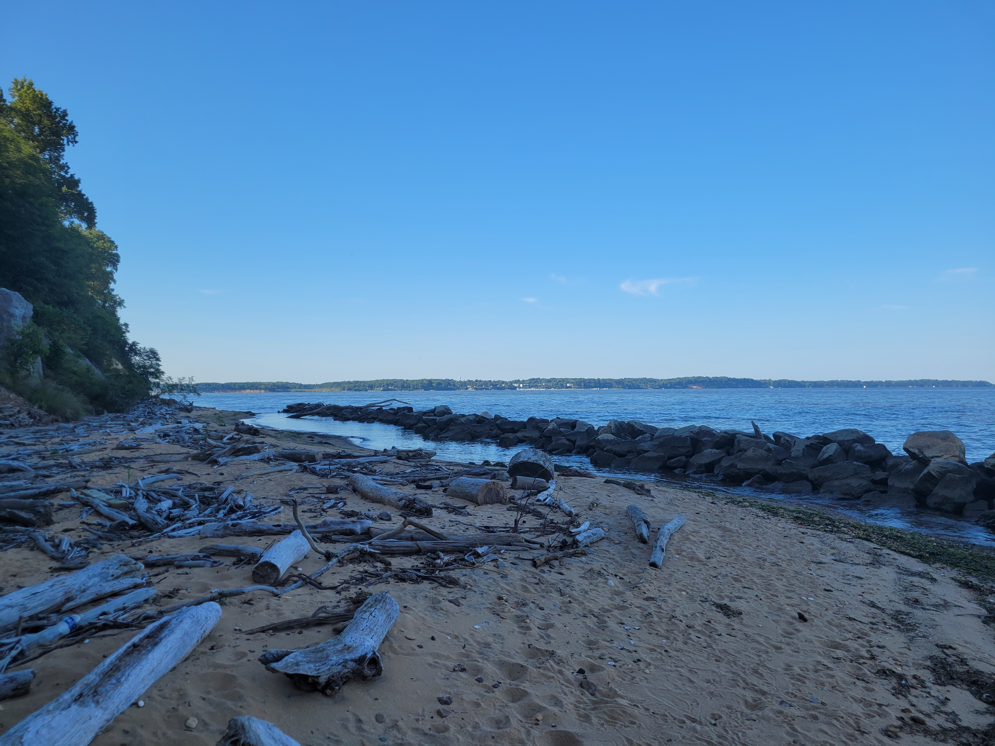
It’s been almost a month since I completed this journey. It was 600 miles total to circumnavigate the peninsula. I promised a reporter in Ocean Pines that I’d let her know when I finished so she could write a story about it. Since that article, my story has now been in three newspapers and I was interviewed on WRDE CoastLife TV show. Feeling some serious imposter syndrome now! Like, is this really news?!

Anyway, I paddled a total of 600 miles that counted toward the overall goal. That 600 miles does not include the extra miles I paddled on some of the out-and-back trips, so I actually paddled 645 miles if we’re getting technical. And that also doesn’t include all the inland paddling I did for fun over the years, and the many kayak trips I led at work.

I’ve been wanting to run some stats on my journey, and I’ve also been wanting to say thank you to everyone that helped make this journey possible over the years. Here are some (probably boring to most) numbers about my journey:

183 hours and 35 minutes of paddling
3.26 mph was my average speed (average moving speed was probably more like 3.5 mph)
74 separate trips (and 74 individual blog posts!)
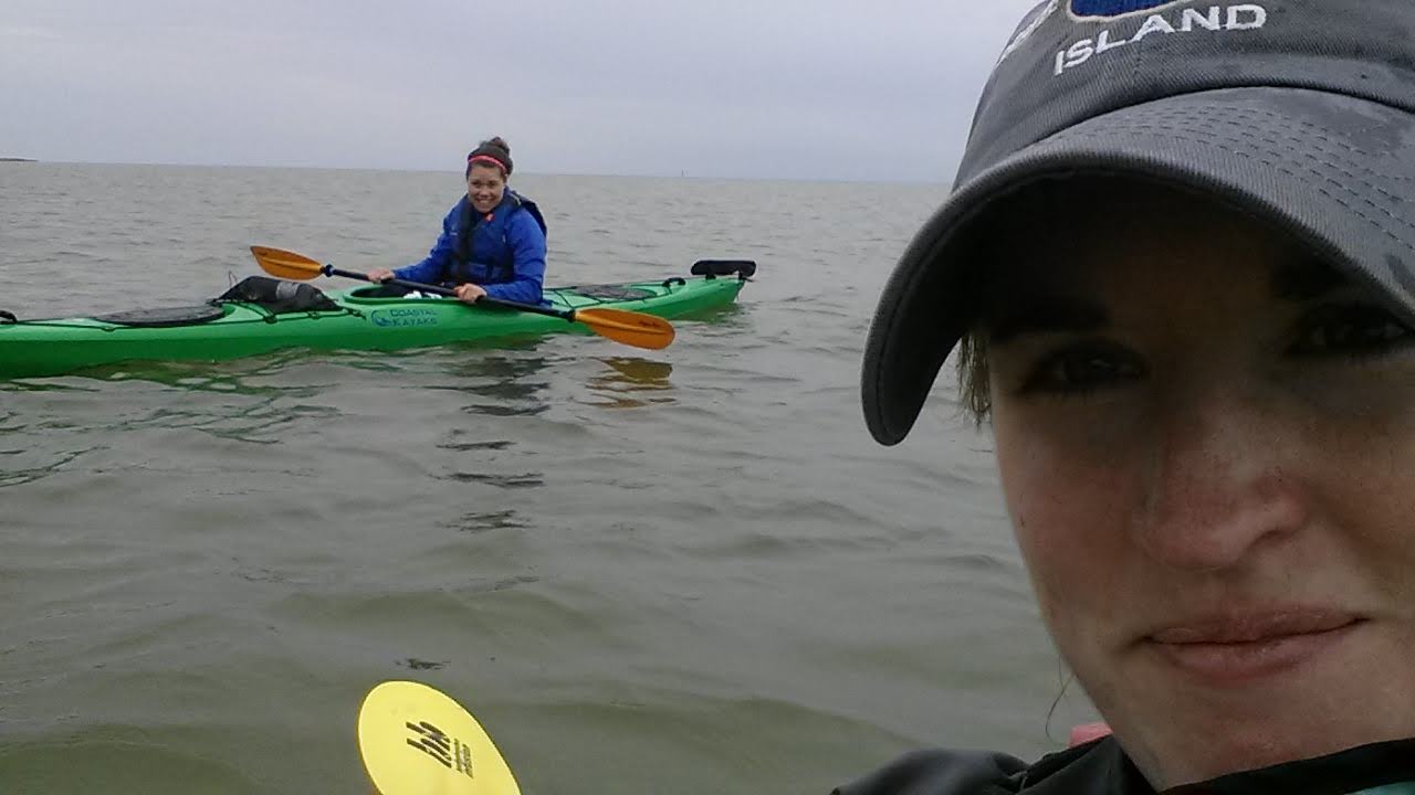
91.5 miles were paddled with friends
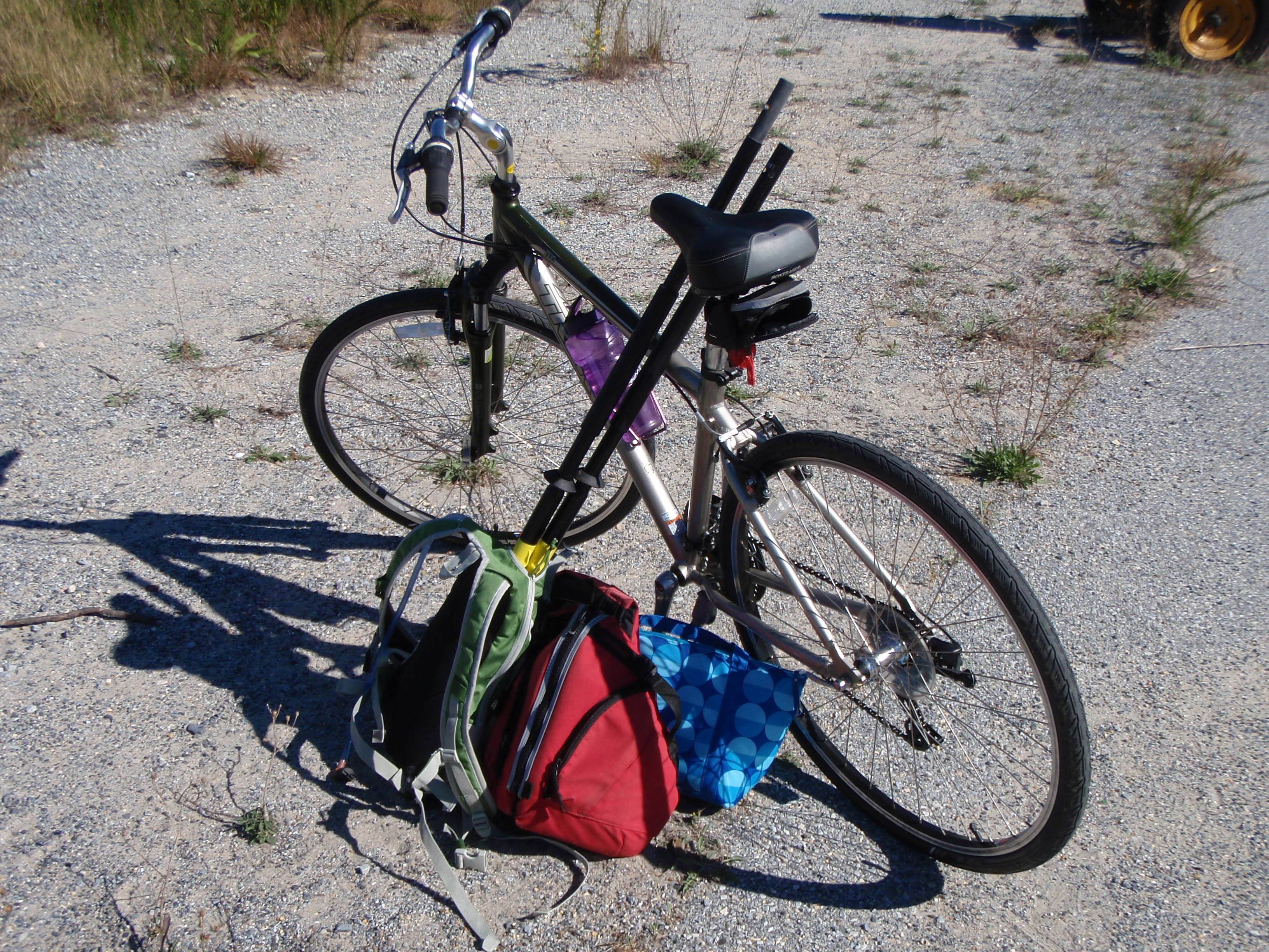
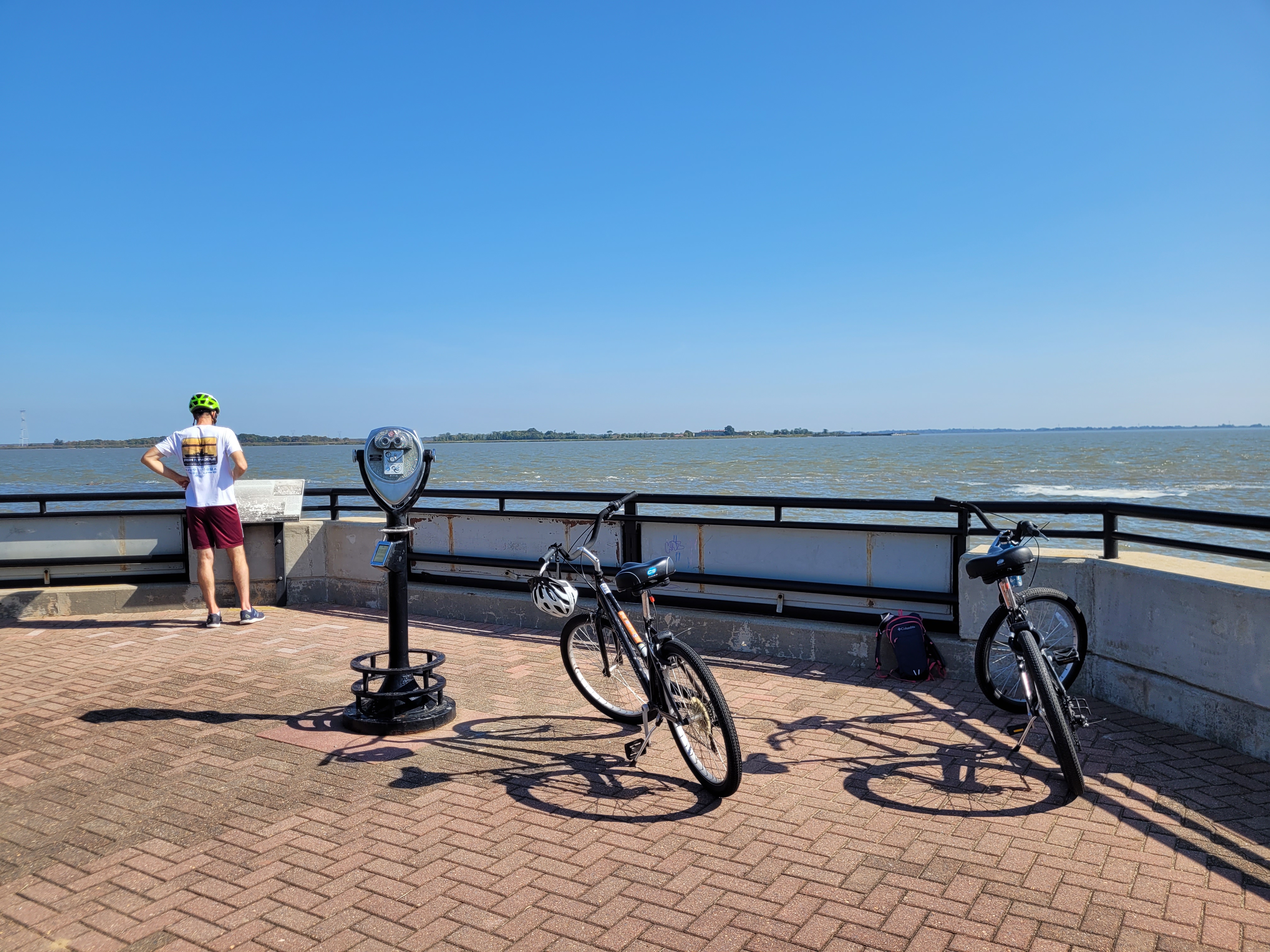
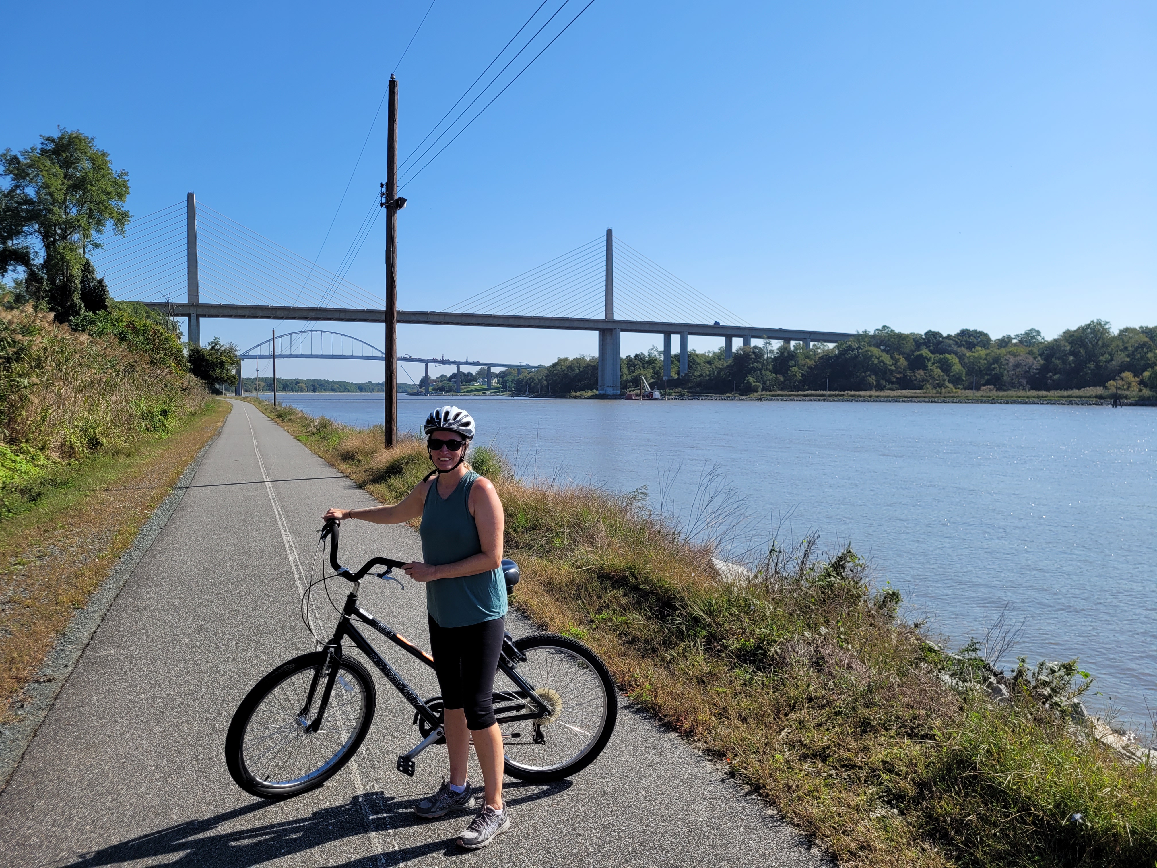
20 trips where I biked back to my car after paddling
169 miles biked
5 miles walked/ran to get back to my car (I only did that on one trip!)
37 trips I had a friend, family, or shuttle company drive me
11 trips were out-and-back
20 trips were in September (the most paddled month – due to nice weather, and quieter work schedule)
1 ferry ride, combined with a bike ride to get back to my car (in Oxford, MD)
115 miles logged in 2023 (the most of any year!)
95 miles logged in 2020 (the second most)
4.8 miles logged in 2018 (the least of any year – not sure why I was so lazy in 2018? thought it was going to be 2016, the year I had Patrick! – I logged 16 miles that year)
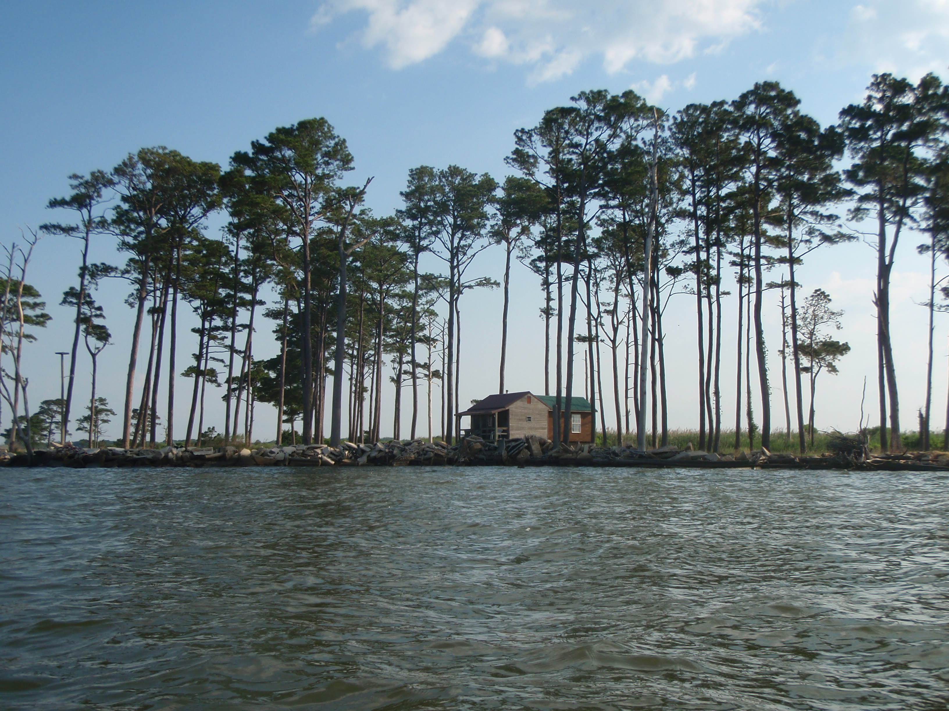
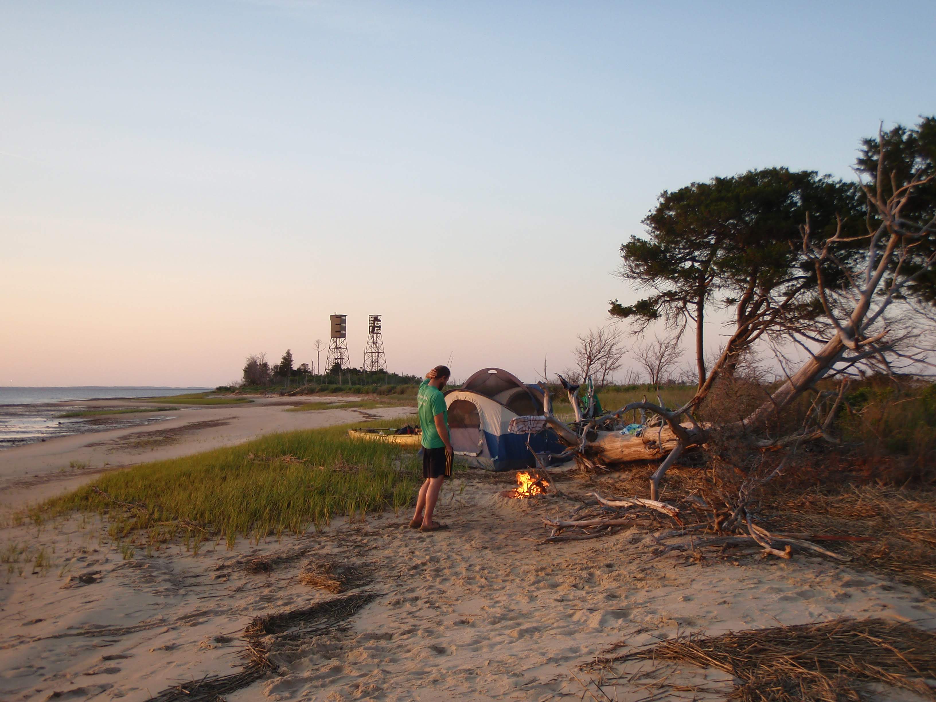
3 kayak-camping trips (Mockhorn Island, Cedar Island (yes, illegal and now that spot is underwater) and a random sand bar between Champ and Crisfield)
2 Airbnb properties used to launch when there was no public access
10,000 miles driven… hah! JK. I didn’t track that. But dang, I’m sure it was a lot. All those miles on back roads to get to remote boat ramps with no cell signal… ugh.

And now a shout-out to all that made this journey possible!

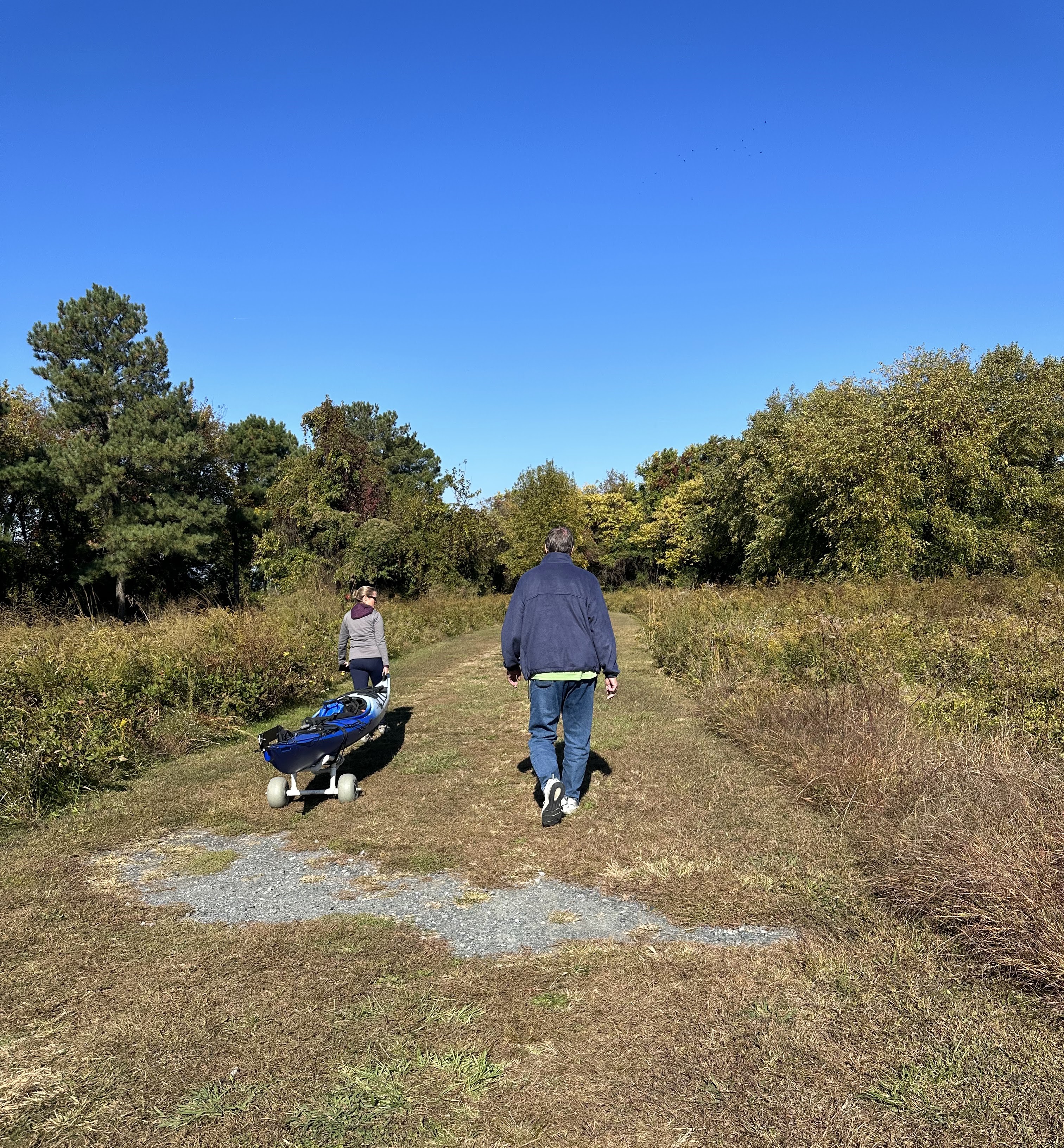
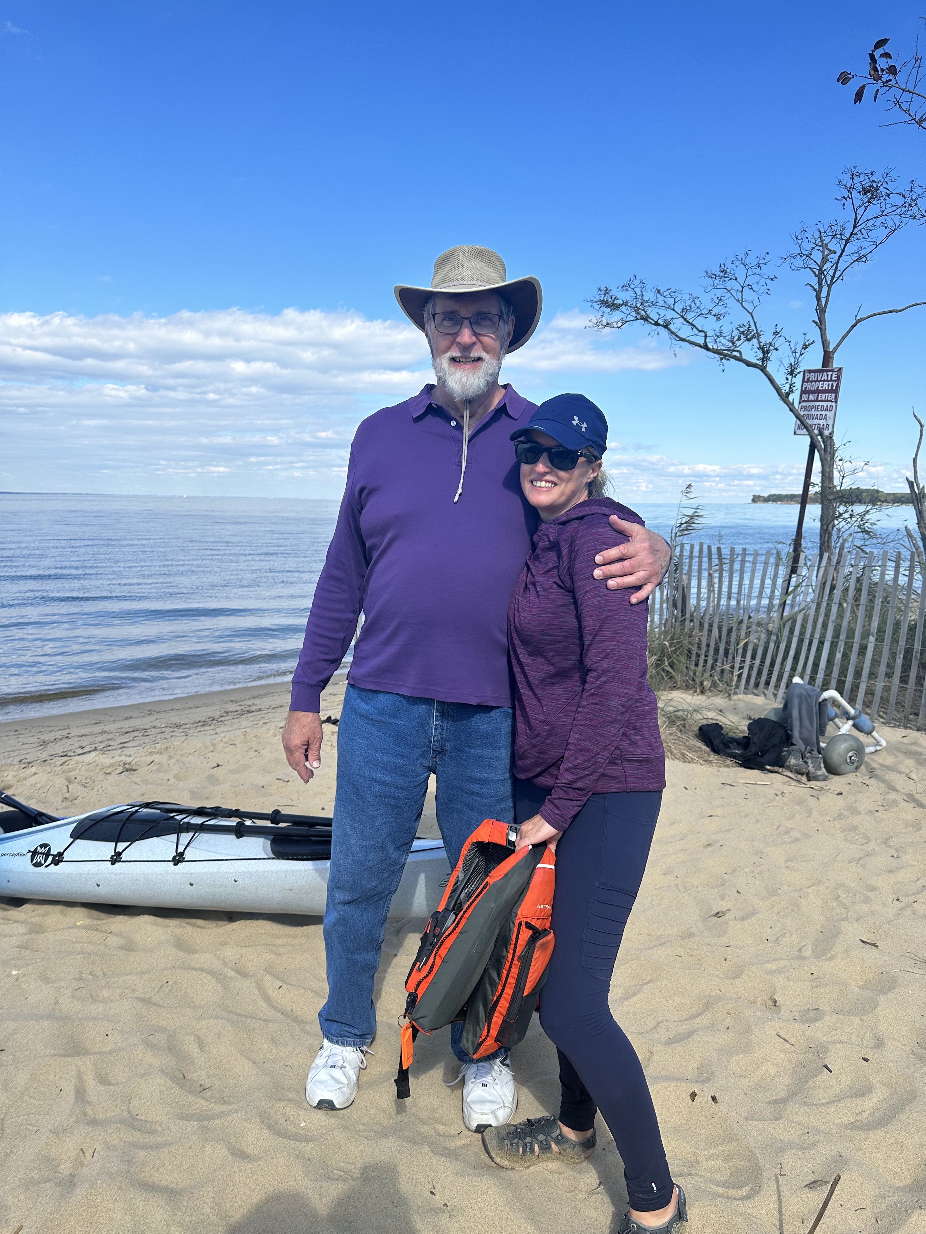
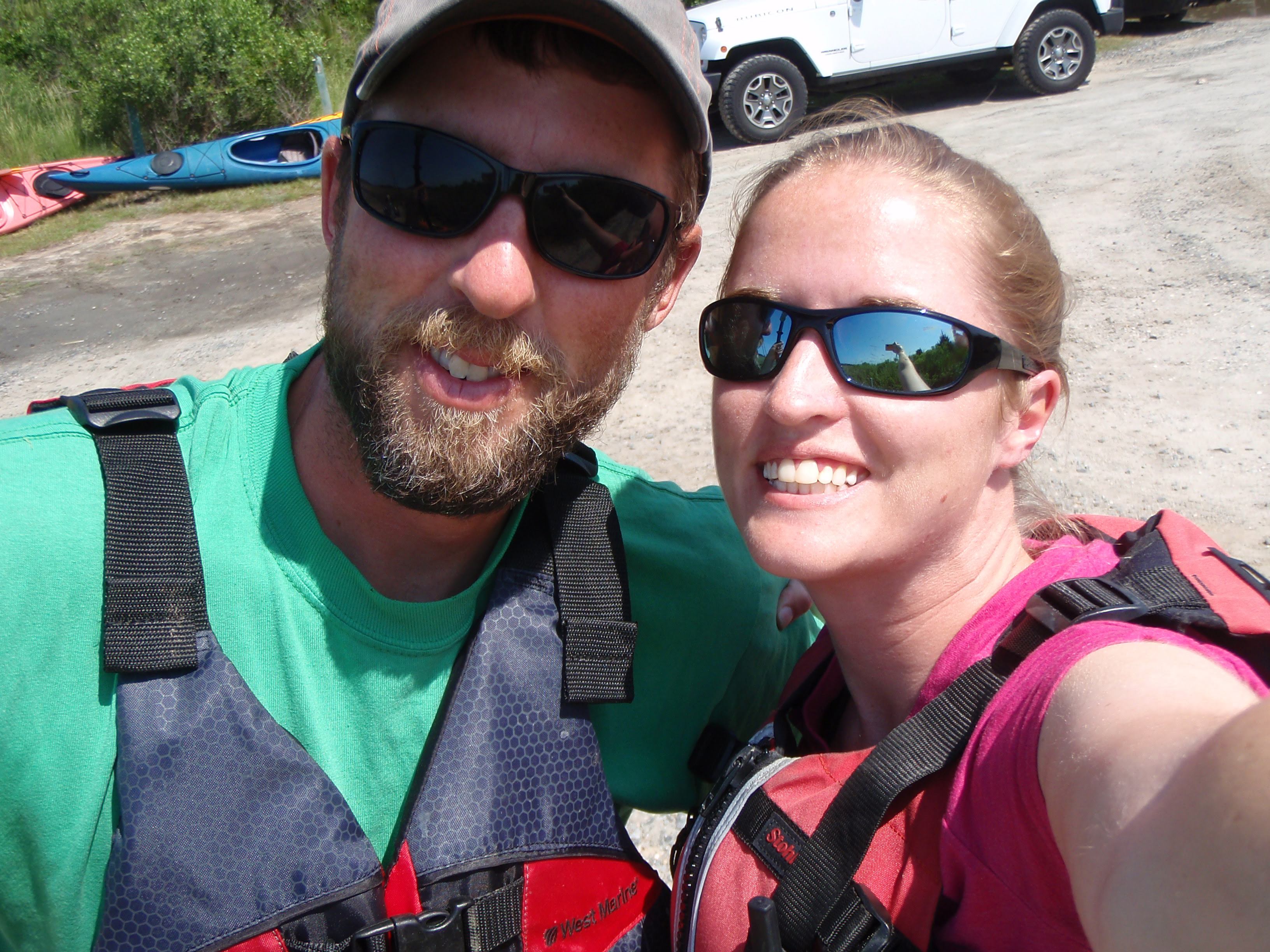
First, I need to thank my husband Brian, for always being my float plan person, helping me read tide charts, encouraging me to go paddle when I was on the fence about going, shuttling me on TWENTY different trips, paddling 3 legs with me, and camping with me on all 3 of the kayak-camping trips.

Next, a thank you to everyone else that helped shuttle me – my Dad, Aunt Margaret Ann, sister Julia, co-worker Lowell, and Wave Riders shuttle company on Virginia’s eastern shore. (forgot to get photos of Margaret Ann and Lowell – sorry guys!)

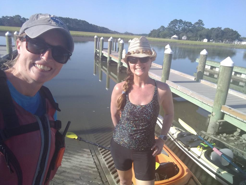
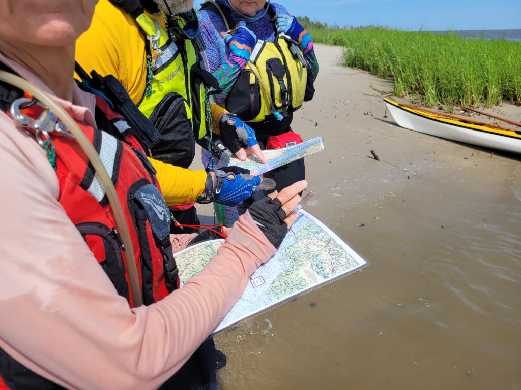
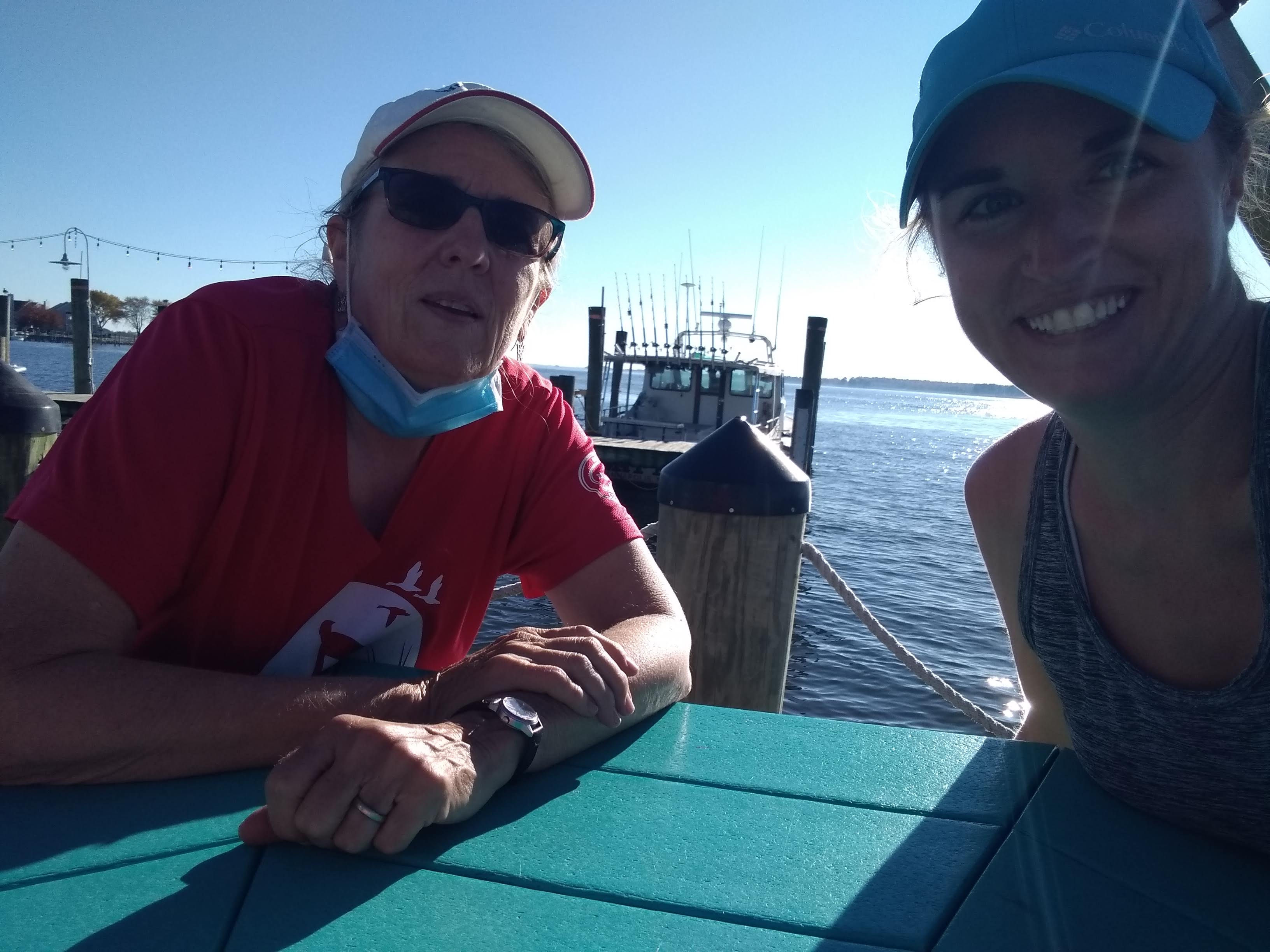
I also have to thank everyone that came and paddled a leg with me. Thanks to my sister Julia, my best friend Julia, Badassawomen Lisa & Kim, and super experienced sea-kayaker Mike (and his 3 other awesome kayaking friends, Gail, Samm, & Adam) for breaking the monotony of paddling alone and coming along on some of the longer, more remote paddles.

view from Lambert Shellfish

I also couldn’t have done this without unconventional water access points in areas where there was no public access. Thank you to Lambert Shellfish in Machipongo, Virginia, that allowed me launch from their property TWICE this year. There’s about a 30 mile stretch of shoreline on the lower Chesapeake side of Virginia’s eastern shore with no public boat ramps, so being able to launch there was key!

I also launched from two vacation rental properties. One was located near Onancock which we had rented for a long weekend. Check that out on VRBO: https://www.vrbo.com/630033

There was another long stretch near Cambridge, Maryland that had no public access and I was able to find an Airbnb that was exactly halfway between the nearest boat ramps. I didn’t book this place, but I did request permission from the owner, Lisa, to launch my kayak there. She was so accommodating, didn’t charge me a dime, and even let me use her bathroom. Check out her property here: https://www.airbnb.com/rooms/17871330

Aside from friends and family that helped shuttle me, I was super grateful for Wave Riders, a local business on the lower eastern shore of Virginia (where I don’t have friends and family!). I booked a shuttle with them 3 different times and one time they even hauled my kayak for me!

I also need to mention Rise Up Coffee! Specifically the one in Cambridge. I stopped there countless times on the way to, or the way back from, multiple trips across the shore. And sometimes I would hang out in the West OC location to write my blog posts. Rise Up really became a staple in this adventure.

And last, but certainly not least, I need to thank everyone that cheered me on along the way. Friends, family, coworkers, random people in paddling facebook groups, people I met out on the water. Not one person thought my goal was silly or unattainable.

So now what?

I’m seriously thinking about paddling all the major rivers on Delmarva. I can even keep this same blog going without starting a new one. If anyone wants to join me on future paddles, please reach out! I do love paddling solo, but it gets lonely out there sometimes!


1 Comment

The FINAL Mile!

It’s just a few days before my 40th birthday, and I have ACHIEVED my goal of kayaking around the entire Delmarva peninsula. Exactly 600 miles. Complete.

On Wednesday, October 18, I paddled the last 1.4 miles underneath the Chesapeake Bay bridge along the shoreline of Kent Island. Now I’ll be honest, I had visions of ending at the restaurant there by the bridge (Libbey’s) on a beautiful Saturday afternoon, joined by friends and family. But if anyone has noticed, the weather has been TERRIBLE the last few weekends. So in order to reach my goal of completing the final leg before my 40th, and before the water temps dip too low this season, I squeezed in the last stretch on a lovely Wednesday afternoon. My Dad, my Aunt Margaret Ann (AMA) & her hubby Rich, and my dear friend Michelle from Ocean Pines came to join me, cheer me on, and celebrate over lunch.

Now if you recall from the time I launched at Terrapin Nature Park back in 2021, the parking area is 1/3 mile from the beach! So my Dad, AMA, Rich, and Michelle walked out to the beach with me as I hauled my kayak on our little kayak cart thingy – they even took turns pulling it for me!

There’s not a lot to talk about when I only paddled an out-and-back trip with a total of 2.8 miles, but I will say that I’m thrilled I left this leg for the final stretch. The day was gorgeous. Winds totally calm. A beautiful day on the Chesapeake.

And I totally underestimated how cool it would be to paddle under that bridge! Holy cow! I’ve of course driven over it hundreds of times, been under it a handful of times on a boat, but paddling in my little 14′ kayak was a totally different experience. It was really cool to stop between the two spans and take in the view.

There was also something pretty special about being under that iconic bridge. It so… Chesapeake. If that makes any sense. We studied the Chesapeake in my 1st grade class and that was my initial inspiration for my career, and ultimately led to my decision to live my adult life on the eastern shore. And as I paddled under the bridge, I couldn’t help but notice that it is THAT BRIDGE that links the first 20 years of my life to the second 20 years of my life.

I started spending summers in Ocean City when I was 19. I remember coming home to the western shore after that first summer and had a feeling of “being home” when I finished driving the westbound span. But after spending that second summer on the eastern shore, I always felt a sense of relief and a feeling of “being home” when I finished crossing the eastbound span.

As I pulled up on the little beach near Libbey’s, I had officially hit my goal. 600 miles around the peninsula. And since I still had to paddle back to my little entourage back at Terrapin Nature Park, I had a quiet moment to myself to take it in what I had just done. It was a pretty powerful moment.

Then I called Brian to share my news. Although I was bummed he couldn’t be there, it was also kind of cool to celebrate with just him for a moment before heading back.

When I got back, my crew was waiting for me on the beach, each with a camera and cheering. We didn’t waste any time, hauled my kayak back to the parking lot, and drove over to The Jetty for lunch and some celebratory cocktails.

“So how do you feel?” “How did you come up with this idea?” “What made you want to do this?” “What was your favorite section?” “What’s NEXT?!”

I’ve been hearing those questions A LOT lately. Those questions don’t just come from other people though. I’ve been asking myself those questions too! I don’t have all the answers yet, but I’ll do my best to answer a few.

I set this goal back in 2012 when Brian and I were driving northbound over the Chesapeake Bay Bridge Tunnel. As we approached Fisherman Island, I wondered what it would be like to paddle to some of Virginia’s barrier islands. And then I wondered what it would be like to paddle around the whole damn peninsula. I laughed at the idea at first, but then it was one of those ideas that you just can’t shake off. You keep thinking about it. And after a few weeks of thinking about it, I started scouring google earth to plan each leg, measured how far it was, started a blog, and before I knew it, I logged my first 8 miles between Wallops Island and the Chincoteague causeway.

At first, I wanted to paddle around the Delmarva peninsula to see the sights. And dang, did I see some sights. But as the last 11 years progressed, my kayaking goal became way more than sightseeing. With each mile logged, I became both physically and mentally stronger. Some stretches pushed me to my limit, enabling me to dig down and find strength when I felt like I was depleted. Other stretches forced me to work through the serious anxiety of being out in the wilderness alone, miles from another human.

Over the last 11 years, I switched jobs, moved, got married, became a mom, bought a house, started a business, experienced the struggles of raising a special needs child, and lost my biggest cheerleader – my mom. Life is pretty crazy sometimes, but being able to chip away at this long-term goal gave me stability and a form of much-needed self-care when I was at my lowest.

Some people could paddle around the peninsula in 3 weeks. But I’m not at all disappointed that it took me 11 years. I’m actually even MORE proud of myself for sticking to something for 11 years, despite some of the curveballs life has thrown at me.

While I’m eager to reminisce and share my most memorable moments, as well as recognize everyone that helped me achieve this goal, and tell you about my plans for what’s next, I need time to put all of those thoughts together. For now, check out my completed map enjoy a couple photos from the last 11 years:


Leave a comment

Matapeake to Libbey’s Coastal Kitchen

I’m pretty darn close to finishing my 600 miles around the peninsula! I’m hoping the weather works out that I can paddle the last stretch to end at Libbey’s Coastal Kitchen on Kent Island and have a few friends and family join me to celebrate soon.

Last Tuesday, while on vacation with Brian, I paddled from Matapeake Pier to Libbey’s. I’ve known other sea kayakers that have paddled to Libbey’s for lunch and I even called the restaurant in advance to make sure it was okay to land my kayak on the tiny beach on their property – all good.

Brian dropped me off at Matapeake pier and I started the short journey north. Winds were so calm and it was a gorgeous day to be on the water. I’d say the most interesting thing I saw on this trip were four aircraft that took off from the small airport near the bridge. They were like motorized hang gliders that had inflatable rafts on the bottom of them!

As I approached the restaurant, I realized the beach was smaller than I expected, but still enough room to get out. I pulled up on the beach but wasn’t quite sure if there was space to walk from the beach to the restaurant itself, because there was a ton of brush and bushes. Luckily, there was a small cut-through so I walked up onto the lawn and called Brian. He was in the parking lot, but there was a fence and a locked gate separating the lawn and the parking lot and nowhere to pull my kayak out and get it to the car! Brian advised me to get back in my kayak and paddle around to the marina and get out at a floating dock.

As I rounded one of the docks, I took a photo of the massive boats around me. But I guess I looked super out of place in my 14′ kayak, taking photos of the boats, because one of the guys that worked at the marina asked me if he could help me with anything. I explained that I couldn’t get out at the beach. He was like, “the beach isn’t there anymore?” I said it was, but the fence was locked and there was nowhere to carry my kayak out. I clearly wasn’t supposed to be in the marina or using their floating dock, but at that point, I didn’t have much choice. Brian swiftly grabbed my kayak and carried it out to the parking lot. “Why did you talk to that guy?! You’re not supposed to be here!” he said. “Because he talked to me first! What was I supposed to do, ignore him? That would be even sketchier!”

Looking back, I guess when I called the restaurant to ask if I could arrive by kayak, I should have clarified that I also wasn’t planning on kayaking back to where I came from! I think the person I spoke to assumed I was paddling to lunch, then paddling back – oops!

At this point, I have 1.4 miles left (out of 600!), starting at Terrapin Nature Park and ending at Libbey’s again. Not sure if I should call the restaurant again to clarify what I want to do and ask if they can unlock the gate so I can load my kayak when I’m done? Or maybe I should not call again at all, because it’s easier to get forgiven than permission?

Ugh, I’ll try not to get on my soap box again about public access to waterways, but this is yet another example of how difficult it is to access the water where I need to!


Leave a comment

Jackson Creek to Eastern Neck NWR

I don’t know why I put this leg off for so long. It’s 3 miles out, 3 miles back. And it’s an easy drive from home and doesn’t require me to get help from anyone else. But after Sunday’s boat-filled journey and scary river crossing, I was happy to have Brian join me as I paddled the 3 miles across the mouth of the Chester River – although he didn’t even complete the whole crossing with me because it was “so boring.”

The water was flat calm and boat traffic was minimal compared to Sunday, so it was an easy trip across the river. And Brian was right, it wasn’t super exciting, but then again, I never said it would be! This was just a “connect the dots” trip! The only semi-interesting thing that happened was a bird flew down and swooped across the bow of my kayak. I thought it was a juvenile laughing gull, but Brian disagreed. He thought it was a small hawk or something. I suppose we’ll never know!

Oh – another bonus to paddling with Brian – he loads the kayaks on top of the car 🙂

Here’s a few photos and the path I took:


Leave a comment

Chesapeake City to Delaware City

When I originally set the goal of paddling around the Delmarva peninsula (11 years ago!) I didn’t know that kayaks were prohibited in the C&D canal. So my circumnavigation idea can never truly be completed unless there’s some kind of special event to paddle the canal one day. However, a nice alternative to paddling is biking, and there’s a bike trail that runs almost the entire length of the canal, so Brian and I rented bikes and biked the 15 miles from Chesapeake City to Delaware City, and the 15 miles back. I’m not a strong cyclist so 30 miles is a lot for me, particularly on a bike that isn’t mine!

The town of Chesapeake City has a cool bike rental kiosk that was super easy and convenient to use. I downloaded the app ahead of time, scanned the QR codes on the bikes we took, and the app unlocked the bike. No bike rental staff necessary!

We took off to the east and enjoyed the waterfront view the whole way. Most of the ride was pretty flat, but there were a few spots where the trail went up a hill, back and forth on a few switchbacks, and back down the other side of a marina or a trail wash-out. It was really cool to bike underneath the Route 1 bridge – totally different view than the dozens of times we’ve driven across it!

We took some time to eat, hydrate, and explore the waterfront of Delaware City, and then we headed back to Chesapeake City. I definitely struggled on the ride back. My thighs were burning by the end! Totally different experience than kayaking, that’s for sure!


Leave a comment

Stemmer’s Run to Harbor North Marina

Last week Brian and I spent 5 days traveling around Delmarva to celebrate our 10 year wedding anniversary (shout out to his parents for watching Patrick all week!). This was the first time we’ve spent more than one night together, away from Patrick since he was born, so we decided to stay somewhat local, doing what we love – kayaking, biking, fishing, and hiking.

On Sunday, October 1, we started our journey north and I completed another 9 miles in the upper Chesapeake. Brian dropped me off at Stemmer’s Run boat ramp and explored a nearby wildlife management area while I paddled. I was thinking it was only 8 miles and it would take me a little over two hours to complete, but it turned out I was paddling against the wind and tide, and there were tons of boats to deal with, which really slowed me down.

We had had a string of crappy weather, and Sunday was the first beautiful day we’d had in nearly two weeks, so it seemed like everyone that owned a boat was out and about. As I approached the mouth of the Bohemia River, I was half tempted to cut the paddle short and paddle upstream to a kayak launch a few miles up. Crossing the river seemed terrifying with so many boats around, many of which were speed boats – boats that were so loud I could feel their engines reverberating in the hull of my kayak and I could barely hear myself think. But just as I was about to start paddling upstream, the wind immediately started to die out and boat traffic was almost nonexistent. It was super weird. I took it as a sign to just go for it and I made a bee line across the mile-wide river and was on the other side in no time. At no point was I even close to a boat. It was like the universe stopped for 20 minutes so I could safely cross.

Between watching boat wakes and dealing with wind, I didn’t take many photos. This trip was a “just get it done” trip. Scenery was mediocre and wildlife sightings were basically nonexistent. As I approached the mouth of the C&D Canal, I did see some interested aids to navigation and one GIANT yacht. Like a personal cruise ship!

I completed this leg in 3 hours, where Brian was patiently waiting for me at the end (I use the term patiently loosely – IYKYK!). Since there is no public access north of the Bohemia River kayak launch, I pre-arranged with the manager of the Harbor North Marina to allow Brian to pick me up there. Most marinas will not allow this, even if I try to throw money at them, which I find super rude. I could get on my soapbox now about public access to waterways, but that’s probably a topic for another time! The best part of this paddle was that it ended at a bar. I honestly think this stretch of my journey was my least favorite leg to date, so ending with a cold beer, with my husband, was a treat!

Here’s a couple photos and the path I took:


Leave a comment

Bowers Beach to Port Mahon

After the 16 miles in the upper bay, I decided to finish out the last remaining stretch in Delaware the following day! My dad was again willing to come along for the adventure and drive my car to pick me up at the finish line. I couldn’t have done these final stretches without him.

After dropping Patrick off at the bus stop, my dad and I headed up to South Bowers Beach. The tide was still favorable for paddling northward, but I knew the wind was supposed to be a bit breezier than the day before. Brian had recently introduced me to the Fish Weather app, which has really detailed hourly wind forecasts. Based on what the app said, the wind was forecasted to be NE, about 8 mph, and that’s exactly what is was when I launched.

I had planned to hug the coast, but the first stretch would have been in a NW direction and that would mean the wind would be coming at me perpendicularly, which I hate. So instead, I headed due north, straight for the southernmost house of Kitts Hummock. Because the wind made the first 3 miles a little tricky, I didn’t take any photos.

My dad had planned to stop at the tiny village of Kitts Hummock to watch me paddle by, but I didn’t see him anywhere on the beach. I finally got to a spot where I could check my phone and I saw he had texted me 20 minutes prior, wondering where I was. I guess he was expecting me to arrive sooner, based on my super speedy rate from the day before! I replied, and shortly after, I saw him walk out on the beach. After a quick “are you okay” – “yes, I’m fine” conversation, I waved and paddled on.

There wasn’t a ton of scenery along this stretch, except the peaceful, undeveloped shoreline. But since I was so close to Dover AFB, there was plenty of aircraft to see! I wish I had been able to take some photos closer to Bowers Beach when they were REALLY low flying over me!

I arrived at Pickering Beach another 45 minutes later, where my dad also planned to stop and wave. As I approached the tiny beach village, I tried to see if I could spot him in the distance. He’s 6’5″ so I thought he’d be easy to spot. I knew he was wearing a light-colored hat and a darker shirt and thought the tiny speck on the horizon was him. And then I thought to myself, or maybe that’s an eagle sitting on a white post? And then I literally laughed out loud at the “is that my dad, or an eagle?” train of thought!

Turns out, it WAS may dad! Again, after a quick “are you okay?” conversation, I continued north. It was also around this point that the wind started to die out. EXACTLY what the fish weather app had predicted – yay!

Somewhere between Pickering Beach and Port Mahon, which was completely undeveloped and a rugged shoreline, I spotted a few dump trucks flying down the coast! They weren’t directly on the beach, but just behind a narrow section of phragmites grass. I honestly thought this was all wild marshland, but clearly there was some kind of road that they were driving on, although I have no idea where they were going or what they were doing there. I guess it’s possible they were doing some maintenance on impoundments? I’m pretty sure that area is part of the Little Creek Wildlife Area.

As I approached Port Mahon, I was reminded of how sketchy this area can be. I have visited in the past by land, and there were questionable characters just sitting in their cars and I just felt uneasy. So needless to say, I was glad my dad was picking me up at the boat ramp, rather than me needing to bike back to the beginning or catch an Uber or something!

Once I was about to go under the fishing pier, two guys on the pier were waving. “Hey Laura!”

Huh? Oh right, my dad was probably on the pier not long ago, proudly explaining who I was and what I was doing.

“Your dad just texted you! He’s heading down to the boat ramp!”

Haha, I know. I got that text already. That’s my dad though; very thorough!

Then I spotted my car, driving away from the boat ramp towards me. I waved, my dad saw me, and turned around to head back to the ramp. I was only a half mile away from the ramp, but since the road runs adjacent to the shoreline, he drove at about 3.5 mph just to stay even with me for the last half mile. It made me laugh! It’s nice to know that no matter how old I get (gonna be 40 in a month!), my dad is still willing to go out of his way to make sure I’m safe. And I think he got a kick out of hopping from place to place to follow my journey today! And I know my mom was smiling down on us the whole day 🙂

As I loaded up my kayak on my car, the feeling of accomplishment was pretty spectacular – Delaware is COMPLETE! I now only have 15 miles left of my entire goal. I can’t believe this journey is almost over, having started 11 YEARS ago! I have about 10 miles left up in Cecil County, and 5 miles left around Kent Island.

We celebrated my accomplishment with a pizza at Frederica Pizza House on the way home.

Here’s the map of my final leg in Delaware:


Leave a comment

Collins Landing to Delaware City

The 16 miles from Collins Landing to Delaware City had felt daunting to me for some time now. I know the tides in the Delaware Bay can be pretty strong and I’ve always been a little unclear on how the flow of the Delaware River affected the upper bay. And then there’s the C&D canal that probably makes the currents even more confusing.

But on September 20, I surprised myself and conquered it all! With the help of my dad 🙂

I recruited my dad to help me with some shuttles this week. My original plan for Wednesday was to paddle from Collins Landing to Augustine Beach, about 9.5 miles. Paddling all the way to Delaware City is more like 16 miles and that felt like a long, scary distance to do alone (plus crossing the mouth of the C&D canal alone sounded scary).

We got a pretty early start and drove the hour and 45 minutes to Collins Landing, which is within Cedar Swamp Wildlife Area. I chose this day to paddle because winds were minimal, and I was able to time the trip with the incoming tide.

As I was launching, some watermen were coming into the boat ramp and jokingly commented on how my vessel must not be bad on gas. I agreed and then my dad chimed in proudly, “she’s paddling around the whole Delmarva peninsula!” I don’t remember their exact reaction because I was already starting to paddle away, but it was a mix of surprise, awe, and well… confusion. Yes, some people think I’m crazy for doing this!

As soon as I rounded the corner of the marsh and into the bay, I had a lovely view of the power plant in New Jersey. It’s literally the only thing you can see on the NJ side of the bay for this entire stretch of bay. I remember seeing it when I completed the stretch from Port Mahon to Collins back in July, and thinking it was such an eyesore, but honestly, it grew on me as I paddled throughout the day. It was always in sight because it’s massive, and the steam just silently flowed gracefully out of it all day. Is it weird to say it was even calming?

On the Delaware side of the bay there was almost nothing to look at except rugged shoreline and phragmites grass and the occasional eagle. I did pass a strange… monument? It looked like a mini Washington monument on top of an old ferry piling, and it did have some words engraved on it, but I couldn’t get close enough to read it. I was told later by a friend that it marks the line between the Delaware River and the Delaware Bay. I also passed a LARGE electric line that appeared to start on the shoreline (or probably ran under water from the power plant?) and headed far inland.

I had a great cell signal for the whole trip. I was able to update my dad on my whereabouts with screenshots of my GPS location and he was able to time his arrival at the end point accordingly. But I still can’t believe how FAST I paddled! I averaged 4.3 mph which is like record speed for me! That incoming tidal current really was strong and I rode it all the way to Augustine Beach. It was honestly the easiest 9 miles I’ve ever paddled!

me, paddling into Augustine Beach, taken by my dad

When I arrived, my dad was chilling on the beach with his chair and umbrella. I was on such a high from such an enjoyable paddle that I told him I was considering paddling the remaining 6 miles up to Delaware City. We drove so far to get here, the wind was so calm, and the tide wasn’t supposed to change for a few more hours, I couldn’t pass up the opportunity to just get it done!

After a quick snack and hydration, and a quick call to Brian to see if he was available to pick Patrick up from the bus stop in the afternoon, I set out again and continued north. As I was launching from the beach, I saw a large ship heading up the bay from the south. I checked my Marine Traffic app to see what it was. It was the Shimanami Star, a bulk carrier from the Bahamas. As I write this three days later, it is now up the Delaware river near Trenton.

The next 3.5 miles flew by effortlessly. The tide continued to carry me up the bay. At times I felt like I didn’t even need to paddle.

And then came the mouth of the C&D canal. The spot I was anxious about. I turned my radio on to channel 16 so I could listen in on any communication happening between nearby boats. I also checked my marine traffic app again to see if any ships were headed up the canal or looking to turn into the canal. As I approached the southside jetty, I waited for a small recreational boat to come out of the canal. After that, it appeared that the coast was clear for me to cross the 0.3-mile canal. There definitely were some squirrely currents, but nothing I couldn’t handle. I just had to remind myself – “loose hips!” – something I learned from women’s paddling weekend back in June.

Then, out of nowhere, another boat was heading into the canal from the south. This guy must have been CRUISING because I had watched downstream and all around to see if any other boats might be approaching the canal before I crossed and I don’t think this one was anywhere in sight. I was over halfway across so I paddled like hell to continue on and get out of his way. He showed no signs of slowing down and I doubt he ever saw me at all. The wake that boat put out was massive too. I saw the giant wake heading toward me, and having never taken a wave from behind that large, I whipped around 180 degrees so I could take it head on. That wake was probably the largest wave I’ve ever dealt with to be honest. While I never felt like I was going to lose control, it still got my adrenaline pumping big time. Once the wake settled down, I spun back around and finished the canal crossing. I got safely north of the northside jetty and thought to myself, “damn, glad that’s over, I don’t need to do that again!”

I then gathered my composure and pressed on toward Delaware City. Before I got into town though, a spotted lanternfly landed on my kayak. We still aren’t seeing these down in Berlin, so I took a picture, and then promptly squashed it – kind of satisfying!

Having worked for Delaware State Parks for many years, I was somewhat familiar with the town and the smaller canal into town, since I had been out to Fort Delaware State Park several times. In fact, as I entered the little canal, a DNREC boat was leaving for the island. I waved excitedly as I saw two people in Delaware State Parks uniforms on the boat. I snapped a photo as I waved – they were probably wondering who this random girl was that looked so excited to see them!

A few minutes later, I was approaching the boat ramp and there was my dad, on the floating dock taking pictures. I felt SO accomplished! I had no intention of paddling 16 miles, and I could now say the upper Delaware Bay was complete! After I loaded up my kayak and changed into dry clothes, we enjoyed a nice seafood lunch at Crabby Dick’s in town.

Here’s my epic, solo journey on the map. If you zoom in far enough on the canal crossing, you can see the little zig-zag from where I dealt with that boat’s wake!


Leave a comment

Lambert Shellfish to Cape Charles

Today was a HUGE milestone! Maybe the biggest yet for my 11-year journey. Ready for it?

I am FINISHED paddling the shorelines in Virginia! Everything from Saxis, down around the tip of Wise Point, and up to Chincoteague and Greenbackville. And well, if we want to get technical, that line continues up to Kent Island and Bowers Beach, DE. I now only have 41.5 miles left to completely circumnavigate Delmarva, and I feel poised to finish this season, as long as the weather cooperates.

Just 3 weeks ago, my friend Lisa and I paddled a 14-mile stretch from Lambert Shellfish to Morley’s Wharf. Let me just tell you that I am SO thankful to have met Alex, the owner of Lambert Shellfish back in the fall of 2021 while I was doing some work for Virginia Water Trails. There are no public boat ramps between Morley’s Wharf and Cape Charles, so for years, I was perplexed as to how I was going to complete the 25-mile stretch (not a fan of paddling that far in one day). Alex was gracious enough to allow me to launch from his family’s property, not once, but TWICE, so I could complete this section of Delmarva. To read more about Alex and Lambert Shellfish, check out the blog I wrote back when I toured his facility. It’s a fascinating story about how he quit his job in Manhattan to move to the eastern shore of Virginia to start the oyster farm.

Now, as all of my blog posts seem to begin, I saw the marine forecast was calling for 5 kt winds from the SE and The Weather Channel was calling for “abundant sunshine.” I booked another shuttle with Wave Riders, loaded up my kayak the night before, and started my drive down to Machipongo at 5 a.m. the next morning.

The sun came up only 15 minutes before I arrived at Lambert Shellfish, and the bay had a gorgeous pink/blue glow to it. Winds were totally calm. It was stunning.

As soon as I launched, I again spotted a handful of small stripers in the shallow water (same thing happened when Lisa and I launched there a few weeks ago). There were also a number of fish jumping. Like 12″ bluefish! I think I even spotted a Spanish mackerel, which Brian confirmed was quite possible. And now he wants to launch there too, so he can fish! 🙂

This area seems to be packed with sandbars, which I noted in my previous post while paddling to Morley’s Wharf. Today was a higher tide and most of the sandbars were submerged, but still a few were above the waterline, allowing birds to hang out, like this great blue heron. For some reason I don’t see a ton of herons in this part of the bay. Usually, I have to be in a narrow creek to spot them, so this guy looked goofy to me, out enjoying the sandbar all by himself.

I had big plans on this trip to get out and explore Savage Neck Dunes, a state natural area preserve. Brian, Patrick, and I explored the trails back in early 2020 and I was stunned at the topography and massive dune system when we were there. But today I could not spot where the trailhead was, and I didn’t see any human footprints on the beach. I wondered if maybe it is currently closed to visitation, so I have a call into my contact at DCR to find out the scoop. I did land my kayak on the southern end of the property and walked a small stretch of the beach. There were TONS of fox and ghost crabs tracks, but no human tracks except mine.

The sandbars in this area seemed to continue all the way south, almost to Cape Charles. At times, I spotted larger waves (likely wakes from container ships) crashing into them. At first I was slightly alarmed at the possibility of a rogue wave coming at me (although I’m told there’s no such thing as a rogue wave!), but then I realized they were just more sandbars, ultimately providing protection for me and reducing the wave energy closer to shore.

As I approached the mouth of Cape Charles Harbor, I was also grateful for the breakwaters that are just offshore. This again protected me from larger boat wakes as I entered the busy harbor.

Cape Charles is interesting to me. On one side of the harbor, you have a gorgeous fishing pier, historic homes, and a quaint downtown. The other side is majorly industrial. Large machinery was moving sediment from barges into giant piles. A work boat was racing out of the harbor, and a handful of recreational fishing vessels were coming and going from the boat ramp.

When I arrived at the boat ramp, I was happy to see a kayak launching area, so I didn’t have to get in the way of several fishing vessels AND a USCG rescue boat. But I’m honestly not a fan of floating kayak launches. They seem great in theory, but it would’ve been way easier to just use the boat ramp. It was difficult to shimmy myself far enough onto the floating launch so safely get out, and once I was out, it was incredibly awkward getting my kayak out of the launch itself. Again, I was glad I wasn’t in the way of the boaters, but floating launches are not my thing.

When I finally got out, I felt SO accomplished. I’m officially finished paddling Virginia. But with one caveat. Brian thinks I need to paddle Fishman Island. This is the southernmost barrier island of the peninsula and it was not part of my original goal. I paddle INSIDE all of the barrier islands – not out in the ocean! But I told him I’d be up for the challenge if he went with me. He paddles and fishes Fisherman Island often, so he knows what to expect when it comes to tides, currents, and surf. If the weather works out, we may do this as part of our 10-year anniversary trip in early October. We’ll see though 🙂

I locked my kayak to a piling, ate some lunch at a picnic table, and before I knew it, my driver from Wave Riders was there to shuttle me back to my car. Long, tiring, but super productive day!

Here’s the 10.8-mile path I took today:


Leave a comment

Stemmer’s Run to Grove Neck

I was able to paddle 8.8 miles today, but only 4.1 really counted towards my circumnavigation goal. I always like to paddle a one-way trip, rather than an out-and-back, but sometimes I can’t avoid the out-and-back due to geography and the lack of someone to shuttle me, or safe roads to ride my bike on.

Last year I headed up to the upper shore and paddled from Still Pond Station to Betterton Beach, and then paddled a 4-mile round trip from Betterton to a peninsula called Grove Neck and back to Betterton. You can see that trip here:

Today I paddled to Grove Neck from Stemmer’s Run boat ramp, located about 4 miles to the north. 

I had some commitments in the afternoon (Patrick got to meet his 1st grade teacher!) so I hit the road just after 5 a.m. to head up to Cecil (!!! first time paddling in Cecil!) County. I got on the water around 7:30 and started down the shoreline. Winds were near calm and the water was flat.

One thing I noticed as soon as I launched, was that there was a LOT of grass in the bay. Rafts of grass were floating about, sometimes completely engulfing the crab pot buoys! I’d imagine the local watermen may have had a hard time locating all of their pots because their colorful buoys were covered in dark green grasses!

The calm winds didn’t last though. What little wind there was, was coming out of the NE and I didn’t realize it at first, but the Elk Neck/Turkey Point peninsula was providing shelter from the wind when I first launched. But the further south I went, the more fetch there was for the wind to create some waves coming out of the NE. 

The last half mile before I reached the point along Grove Neck where I head left off last year, was, well, a little nerve-wracking. I wasn’t in any real danger, and I definitely have more confidence since taking a women’s sea kayaking course in June (run through Cross Currents Sea Kayaking – check them out!), but the turbulent water, coming from an awkward direction, made me nervous since I was paddling alone this time.

I successfully made it to the spot where I ended last year, right near a property where the landowners somehow installed a concrete boat ramp at the bottom of their VERY steep descent from the house to the water. I can’t imagine backing a boat trailer down that thing!

And although there were some steep cliffs along the edge of Grove Neck, there was a small beach right by my turnaround spot, allowing me to get out for a minute to stretch and catch my breath (the beach was also covered in that grass).

The return trip was a lot less stressful going into the wind. Some people may think paddling against the wind would be more difficult, but when a wind is coming from behind at an angle, maintaining direction and stability is a little more challenging. When I paddle INTO the wind, I can see every wave coming and sail right over them. And just as expected, once the elk neck peninsula was between me and the direction the wind as coming from, I noticed calmer waters as I headed back north.

On the way back, I decided to hug the coast a little more than I did on the way down. I saw on the satellite images that there was a small marsh creek and some beaches off to the east that I wanted to explore. I paddled into the calm waters of the creek, but unfortunately, the beaches were covered in “no trespassing” signs. I obeyed orders and never got out on the beach, and instead, headed back to the boat ramp to call it a day.

One thing that I noticed on the way back, and completely missed on the way out, was that you can see the Turkey Point Lighthouse from here! It may have just been a white speck amongst trees, but it was still cool to see a lighthouse while paddling. And I don’t normally get excited for bald eagle sightings (they’re like any other ol’ bird nowadays), there were TONS of them around! Adults, juveniles, everywhere. It was kinda cool.

Here’s the path I took today, both to and from Grove Neck. Just 52 miles left to my goal! (scroll down for a few more photos too)