It’s Memorial Day Weekend and what does that mean? Time for Brian and Laura to leave town, escape the Ocean City madness, and go on another kayaking-camping adventure.
Last year we had perfect weather and camped out on Cedar Island on the eastern shore of Virginia. This year, the weather forecast was looking perfect again so we headed to the Chesapeake side of the peninsula. Last fall, Brian had been fishing out near the teeny tiny town of Rumbley, MD which is somewhere between Deal Island and Crisfield, and he thought there were some islands out there that had good camping potential. In order to get some decent distance in, he dropped me off in an even smaller town, Champ, MD. As I started to paddle south, he drove to Rumbley and fished for a while. Although Champ had only a handful of houses, there seemed to be quite a bit of activity at the “wharf” (really it was just a beat-up, old boat ramp). There were a few watermen that had just come in, and several families were getting ready to head out on the water for the day.
 Once I got out of the boat ramp area and out of the creek, things quieted down very quickly. Except for the osprey – there must have been a nest on every channel marker and more in the dead trees in the marsh. I don’t think I’ve ever seen/heard such a dense population. Despite the osprey though, the quiet got me thinking – I would love to own property out here one day. Nothing fancy, just a waterfront lot with a little bungalow. I don’t even need proper plumbing and electric. I told Brian later, if we ever get to a point in our lives when we can manage a second home, I want to buy out here (or really anywhere from here south to Cape Charles). Just a place to get away from the crowds, get away from cell phone reception, and spend our days fishing, crabbing, and hanging out on the water.
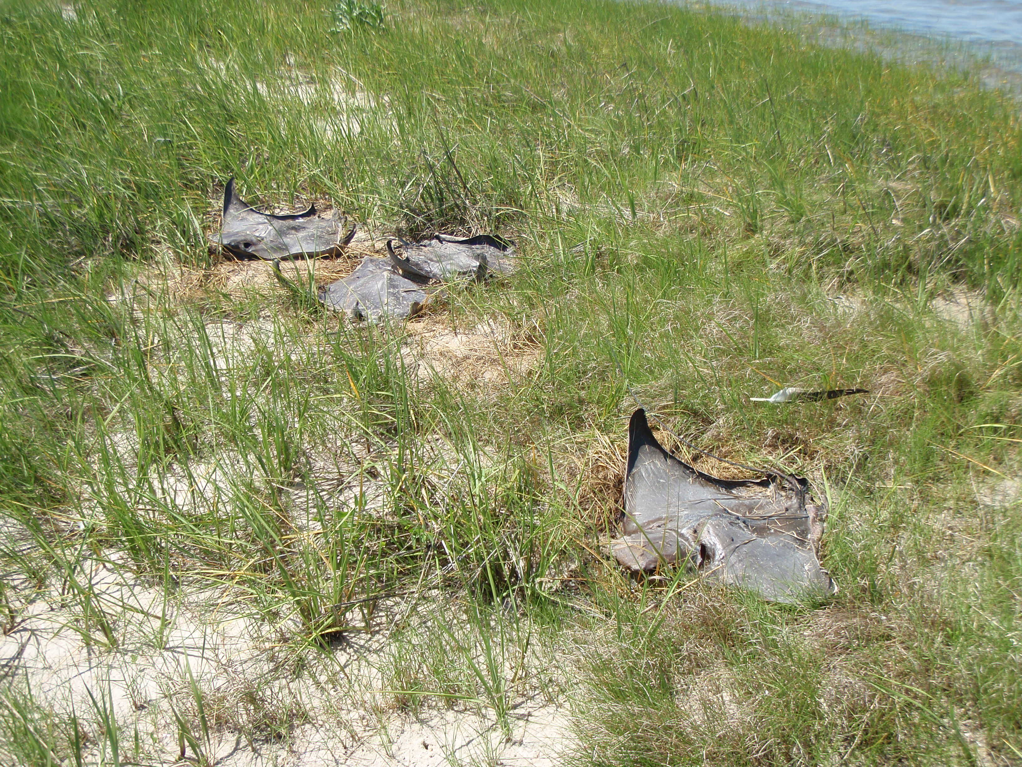 So enough day dreaming. The first spot that I decided to get out on dry land was a small marsh point, about 2 miles into the journey. Bad idea. As soon as I got out of my kayak I was engulfed with flies. As I looked around, it was clear why: sting ray graveyard. There were about 5 cownose rays that were dead and dried up and covered with flies. It appeared that they had swam over the point at a high tide, and as the tide when out, they got stuck. Gross. And to be honest, I didn’t really have much sympathy for them – I’m still bitter about my sting ray incident 5 years ago (another story for another time).
To escape the flies, I hopped back in my kayak and pushed on. The next place I stopped was a small sand bar. After inhaling my sandwich, I decided to take a detour from my original course plan. The wind had started to pick up at an awkward angle and I was not in the mood for battling wind/current issues. I pulled out my trusty Android and “My Tracks” app to see what my options were. I quickly realized I could cut through some of the marsh peninsulas instead of paddling all around them. I veered off to the east and pushed forward.
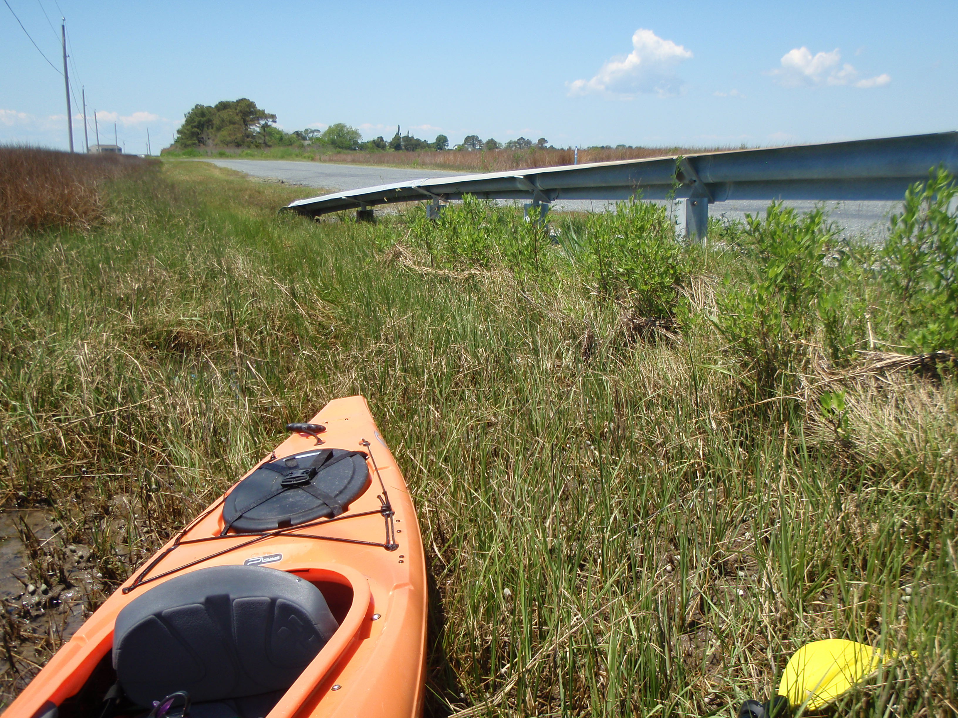
This seemed like a great plan until I reached a bridge. A bridge that was much to low for me to fit underneath! Ugh portage. It breaks my rhythm, it’s awkward to haul my boat across the road, and worst of all, my kayak was packed with camping equipment, making it extra difficult! The temper tantrum that was going on in my head was only exacerbated by the traffic. Yes, I said traffic. And by traffic I mean one single vehicle – an ATV. Some dude was out on Frenchtown Rd hauling ass on his ATV. And not just down the road once, but repeatedly back and forth, faster and louder each time. Is that what people do around here for fun? Lame.

The next stretch was pretty uneventful, aside from the crazy amount of flies that were swarming around my head the whole time. Usually flies aren’t an issue at all when I’m out on the water; they are most annoying when on land, however this was different. It was the first time I actually put on bug spray while on the water. Other than the flies, the only thing I really noticed about this portion of the trip was the vegetation: black needle rush. In all my years of leading marsh walks, learning about the vegetation level of a salt marsh, I never once encountered black needle rush (even though it is a native of the Chesapeake region). The only reason I knew what is was, was because of a small patch of it that was planted on Poplar Island (where I used to work). However, this was no small patch – this was acres and acres and ACRES of the pointy marsh grass. From a distance, I thought it was some kind of stone wall or old dock since it’s not green like the rest of the marsh grasses this time of year.
 When I came out of that marsh creek and entered the open bay again, I spotted Brian and his yellow kayak. I called him on the radio to see if he could see me to the south (we were some distance away). He was a bit confused because he said I didn’t pass him yet – sneaky me took a short-cut through the marsh creeks!
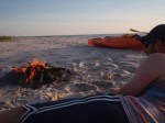
Once he caught up to me we paddled together for a little while until we reached an island labeled as “Pat Island” on Google Earth. This was the island Brian was envisioning camping on and it was perfect. We pulled up onto a sandy strip of land (less than 50 yards wide?) and decided, based on the high tide lines, that this would be a great place to camp. However, we weren’t totally sure if it was okay to camp here so we decided to wait several hours before setting up the tent (it was only mid-afternoon when we got there).
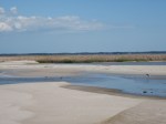
I took a break from paddling while Brian continued to fish around the island. I was amazed at the number of sandy beaches in this area! Everywhere I turned there was a beach or a sand bar. There was even a DUNE at one end of the island! This surprised me because all I’ve heard throughout my career is that there is major habitat loss when it comes to sandy shorelines. I heard that as a seasonal employee in Delaware, and I heard that all the time when I worked on Poplar. However, I wouldn’t go telling all the terrapins to come nest on the islands near Rumbley though, they were COVERED in raccoon tracks!


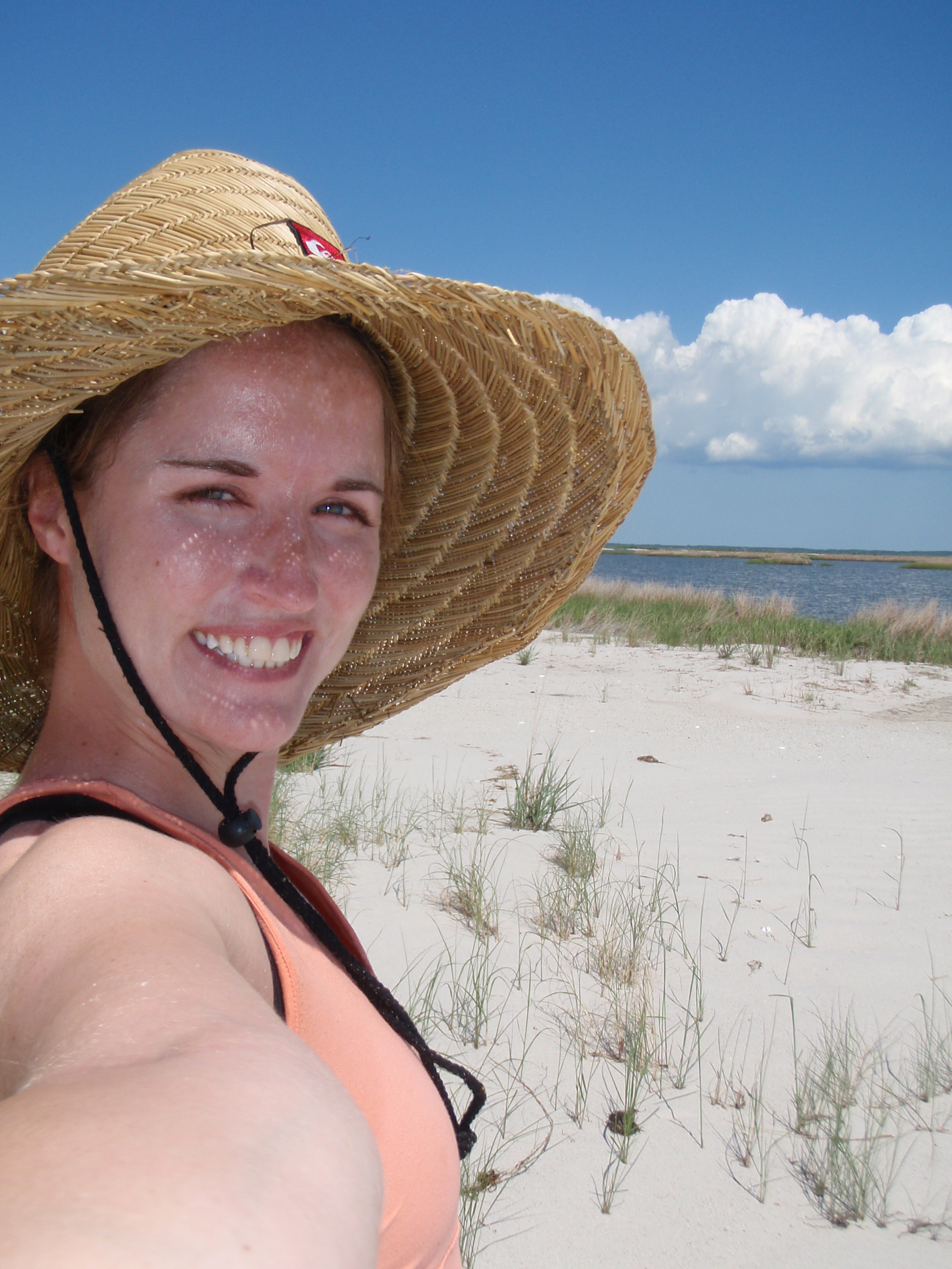 You know what else I was amazed at? This awesome HAT I found! O’neil brand, like-new condition, and EXACTLY what I needed – more shade for my face and shoulders. Finders, keepers!
Once the sun started to set and we were getting hungry, we decided to set up camp and have dinner (chicken, broccoli salad, beer). It was cool to actually see the sun set over a horizon of just water – not something I normally see in Maryland 🙂 After the sun set Brian continued to fish – he had the proper “all around white light” too to stay safe! I was pretty beat after 9 miles of paddling in the sun so I relaxed by the fire and watched the stars instead (being out on this island made for some phenomenal stargazing!). An hour or two later Brian got back, but still no keeper fish! What the heck Brian, you said this was your “speckled trout hot spot”.


—————————————
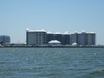
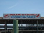
 Morning! After packing up camp and a gourmet breakfast of PB&J sandwiches, it was time to continue on. The plan was for Brian to continue fishing (isn’t that always the plan?) and for me to paddle down to Crisfield where he would pick me up later. I had never been to Crisfield so I didn’t really know what to expect, although the condo buildings in the distance did not fit what I was envisioning.
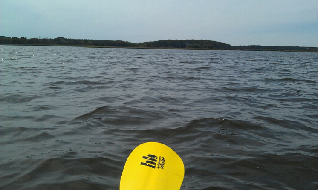
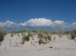
It was a bit windy so I expected the first stretch, that was over open water, to be the most challenging. I’m not sure of the distance, but I would guess it was about 2 miles of open water. I reached land in just 45 minutes or so and felt pretty accomplished so far – I was off at a great pace. The land I pulled up on was the north end of Jane’s Island State Park. Again, I was astounded at the long sandy beaches – really not something you see very often in he Chesapeake!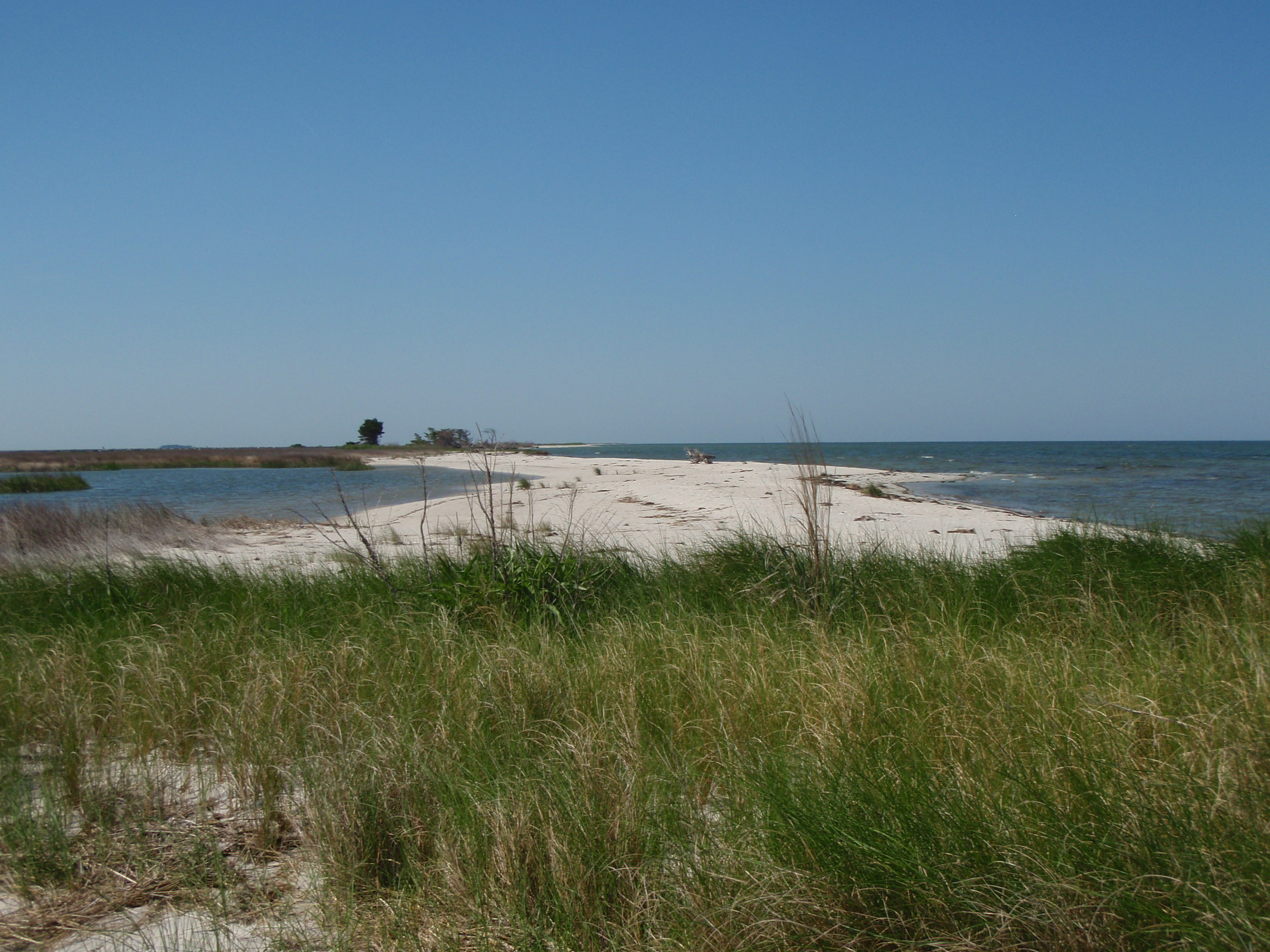
The next hour and a half was tricky but fun. After exploring yet another sand bar and sandy island, I had to navigate through a crazy maze of marsh creeks. If it had not had my trusty Android to guide me through, it probably would have taken me weeks to find my way out of there! At every bend I had to pull out the Google Earth and reevaluate my current position and where I was headed. Also at every intersection of creeks, there were probably 5 or 6 options of direction from which to choose! By the time I made it to the main channel, I was exhausted. Even though I was in protected marsh creeks, the wind was still pushing hard against me.
 Brian called me around this point to say he was packing up and on his way to Crisfield. I figured that since I was in the main channel and that I could almost see Jane’s Island State Park boat ramp, I was probably pretty close and it was good timing. But… I think I was wrong. The last stretch through the Crisfield ditch (not sure if that’s what it’s called, but that’s what I named it) was killer!! Not only was the wind against me, but it was funneling the water through the ditch at a crazy pace. Add boat traffic and wake to that and I had water and waves coming at me from all angles! I did feel pretty awesome when I just cruised by a family in a canoe – a family of 6 PEOPLE in a wobbly canoe. Not sure, but I imagine they didn’t get very far!
As I passed the waterfront hospital (damn, if I have need a hospital stay, send me here, must be beautiful views!), watermen docks, seafood processing buildings (do they have a more official name/term?), people swimming, people fishing, people jet-skiing, condo buildings, the U.S. Coast Guard boats, the Tangier Island Cruises boat… I began to feel incredibly small – just some girl bobbing around in an orange kayak amongst so much activity. I wonder what people thought when they saw me? That girl is… stupid? ambitious? brave? clueless?

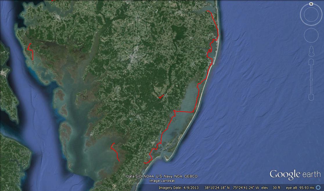
Well it doesn’t matter what they thought because although I was probably an hour late to meet Brian, I just paddled 9 miles to get here! And 9 miles yesterday! Plus 2ish miles around islands. That’s like 20 miles in the last 24 hours! What did YOU do today? Here’s my path; blue for Day 1 and red for Day 2: