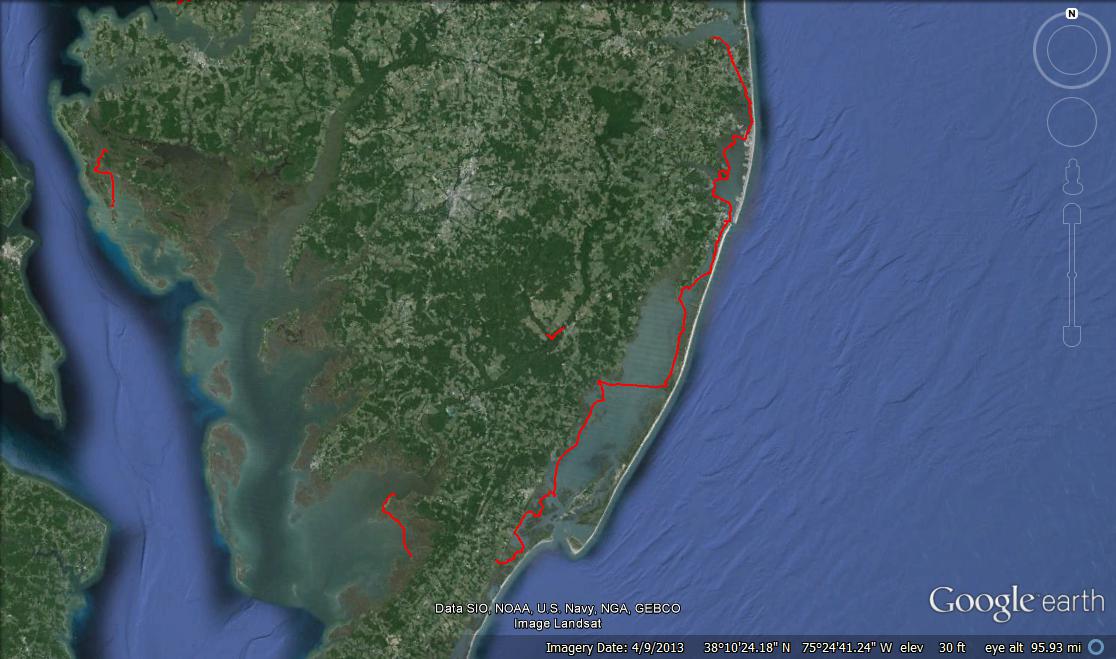
On Monday, May 5 (Happy Cinco de Mayo!), I connected the dots and completed the leg between Fenwick Island State Park and Williamsville, DE. I have now completed everything from Holts Landing State Park (Millville, DE) all the way down to Pierce Taylor Rd in Hallwood, VA. That’s a total of 82 miles and over 24 hours of paddling! And that’s not counting the other random trips over on the Chesapeake side.
The cool thing (in my opinion) about this leg was that it was my first one way trip that I have completed that I DIDN’T need assistance from Brian or anyone else to shuttle me from one end to the other! I was able to ride my bike instead. The logistics got a little confusing. Actually, it was SO confusing that I had to write down my itinerary to make sure I didn’t forget anything. No seriously, I should have taken a photo of the post-it note I had with instructions I wrote for myself – it was pretty ridiculous.
First I loaded my kayak on top of my car (with my awesome new Yakima “hully rollers”), and loaded my bike inside my car. I’m really impressed with how much my little Nissan versa can handle! I then drove to Fenwick and unloaded my kayak and locked it to a picnic table with my dry bag, paddle, and PFD stuffed inside. Then I drove back south to Northside Park in Ocean City. There, I hopped on my bike and pedaled back up north to Fenwick. When I arrived, I had to unlock my kayak, lock my bike to the picnic table, and launch into the Little Assawoman Bay. Once I completed the paddle (that story coming in a minute), I had to load my kayak on my car, drive BACK up to Fenwick, unlock my bike, pack it up in the car, and finally head home. I still can’t believe I didn’t screw up, like leave my keys with my bike, or forget to lock something up properly. Somehow I pulled the whole thing off! Good thing I had that post-it note.
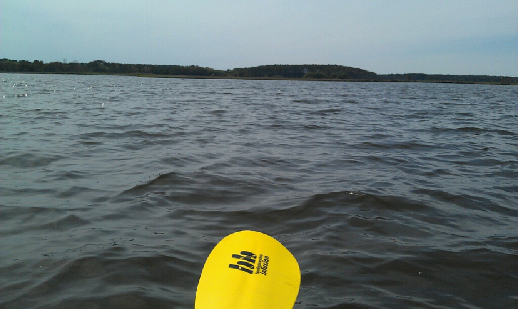
Distant view of Assawoman Wildlife Area
This paddle was interesting in that I paddled a stretch of the coast that I drive everyday, to and from work, so it definitely offered a different perspective from what I’m used to. When I drive up the coast, I am mostly passing houses on the bayside and I usually forget that just on the other side of those houses and the bay, is the Assawoman Wildlife Area. It’s a gorgeous, often forgotten area, full of good kayaking and exploring. Some of those houses along Route 1 are pretty damn lucky – unobstructed views of the ocean to the east, the bay and beautiful, undeveloped land to the west. Must be nice.

Approaching Route 54 bridge
For the first part of this paddle the wind was coming straight out of the west, making paddling a frustrating, but not too difficult. However, about 2 miles in, I saw some threatening looking clouds. Well, I thought they were threatening looking, most people would probably disagree and call me paranoid. I stopped for a quick break at Coastal Kayak (a nice kayak rental outfitter but they were closed) to check the radar on my phone. Yup, the closest precipitation was in Virginia and the “thunder” I thought I heard was a plane.
 I kept heading south, admiring all the fancy homes in Fenwick. I then entered the “Fenwick Ditch” which is a narrow area that connects the Little Assawoman bay in DE, to the Assawoman bay in Maryland. I was a bit worried about how hard the tide would be running through here, but it wasn’t bad. It may have even been slack tide. I went under the Route 54 bridge and I have to say, this was the first time I have passed a tiki bar while paddling. Even though it was Cinco de Mayo, very few people were hanging out at Harpoon Hanna’s. Maybe had it been a warmer day, I would have stopped in for a margarita!
As I came out of the ditch, I headed west. When I started this whole trip, I wasn’t sure if I was going to go to Northside Park, or if I was going to go to the kayak launch in the Bayside community (where I had started the OC paddle last September). I decided I wanted to do this right and connect all the dots, so I paddled over to Bayside. Once I arrived, I was pretty beat so I got out, ate a sandwich, and pressed on to Northside Park.
I was pretty worried about this last stretch because I was going to be going directly into the wind and it was a straight 2 miles across open water. Luckily, it wasn’t that bad! I don’t get it. There are times when going against the wind is torture, and then there are other times when I swear it is actually easier than going WITH the wind! I was cruising! I couldn’t believe how quickly I made it to the park.
The worst part of this whole day was the last part as I got out of my kayak. The park doesn’t exactly have an official kayak launch. There is a nice bit of sandy beach to get out on, but then I had to carry my kayak several hundred yards to my car! So frustrating. By the time I got to my car, I was so tired that I could barely load my kayak onto the roof rack. My arms will killing me, more from carrying/dragging my kayak from the water than the actual 8 mile paddle!
Although the weather was meh, the wind was frustrating at times, and there was very little wildlife to see on this trip, I still felt extremely accomplished since I did the whole thing solo. No help being shuttled, no help disassembling my bike, no help loading my kayak. I was a bit sore the next morning since it has been quite some time since my last long paddle, but it was worth it! Take a look at my path:
And if you want to see the complete 82 miles from Delaware to Virginia, here it is!