laura paddles delmarva

Circumnavigating 600 miles of Delmarva's shorelines


Leave a comment

Madison to Ragged Point

My staycation continues with yet another kayaking trip. This time was an out-and-back. Not my favorite thing to do, but it’s nice not to have to pack the bike and shuttle between the start and finish. I also crossed the mouth of the Little Choptank so if I had done a one way, I would have had to bike 23 miles (feasible, but not enjoyable for me).

The nice thing about doing an out-and-back is that it saves time which was perfect today because I was able to get some paddling in, and still make it to a meeting I wanted to go to (Mothers of Preschoolers – woot woot!), although I was still late getting there.

In order to time with the meeting I had to get up at 5 a.m. Funny how if I had to get up at 5:00 for work, or to go to the gym, I’d have a heck of a time getting by butt out of bed, but when I get up for kayaking, it’s totally different! I was on the road by 5:15!

DSCF2394I got to the launch just in time for sunrise. There was not a soul in sight, which I was not expecting. Not event a truck and trailer parked in the lot. Usually there’s a waterman working on his boat, someone working in a fish house, or at least evidence that someone had already launched their boat for the day. Nothing here, which was even more surprising because this ramp is not far from civilization. Many of the ramps I go to are practically at the end of the earth, but there are still people there.

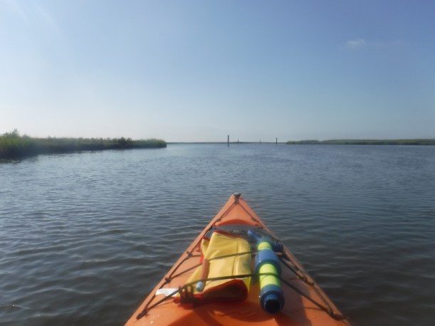
Although the wind was only around 5 knots, it was coming out of the WNW so as soon as I got up north of the marshy area and away from the launch, I was surprised by the size of the swells coming in from the bay. Not huge, but bigger than I would have expected for 5 kts. I actually didn’t need to use my GPS at all to navigate on this trip. Maybe I’m getting better at identifying what I saw on the map before I left? Or maybe this was just a super easy, straight shot over to Ragged Point.

I was also expecting a decent amount of boat traffic, given that I was in what I thought was watermen country. But not once did I have to worry about boat traffic. The paddle was actually quite relaxing and quiet! I zipped across the mouth of the Little Choptank and paddled until I hit land near Ragged Point. There is a boat launch further north of where I hit land, but whenever I end up launching from that ramp in the future, I will be headed south and will intersect the path I made today, so no sense in going all the way to the ramp (plus I had a meeting to get to, so no time to be wasted!).

can you spot the eagle?

I saw quite a few bald eagles flying and fishing, and one perched in a tree. I also saw TONS of GIANT sea nettles! So glad I wasn’t swimming. These things were seriously monstrous! I wasn’t able to get a photo though. By the time I saw one, I was right on top of it and didn’t have time to get by camera out (and didn’t feel like turning around to look at a dang nettle).

Another weird thing I saw was this striped bass. I spotted it from yards away. First I thought it was a water snake, but as I got closer, I thought maybe a muskrat, maybe a turtle, definitely a ray, no definitely a shark… nope. A fish. Chillin’ on the surface. He was totally alive, but I imagine not doing well. What fish just hangs out with its fins out of the water? (sorry, don’t know why I can’t get a clear photo. Of like, anything!)

I hustled back to the ramp and made good time – 3.79 mph (that might be a record for me, although I haven’t really kept track)! With all of these back-to-back paddling trips I’ve been doing on my staycation, I’ve become super efficient and packing up all my crap and loading my kayak on top of the car. From paddling to driving was less than 10 minutes! And I made it for the last 45 minutes of the MOPS meeting 🙂

Here’s the path I took – 3.8 miles. I only tracked one way, but if you really wanted to see the full out-and-back paddle, just draw a line on top of the one you see here:


Leave a comment

Guardshore to Hopkins

Two back to back days of paddling? I think it’s been 4 years since the last time I did that! Well, not counting kayaking for work or just putzing around locally. Today I headed down to Virginia to connect two trips I had done back in 2013 and 2014. I figured today would be easy compared to yesterday since it was a shorter drive, a much shorter bike ride, about the same distance of paddling, and way less boat traffic.

I started the day by driving to “Ann’s Cove” which is a county ramp. I always get a little anxious as I’m driving to a water access point that I’ve never been to, particularly when it’s in a remote location (which most of them are). The roads get rougher and narrower the further you get from the main roads, and the closer you get to the water. Sometimes I feel like I’ve made a wrong turn, thinking “there can’t possibly be a public landing down here!”  Many times I’m unfamiliar with the area I’m driving, and some of the neighborhoods are pretty rough around the edges. I sometimes see some sketchball people and get a bit nervous to be driving to a dead end road, alone, with no cell service, and god knows what creepy people might be around!

This is how I felt today as I drove to Ann’s Cove. I’m sure everyone that lives in the area is super nice and nothing to be afraid of, but sometimes I just overthink things! Maybe I’ve watched too many episodes of Dateline or watched too many murder mystery-type movies?

I noticed the wind was a bit stronger than I expected so I decided to unload my kayak, drive to Hopkins (Johnson Landing), and ride my bike first, rather than paddle first.  The wind was coming out of the east so I figured it would just push me out into the bay, rather than fight it back in. Only 3 or 4 cars passed me as I biked the 5 miles back to Ann’s cove, but I couldn’t help but wonder what they thought of me. I can’t imagine many people are just biking through this area.

Once I launched, I headed straight for Guardshore beach which was right around the corner.  This was the first of several beaches I got out and walked around on this trip.  The next stretch of paddling was super fun. The wind was pushing me in the exact direction I needed to go and I was even about to surf some tiny waves along the way.  As I rounded the first bend out into the open bay the wind was still pushing me pretty good, barely had to paddle. Check out this video, I didn’t paddle at all while taking it, and you can see how fast the wind was carrying me:

DSCF2366 from Laura Baldwin on Vimeo.


The thing that really caught my attention during this paddle were the beaches! Soooo many sandy beaches.  I got out on a few and saw many more. This is something you don’t see that much of in other parts of the Chesapeake, or even in the coastal bays. I’d be curious to learn more about what makes this area so beach-heavy. Currents? Bathymetry? Prevailing winds? Geology? Anyway, the beaches came in handy later. As I continued to round the marshes and beaches, I eventually had to start making my way back east – directly into the wind.  The beaches and small coves gave me several opportunities to take breaks.

The last mile or so was killer. Directly into the wind. Dang did I burn some calories. I was so freaking happy to see my car at the end as I was exhausted! I was also thrilled that I had already done the biking leg. The thought of getting on my bike after that windy paddle just sounded awful!

Another 8 miles in the books. And GUESS WHAT?! I’ve officially surpassed 300 miles of my goal! Only 300+ miles to go. Yikes. Here’s the path I took:


Leave a comment

Neavitt to Bellevue

Today the weather was looking a bit iffy on the lower shore, so I decided to head up to the mid-shore to paddle. The whole day was a little bit of a trip down memory lane as I spent 2.5 years living in Talbot County back in 2010-2012.  As this was another one-way paddle, I started by dropping my bike off at the boat ramp in Bellevue, which is also the ferry terminal for the Oxford ferry.  I then drove to the boat ramp in Neavitt which was 17 miles away – 17 miles I was planning on biking after I was finished paddling.  I was already dreading it since I struggled so much on the 10.5 mile bike ride on Deal Island!

Before I even launched, I had the most notable wildlife encounter of the trip – fish! I was greeted by hundreds of some kind of minnow; maybe mummichogs? Peanut bunker? Mullet? I couldn’t quite tell, but they were swimming in the coolest spiral patterns. I took some video – if you squint, you might be able to see them!

DSCF2344The water was like glass which made for very enjoyable paddling. The most frustrating thing for the first 3 miles of the trip though, was boat traffic! Watermen traffic. It’s one thing to deal with the pleasure boats – people traveling from here to there. But work boats are a different story. Their direction and turns are super unpredictable as they are either emptying a line of crab pots, or heading from end to end of trot lines. And most of the time they aren’t paying much attention for lone kayakers, and steering from the stern, rather than at the helm.  My blood pressure always goes up a little when there are work boats near me. Not sure if it’s because I’m stressed they’re going to run me over, or if I’m just frustrated. I get it though – they have a job to do, and I’m the foreigner in their everyday world.

DSCF2357Once I crossed Broad Creek, the boat traffic died down and I was able to realize the drastic change in scenery on this trip, in contrast to the recent trips I’ve taken. Trees! Wooded shorelines with big oaks, maples, sweet gum. Yeah, many of the waterfront properties had hardened shorelines full of rip rap, damaging the surrounding ecosystem, but it was so nice not to be staring at marsh grasses the whole time!

Another change in scenery were the houses. When you travel up and down Route 33, you don’t realize the number of giant mansions that are in the area because they are all set way off the road so they can be waterfront. Some of these homes are beautiful, and some are just downright ridiculous.

As I rounded the last point and headed towards Bellevue, I was greeted by the Oxford ferry.  I will likely take this ferry next time I head to this landing to paddle (I’ll probably go from Bellevue, to Oxford, to somewhere in Cambridge).

DSCF2360

After a quick snack and locking up my kayak, I hopped on my bike to start the 17 mile journey. I took it slow and steady as to not wear myself out.  It was still overcast and very calm winds, so before I knew it, I was in St. Michaels! I even rode the little 1.3-mile bike path on the west side of town.

The wind was still at my back as I headed beyond St. Michaels and down towards Neavitt.  The last 3-4 miles were definitely tough, but by the time I arrive back at Neavitt landing, I was still not nearly as beat as I was when I was biking at Deal Island. Thank goodness! Maybe I’m not as out of shape as I thought I was!

Another 7.8 miles in the books! Here’s the paddling route I took today.


Leave a comment

Deal Island WMA to Champ Wharf

I’m taking two weeks off from work! Yes, you heard me right. Taking some time to burn vacation days, get stuff done around the house, and go kayaking!

Patrick’s first day of Pre-K3 was yesterday so as soon as I dropped him off at daycare (he takes the bus to pre-k in the afternoon), I headed out to Deal Island to paddle.

Once again, I embarked on a one-way paddle and a bike ride back to my starting point, so I dropped my bike off at Champ Wharf first.  It had been over 5 years since I paddled from this spot, but it was still familiar. I then drove down to the boat ramp within the Deal Island Wildlife Management Area to launch my boat.  About two years ago I ended a trip here and biked up to Dames Quarter boat ramp, but I had sort of forgotten the 2+ miles of gravel road, and already started to dread riding my bike over it later in the day.

Anyway, I set out on my adventure.  The weather was perfect. 5 knots and 75 degrees.

DSCF2320

After about an hour of paddling, I saw a sandy beach to take a quick break on. I don’t normally take a break just to stretch my legs, but I really wanted to take in the silence of the marsh and bay. I could not hear anything man-made. No boats, not aircraft, no cars. Just the soft breeze and occasional laughing gull in the distance. Plus it was a nice spot for a few photos:

After a few moments of soaking in the view, I hopped back in my boat and continued on.  Once again, thank goodness for my GPS tracker app! I have such a hard time looking at a map, and recognizing what’s what when it comes to marshes and tidal creeks.  If you zoom in on the map, you’ll see a few divots in my path – that’s where I thought I was headed in the right direction, but pulled out the GPS and realized I was going off course and had to correct myself.

DSCF2329

Champ Wharf

I finished up the paddle in just under two hours – a total of 7 miles.  The wind did pick up a little out of the NE at the end as I was headed into St. Peter’s Creek, so I definitely got a workout! I felt accomplished when I got out of the water (as always), but I knew my adventure wasn’t over yet!  I had a 10+ mile bike ride ahead of me, I’m not a super strong cyclist, and I was dreading the last 2 miles of gravel!


The first few miles were nice. Back roads, one of them not even maintained by the state, cool old abandoned houses, with plenty of shade and protection from crosswinds. I loved this intersection so much I stopped to snap a pic. If this isn’t a Maryland intersection, I don’t know what is!

DSCF2331

And then I entered the main road (363 – Deal Island Road).  And it was not nice. No shade, wind was picking up, trucks driving by me really fast, and it was now HOT! I powered through until I got to Dames Quarter to take a quick break, grab a drink of water, and catch my breath. I figured the worst was behind me – how bad could that gravel road be?

BAD. So, so bad. I was exhausted from paddling and biking, and now my brain was rattling inside my skull with every damn pebble I rode over. Now I know what mountain bikes are for! I had no choice but to keep chugging along and finally I came to the group of trees next to the boat ramp (I couldn’t see the boat ramp because the trees were blocking it). Shew.  Finally, almost there.

And then I biked around the edge of the trees and realized I had OVER A MILE left of the gravel road. The trees I thought I had just passed were WAY far down the road! I wanted to cry.  I could see the glint of sunlight reflecting off my car and it just seemed so far away.  But, I had to keep going, despite having just finished my last bit of water. Nobody was coming out here to save me, that’s for sure.  After a quick break in a tiny patch of shade, I mustered the energy to get through the last stretch. Holy moly. I was slightly sun burned, exhausted, out of water, and now had a throbbing headache from 2.2 miles of biking on gravel. I cranked the AC in my car full blast and nearly collapsed. Once I cooled off and caught my breath, I was able to disassemble my bike, load it inside the car, drive back to Champ to pick up my kayak, and head home.

I had just enough time to unload all my crap, hose down my PFD & paddle, and get a quick shower before picking up my elementary schooler!

How sweet is this boy??