
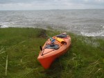
I have to say that after this paddle, I am extremely happy to be on solid ground again. The weather forecast said winds were out of the south at 10 mph. It was more like out of the southwest at 20 mph. My arms feel like Jell-o, I’m sure my shoulders will be sore tomorrow, and I can feel phantom waves when I close my eyes. On the bright side, I feel extremely accomplished after battling the wind and waves for just over 9 miles!
Brian paddled near Deal Island yesterday when I was at work and caught 4 good sized speckled trout. Because the fishing was good and I wanted to complete another leg, we decided to head to the same general area, only this time a little further south from where he had fished. He dropped me off at Guardshore landing, just outside Bloxom, VA. I like this area a lot because of how remote it is (although not having a cell phone signal is a little disconcerting). For 90% of the trip I did not pass one house, boat, power line, or really any sign of life — no birds, no turtles, no jumping fish — just marsh grass and waves. Lots of waves. It was so choppy that I was getting a little seasick. Plus it didn’t help that Brian wanted to fly through all the back roads to get there and I was already feeling slightly carsick. Ugh.
With a slight threat of thunderstorms, I didn’t want to mosey around in the marsh and explore much. I was pretty set on paddling a straight shot, getting a workout, and getting off the water before any afternoon storms started to brew.
-

- Pretty clouds
-

- Darkening clouds
-

- Rain shower in the distance
Here’s the path I took; notice the long straight-aways across open water – not my favorite type of paddling, but good exercise:
I did take a break about half way through the paddle, just to get off the water and cut down on my nausea. I even portaged across the marsh a little ways, just to continue the journey but savor a few moments on land.
-

- Nice looking marsh I stopped at
-
- Enjoying some solid ground
I took a video to show the choppiness, but I’m not sure it really does a justice. Either that or I’m just a wimp.
Choppy Chesapeake from Laura Baldwin on Vimeo.
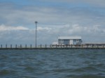
I was pretty stoked when I was entering a small creek and getting out of open water. I could also see some houses in the town of Saxis so I was relieved that the worst was behind me. Or so I thought. For whatever reason, paddling in that creek was probably the most difficult paddling I have ever done. It was like the wind was being funneled through the creek which made it nearly impossible for me to make any headway. I was literally grunting and yelling out in pain as I paddled against the current. In the middle of my little temper tantrum though, a sign of life — a family in a small boat, setting out a trot line. I can’t imagine what they thought of me if they heard me over their little motor, but they just smiled and waved, and I did the same.
I finally rounded the last bend and came up to the town of Saxis. It is a teeny tiny waterman’s town in the middle of nowhere. I love these little desolate Chesapeake towns. It’s like rewinding 50 years and you can just feel that Chesapeake culture by looking at the town and the landscape. I can’t really explain it, but I’m sure some people would concur that there is just something special about them.

I wasn’t quite finished the trip though because I told Brian I would meet him at the end of Saxis Road, which was just around the bend and then another half mile or so. At least, according to the map on my phone. As I passed the last little crabhouse, Brian pulled up in his car and honked at me. I figured he was just waving and saying he saw me, he was off the water, and he’d meet me at the end of Saxis Road. The last mile of the trip was very rough, but actually really fun. The wind was at my back and I was able to ride several waves as they pushed me towards the end.
Then the phone rings. It’s Brian: “Where are you?! I thought you were getting out at the landing! I pointed to the landing when I saw you, where did you go?!” Umm… to the end of Saxis Road, like I told you to begin with. “You passed the end of Saxis Road! That’s where I saw you! Where am I supposed to pick you up now?” Umm… no I didn’t pass the landing. My GPS says it’s right around the corner from where I am now. You’re supposed to meet me there. “I don’t understand where you are! Why did you keep going? Do you want me to leave Saxis? Because I’m leaving Saxis now.” This argument went on for a few minutes. I finally hung up and finished the trip. Turns out, there is no public landing where I finished. After a little more confusion, Brian found me and I was able to find a spot to get out near his car. It was definitely no boat ramp or kayak launch, but it worked.
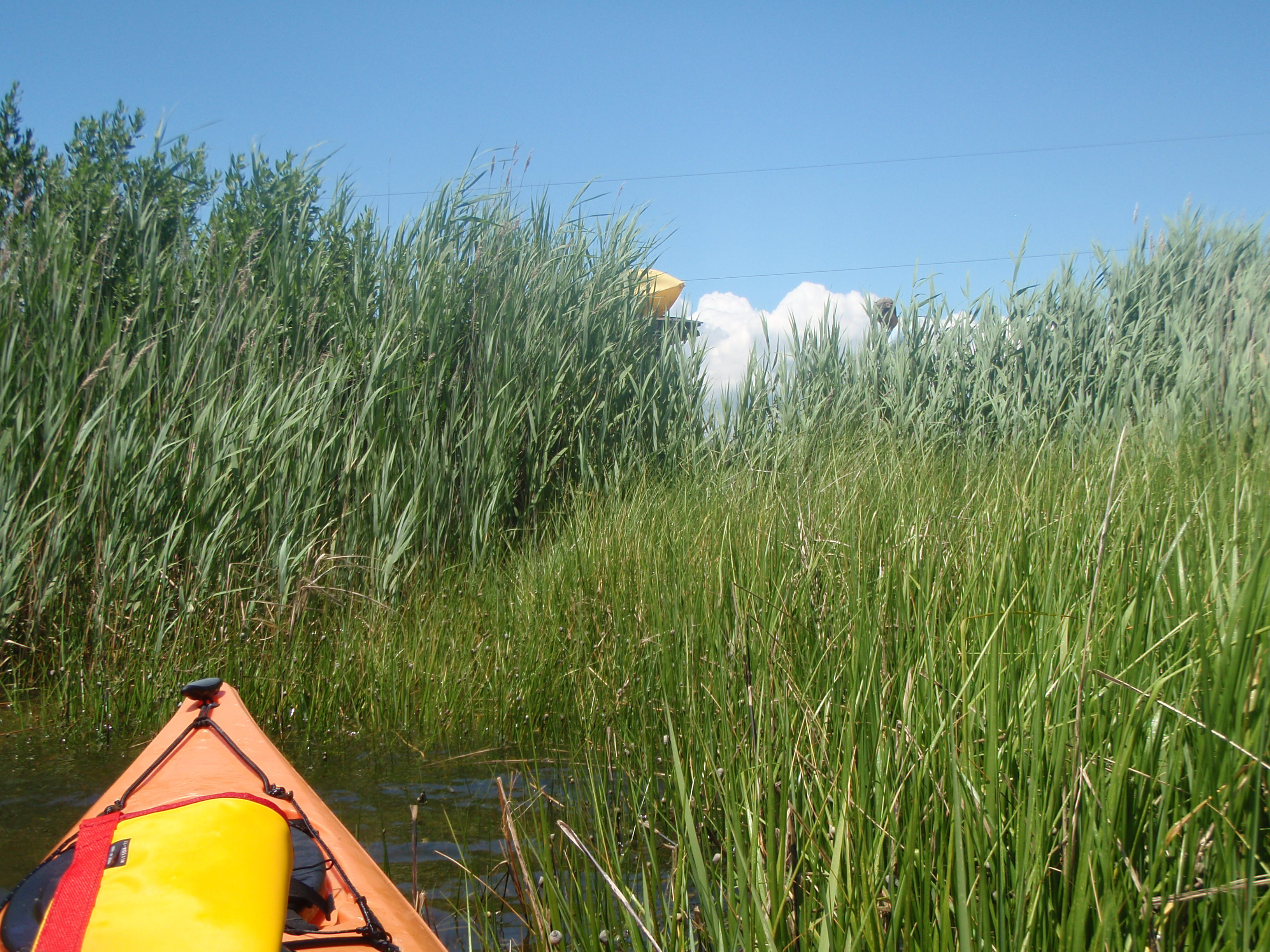
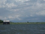
Can you see his kayak on top of his car between the grasses?
Once I was on dry land and about to collapse with fatigue, the argument continued. Turns out, my map had road names that did not match the road signs. So what we thought was a miscommunication was really an error on the map. Frustrating. But don’t worry, even after a stupid argument, the wedding is still on 🙂
Oh, and when we got home, we saw that there was a small craft advisory in effect. Oops.

June 25, 2013 at 1:08 pm
You mean you didn’t ZOOM IN enough on your “smart phone” map to see that what you thought was Saxis rd wasn’t actually Saxis rd. and tried to tell me I was wrong despite being there many times…. 🙂
Pingback: Guardshore to Hopkins | euryhaline paddler