Category Archives: Uncategorized
Eastern Shore NWR, Kiptopeke State Park, Cape Charles, and Smith Island, VA
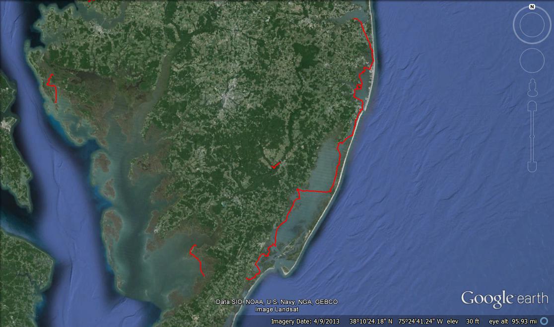
 To celebrate 1 happy year of married life, Brian and I headed south for a quick, 3-day camping trip to Kiptopeke State Park which is roughly halfway between Cape Charles, VA and the Chesapeake Bay Bridge-Tunnel. We got there on Sunday morning, just as the weekend crowd was leaving, allowing us to get the best campsite – furthest from the bathhouse and with our own personal trail leading to the beach!
Kayak Adventure #1 of 3:
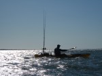
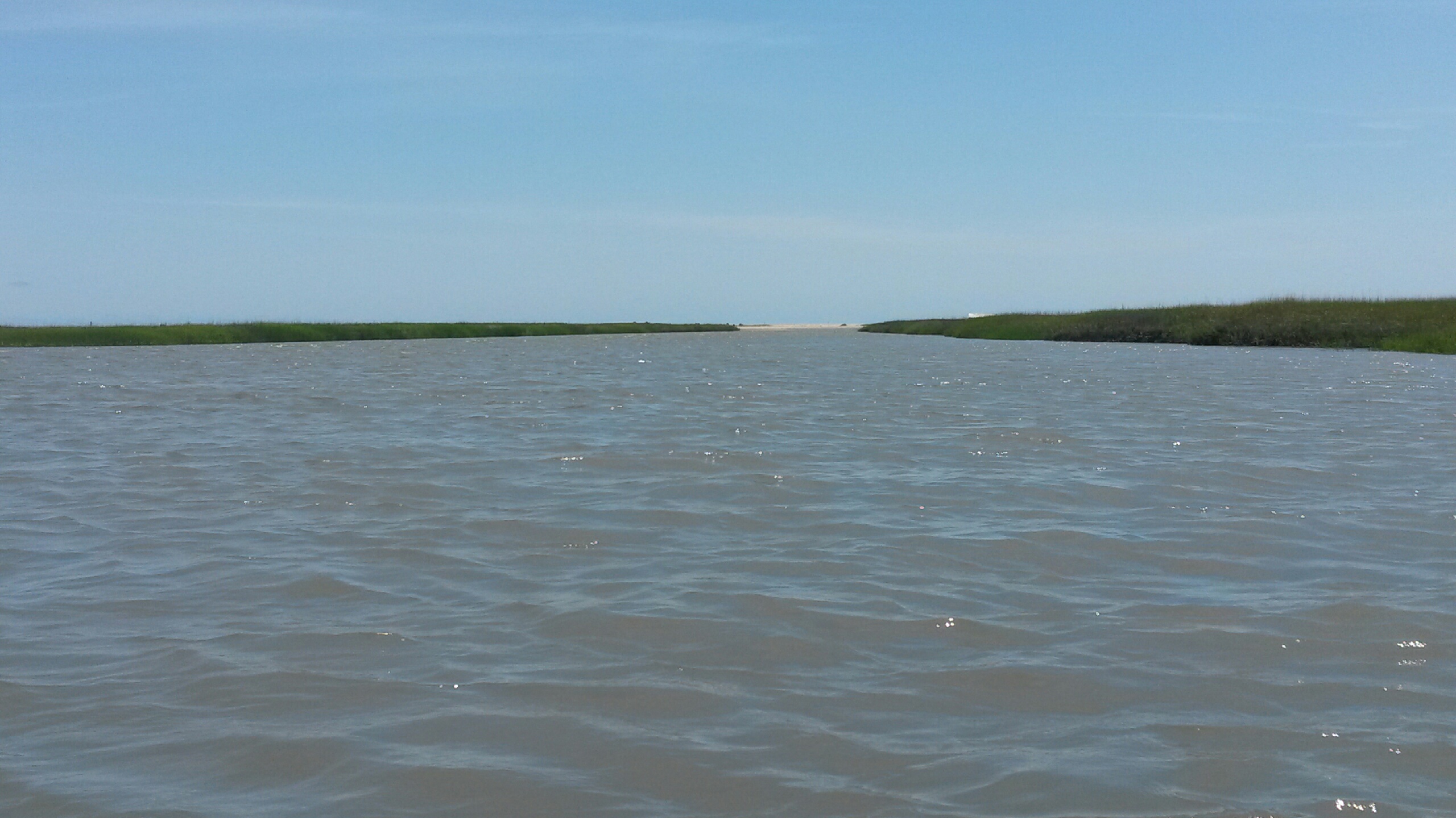
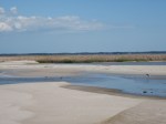
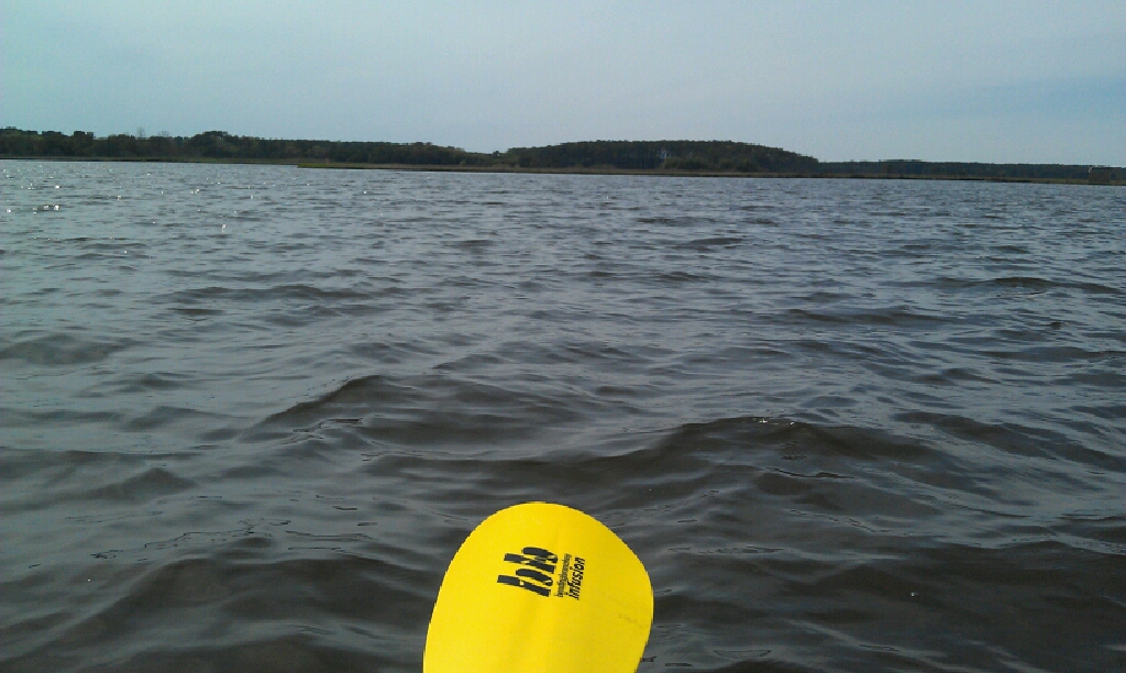
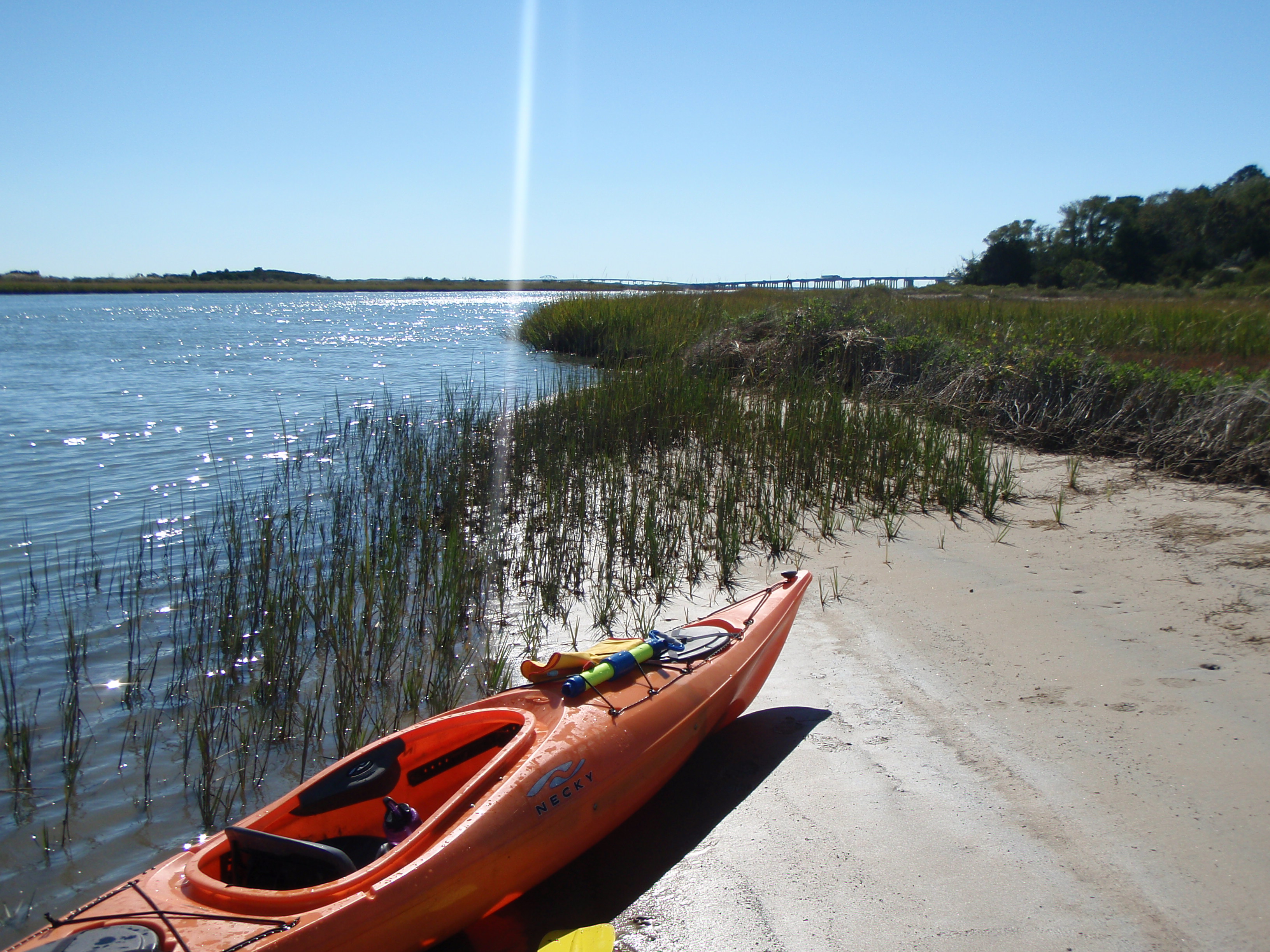 After we set up camp Brian dropped me off at the boat ramp at the Eastern Shore National Wildlife Refuge. The plan was to paddle just 5 miles, around the southernmost tip of Delmarva, and finish at our campsite. The tide was running hard making the first half mile intense. I was paddling as hard as possible and barely moving at all. I had to pull over to a sandy shoreline just to take my camera out to take some photos.
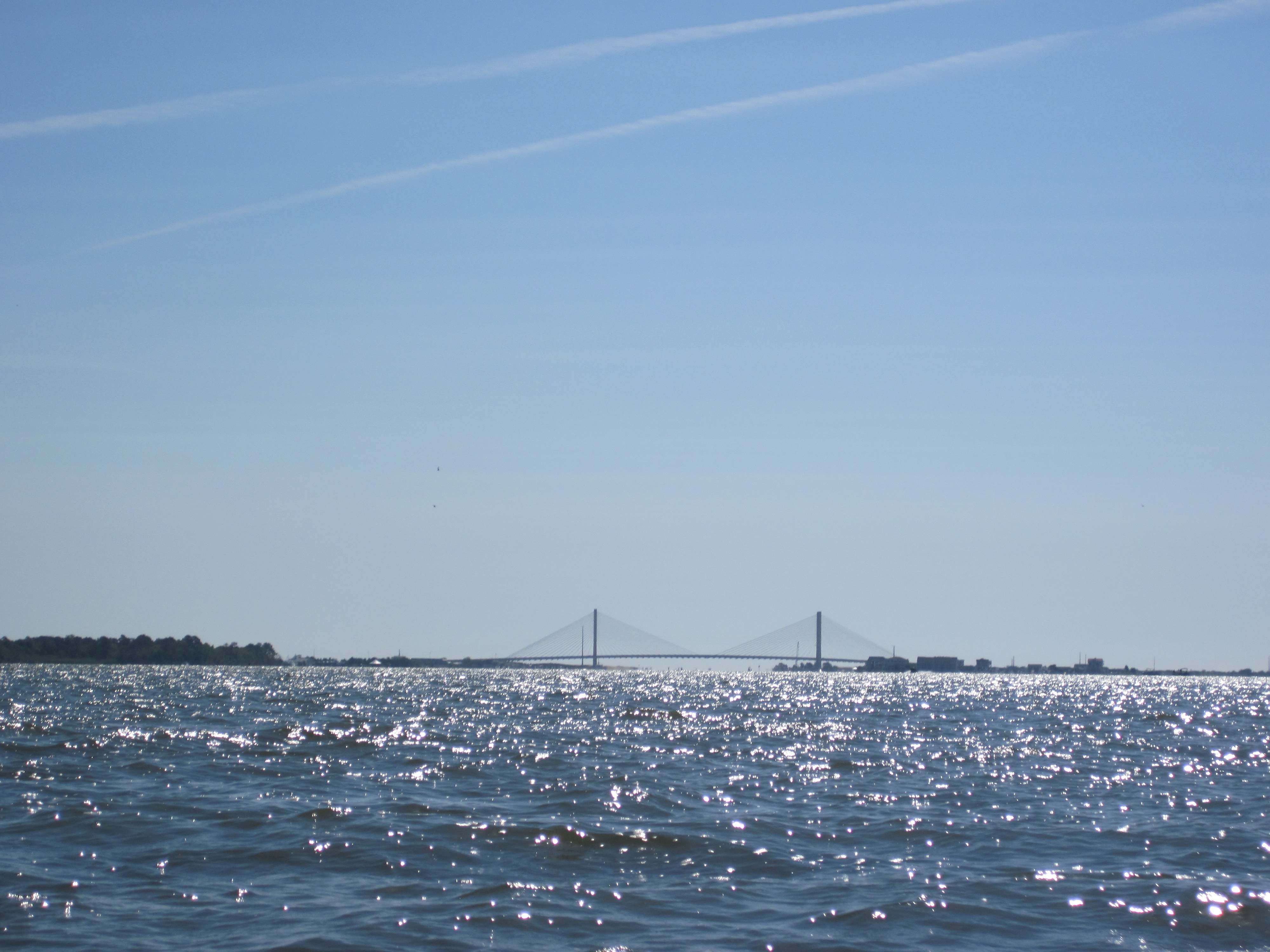
Once I got out of the channel and within 100 yards or so of the bridge, the tidal flow wasn’t nearly as strong and I could relax a bit. It was a pretty cool thing to paddling under the first span of the CB Bridge-Tunnel. Although I’m only about 25% finished my ultimate goal, it definitely felt like a decent milestone. As soon as I rounded the tip the tide and the wind were at my back.


homes at altitude!
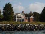
As I cruised back to our campsite, there were two things that I saw that are worth noting. One was the elevation of the shoreline! I realize that these shorelines are probably eroding at an alarming rate, the shear drop from the houses above to the water below was 30 feet in some places! Since when does any of Delmarva have such elevation?

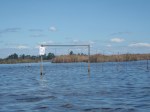
pound net (one of many)
The other thing I noticed were the astounding number of pound nets! Every 100 yards or so I was crossing over another pound net. I will say this now, that I have a weird phobia of being in a body of water and touching something man-made that is covered in aquatic plants and grime. Every time I paddled over a net my stomach lurched at the thought of getting caught or falling out right on the net. Ugghhh my god, I’m cringing at the thought right now. Okay time to chance the subject:

Kiptopeke pier

ships off Kiptopeke
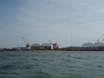
As I approached Kiptopeke, I got a good view of the fishing pier and the many old ships that have been placed just offshore from the pier. I learned earlier in the day that the now fishing pier, was the original pier for the ferry that used to run to Norfolk before the bridge-tunnel was constructed. The ships were placed to create a safe harbor and cut down on wave action. Now, the pier is part of the park and the ships make for great fishing!
When I pulled up on the beach near our campsite, I was reminded of the elevation. Brian was out catching bait so I had to pull my kayak up over the dune by myself, up the steep trail and back to our site. Doing that was harder work than the 5.5 mile paddle!

dragging my kayak up the hill
Kayak Adventure #2 of 3:
On Monday, October 6, I actually paddled WITH Brian for a change! Although our path wasn’t part of my original plan in rounding the peninsula, it is definitely worth including since we spent most of the day on Smith Island, another one of the amazing, undeveloped barrier islands in Virginia.
The plan was to launch at the free kayak launch at the Refuge, but since the tide was too low and there wasn’t enough water in the creek, we launched at the boat ramp. The guy working at the boat ramp was a brat and wanted to charge us the $10 launch fee. Seriously, dude? You’re going to charge us to launch kayaks here when your stupid free kayak launch area is inaccessible? Neither of us had any money (or a freaking checkbook! yes, he said they accepted checks) we said we’d go to an ATM when we got back. Maybe he’d be gone when we got back – we WERE planning to be gone almost all day.

approaching Smith Island light
From the channel we headed straight across the bay towards the Smith Island Lighthouse (built in 1892!). Brian has had to stay out here for work a few times so he already knew his way around and that we could actually climb the lighthouse! 242 steps later, we were at the top, taking in the amazing views of the island. Although my mild fear of heights and the 12 mph winds made me a bit uneasy, it was still well worth the climb. Once we got to the bottom, Brian showed me his fancy accommodations when he stays out here for work. Not. Jealous.
-

- Cape Charles Lighthouse
-

- lighthouse entrance
-

- 242 spiral steps!
-

- view from lense room
-

- modern fresnel lense?
-

- lighthouse shadow
-
- looking west
-
- looking northeast
-

- looking east
-

- shadow
-

- Brian’s satellite office
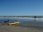
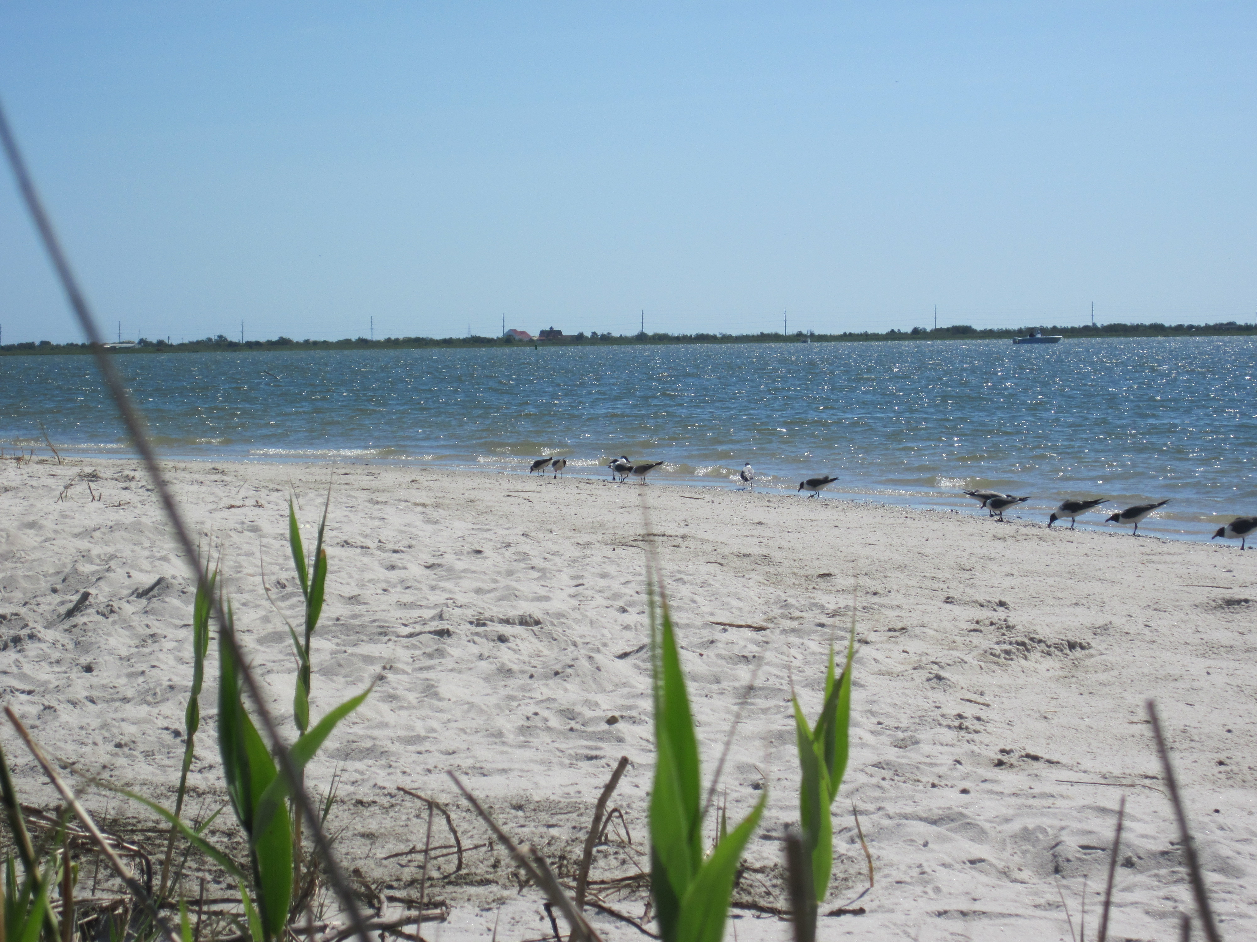
 We then high tailed it through the marsh and back to our kayaks (mosquitoes were wicked in the grasses). We headed down around the south end of the island and to the ocean side. Brian carefully chose his fishing spot for the day and I spent most of the time beachcombing. For an island that is so remote, the beachcombing wasn’t spectacular. On the other hand, the fishing was decent as Brian caught a small red drum (although it was still too big to keep – if they are over 27 inches you have to release)!
After a few hours on the island, we started to head back. However, the tide had come in and the wind had picked up so I was a bit worried, particularly about launching into the swift tide and choppy water. I was so worried that I put my camera and phone in my dry bag, put all my loose items in dry hatches, and then carefully plunged into the water. Somehow I was successful and even stayed dry! Brian says I worry too much. I just figure I’m cautious and well-prepared!


When we got back to the launch, that stinkin’ boat ramp guy was STILL there! Dude, get a life! After we loaded up we actually went to an ATM, came back to the refuge, and he didn’t even have change for a twenty. He tried to tell us to give him the twenty and we could come back to tomorrow for free but Brian refused and just left. Hopefully he didn’t take down our license plate info, but still, I think we grounds to fight if we get a citation.
Kayak Adventure #3 of 3:
The last paddle of this trip was on Tuesday, October 7 from Cape Charles back to Kiptopeke. The wind was supposed to get up to 17 mph, coming from the south, so I would have preferred to paddle from Kiptopeke up to Cape Charles. However, that would have tied up Brian waiting for me at the dock, so instead, after he dropped me off, he was free to fish the ships at Kiptopeke. Plus I could use the workout and a challenge.
As I paddled out of the marina, I passed the huge concrete plant. It seemed to be a pretty heavy construction zone so I made sure to keep my distance as I rounded the corner and headed south.

Once I got out into the open bay I realized that I should have worn my paddle jacket as I was getting splashed with every other wave. Shortly after passing the concrete plant I found a sandy beach to get out. I successfully landed on the beach, but hesitated in getting out of my boat and the next wave to come in got me drenched! I even had to use my bilge pump to get a bunch of water out of my boat. As I was digging my jacket out, I saw a golf cart heading towards me, just over the bank. Great. I stop for 1 minute on someone’s private property and I get yelled at. I pretended I didn’t see them coming so I wouldn’t have to make eye contact and quickly put on my jacket and then my PFD. When I looked up, the golf cart had already passed me – maybe they didn’t even see me?
The next couple miles were tough. The wind and the swells were coming head on and I couldn’t even stop to take photos because I thought I would capsize if I stopped paddling. However, paddling against this wind wasn’t miserable. It was even fun as my kayak bounced over the waves. In addition to it being a physical workout, it was a mental workout as well. I had to calculate how I was going to tackle each swell that came towards me. Although I felt as though I was making hardly any progress, my overall speed for this trip was 2.9 mph which isn’t bad considering I usually average around 3.5 mph.

my helicopter friend first spotted at the ramp in Cape Charles
One thing that I noticed about this section of Delmarva is the air traffic! Commercial airliners, military jets, helicopters, you name it. Honestly it kind of got old. I like peace and quiet when I camp, not roaring jets above and constant rumbles in the distance. However, there was a helicopter (military-looking, I’m not up to speed on that kind of stuff) that kept flying over me, traveling up and down the shoreline. Probably passed me 15 times! I tried to imagine what the guys up there where saying about me. “She’s barely moved since the last time we passed her!” or “Wonder where she’s going” or “Is she freaking stupid fighting this wind??”
I finally came around a point on the shoreline and the ships at Kiptopeke were finally in sight! Only a mile or 2 and several pound nets separated me from solid ground and lunch! Somewhere in the last mile or so, I saw a first (for my Delmarva paddling trips): dolphins. Now I don’t usually get mooshy-gushy about dolphins, but I do when they are a couple arms’ lengths away from my kayak! Some of their faces came out of the water and I got to hear their blowholes. So cool! However, I couldn’t keep up with them, within a matter of minutes they were way ahead of me and I lost sight. I scrambled for my camera but only captured random shots of the water. Woo.
So anyway, I completed my journey back at the campsite. This is the longest post ever so I’m going to stop talking now and you can look at this map with all my kayak adventures from this trip (20.25 miles) in one spot:
Claiborne to Tilghman
On October 1, 2014, I paddled for the first time in Talbot County. Although, that’s a little bit of a lie because I’ve been kayaking many times in Talbot Co, seeing as I used to live there and even had a part time job as a kayak guide for the local YMCA. But this was the first time I’ve kayaking in Talbot County as part of my “around Delmarva” goal. Not only was I very familiar with this general area, it was also nice to take a short walk (or paddle) down memory lane as I passed right by Poplar Island, where I used to work. Here’s the 9.3-mile path I took:
I left work at 12:15, thinking that was plenty of time for this adventure. I must have been stopped at every light and stuck behind every slow vehicle on the way there because I didn’t get to Claiborne until 2:30. I spent about 10 minutes organizing my gear and locking my kayak to a lamp post and during that 10 minutes I counted 5 cars that drove in to the parking lot, looked around, and drove back out. I couldn’t figure it out. One guy looked kinda sketchy, but the other cars just had middle-aged sight-seers in the car. It was still bizarre to me. Was I missing something? Was there something exciting to see? Or were they scoping the place out for a drug deal or some other illegal activity? Or maybe I’m just over-analyzing the situation now.
Anyway, I then drove down to Back Creek Park, a county park right next to the drawbridge leading into Tilghman. My plan was to ride my bike back to Claiborne and paddle back – the Talbot Co website and the sign at the park indicated there was a kayak launch a little further down that path. Perfect.
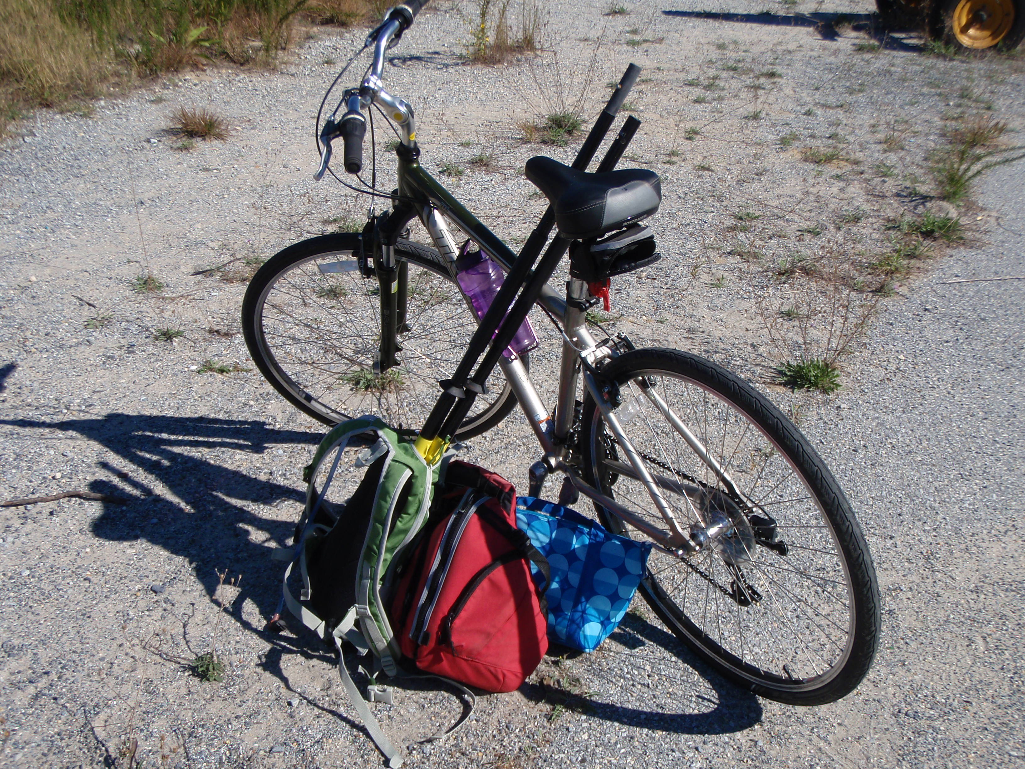
I didn’t want to waste any time because I had left my kayak paddle and PFD (and snacks!) with my kayak, unattended. My biggest fear is that someone will swipe some of these key kayaking accessories in the time that I’m biking. Everything of value I had with me (phone, camera, VHF radio, money, keys). I hopped on my bike and started heading up the road. I wanted to go quickly because I knew I would be racing for daylight, but at the same time, I’m not a strong cyclist so I didn’t want to waste too much energy and save my strength for the paddling.
I covered 9 miles in about 40 minutes which was faster than I expected, and a good thing as I didn’t hit the water until 3:45, leaving just 3 hours of sunlight to cover 9 miles of paddling. Eek! No dilly-dallying on this trip!
I don’t have much of a story to tell with this trip because my mind was set on finishing the whole time. One thing that was pretty cool was being able to see the houses at the end of the driveways that we used to pass on our commute to work every day when I worked on Poplar. We (my fellow carpoolers and I) would pass many driveways, usually with fancy signs naming their property something like “Loblolly Point” or “Black Cherry Plantation”. You could never actually see to the end of the driveway and I was always curious what kind of fancy mansions were there. Here’s a few:


I was so worried that I wasn’t going to finish before dark that I barely stopped to look at my phone and evaluate how much further I had to go. I barely stopped paddling the entire time, only a few times to snap a photo. Luckily the wind was pushing me along which helped me to maintain a speed of roughly 3.75 mph.

Check out this handsome guy.

Last view of Poplar
I finally paddled all the way passed Poplar Island and into the vicinity of Tilghman.
Since I didn’t take the time to check out the Back Creek Park kayak launch, I wasn’t totally sure what I was looking for. We I first reached the park the shoreline was covered in phragmites and thick brush. I figured I’d paddle around the curve and there would be a nice sandy spot to get out. No such luck. Nothing. This park definitely did not have a kayak launch. What the heck, Talbot Co parks?? Nothing along the shoreline could have even resembled a kayak launch. I ended up pulling up in front of the Tilghman Island Inn. THEY had a kayak launching area 😛

“trespassing” through Knapps Narrows Marina
I was a bit nervous that someone from the inn would question whether or not I was staying there and I was trying to come up with what I would tell them when they realized I was trespassing. I left my kayak on the bank and hurried to my car (not far at all). One advantage of pulling up to shore here, as opposed to the park, was that I was able to pull my car up right next to my kayak, rather than dragging my kayak up the path for 100+ yards to my car (the park’s parking lot was pretty far from the “kayak launch”).
By the time I had loaded my kayak onto my car, the sun still had a good 15 minutes before setting – not bad! All that was left to do was pick up my bike and head home! Since I rarely go kayaking around sunset, here are a few shots of the sun setting over the bay:


Beach Plum Island to Lewes
Today, September 27, 2014, I paddled from Beach Plum Island to the Lewes Canalfront Park. The distance was 3.5 miles but since I was going solo and biking between the start and finish would have been long and tricky, I decided to paddle an out-and-back, totaling 7 miles. Here’s the path I took:
 I started the journey at the Lewes boat ramp, located at the end of Pilottown Road. I had never been to this boat ramp and didn’t really have any expectations, but my god! Soooo much parking! I pulled up to the ramp, unloaded my gear, and then went to park my car. The parking area for “single cars” (aka no boat trailer) was a tiny section in the back corner of the lot. I almost felt like I didn’t belong there because there was so much parking for boat trailers. As I was walking back to my kayak, a man stopped to say hello, and also complimented me on my kayak unloading skills. He said he saw me and was going to walk over and offer to help, but realized “that girl knows what she is doing”. Yup – that’s right :).
The tide was coming in so the first stretch was really easy. I paddled to the north end of Beach Plum Island in probably 10-15 minutes. The only challenge I had was dodging the fishing lines – there were probably a dozen people scattered along the bank fishing. I wasn’t expecting this because I just thought everyone came to Beach Plum to fish the surf, not the back bay. Although I suppose being that close to Roosevelt Inlet that some decent sized fish are in that water.
Once I got to the spot where I finished my last trip, I turned on my GPS to start tracking my path and I turned around and started heading back towards Lewes. I was a bit nervous that this would be the most difficult part of the trip because I was going directly against the tide. Surprisingly though, as long as I stayed close to the edges of the creek, it was pretty smooth sailing.
As I neared the Lewes boat ramp, I felt the need to hydrate so I grabbed for my water bottle. Not there. What? I must have left it in the car. Yeah that’s it. Okay so once I get to the boat ramp, I’ll take a quick break and grab it from the car. Wait. No wait, I don’t remember putting it in the car this morning when I left the house. Where the heck is my water bottle? Oh. Right. Sitting on the kitchen counter. Nice one, Laura. I suppose it would have been worse had I left my paddle or something at home, but this was still quite frustrating. No worries though – I can power through it.
 I then continued on passed the boat ramp and towards Roosevelt Inlet and Lewes. Paddling passed inlets always makes me a little nervous because I never know what the currents and the tides are going to be like. This inlet was just like Ocean City, Metompkin, Gargatha, and Wachapreague inlets – uneventful and easy to just cruise on by.
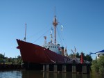
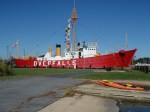
Because the tide was still coming in (I hoped to time it so that it was going out when I turned around at Canalfront park) I cruised passed the UD wind turbine, all the pretty houses and boats, as well as the Lewes Life-Saving Station and the Lightship Overfalls. I’ve toured the inside of both of these places but it was cool to see them from the water. I finally stopped as a “kayaks only” boat ramp, right next to the Overfalls.


I got out, stretched, ate a snack, turned off my GPS, and checked the time. The tide was not supposed to change for another 45 minutes. Ugh, not worth the wait, so I decided to head back and power through the incoming tide. I could use the workout.
This time I hugged the east side of the canal which is mostly marsh grasses and again, as long as I stayed close to the shoreline, paddling against the tide was pretty darn easy. However, as I passed the inlet for a second time, there were definitely some eddies and swirlyness going on that I didn’t feel the first time. Not bad though – just had to push through it and as soon as I was passed the inlet, the tide simply carried me right back to the boat ramp. Not a bad paddle for a beautiful Saturday morning (without drinking water, mind you)!
Prime Hook Beach to Beach Plum Island
Today, September 22, I paddled my first portion of the Delaware Bayshore AND I completed another 100% solo trip (meaning there was no help from Brian or anyone else to shuttle me from one end to the other).
I packed up my little car last night: kayak on roof rack, bike disassembled and inside my tiny hatchback. I’m amazed that silly little car can transport multiple, oddly-shaped objects. It was a bit windy when I woke up but I decided not to let that get me down. I knew that the wind and the tide would both be in my favor. I drove to Prime Hook Beach first to unload my kayak (which I locked to a Prime Hook Wildlife Refuge sign). A couple of construction workers were working on some utility lines and looked at me like I was crazy and I was a little worried that they were going to stop me from leaving my kayak there. But then again, why would they care? If anything it would be the local residents that wouldn’t like it. I then drove down to Beach Plum Island at the south end of Broadkill Beach. Cute little spot – can’t believe I’ve worked for Parks on and off for 8 years and never went there until today.
Once I assembled my bike, I had to figure out how to deal with all my kayaking accessories. Paddle disassembled and in back pack (sticking out by 2 feet, mind you!), PFD clipped to the outside of my back pack, and lunch box over my shoulder. I probably looked pretty ridiculous, but it worked really well.
Although I had to drive out to Route 1 to get here from Prime Hook Beach, Google Maps indicated that I would be able to ride my bike straight up the coast on some sandy-looking back roads.
Wrong. Google Maps you deceived me! Stupid rich gated properties threw a major wrench into my biking plans.


I then had to back track, access the beach at the public access point, and proceed to WALK my bike and all my gear up the beach. Not. Fun. 1.5 miles rolling my bike through sand. I’ll probably be feeling it in my legs tomorrow morning 😦
walking up the beach w/ my bike. and my guns (aka kayak paddle)
I finally made it back onto a road and only had about a mile until I reached my kayak. When I got there the construction guys were teasing me about how much they were going to sell my kayak for and then they were teasing each other about not helping me carry my boat down to the water (about 50 yards away from where I stowed it). Nobody actually came to help me but that’s okay because this was one of my “independent woman” kayak trips 🙂
I locked up my bike and they then said they were going to sell that instead of the kayak but I assured them my kayak was worth way more and they missed their chance to make some money!
my new construction friends
As I was launching my kayak, a man drove by and told me not to blow away. Yikes. Should I really not be kayaking in this weather? It’s probably gusting to 20 mph. But then again, the wind was blowing at the exact angle and direction I needed to go. And if it got really bad, this water can’t be more than what, 2 feet deep? What’s the worst that can happen?

meh. not too rough. I can do this.
Sure enough, the wind (and tide!) carried me quickly and gracefully. So quickly and gracefully that I actually didn’t get as much of a work out as I had intended for the day. As always, I pulled my phone out to check Google Earth and make sure I was correctly navigating the marsh creeks and not getting lost.
Wrong. I was in the middle of a wide open little bay and Google said I was on land. Very, very wrong. Once again Google Maps, you have failed me. I thought maybe my GPS was off a little, but NOTHING around me matched up with what it looked like on the map. I saw the wind turbine near Roosevelt Inlet off in the distance so I just started out in that general direction. I started to make out a shiny object way ahead which must by the bridge I needed to go under (Broadkill Beach Rd). I continued on, straight towards the shiny object (ooo… shiny object!). But shiny objects are notorious for distracting people and that’s EXACTLY what happened here! As I got closer to the shiny object, I realized I was going off course and the bridge I needed to go underneath was about 200 yards west of the said shiny object. Darn it.
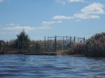
No big deal though, I just had to alter my direction a tad and continue on. As I got closer and closer to the bridge though, I realized there was something blocking my path. Not sure what, but something. I then passed a sign that was facing the other direction. Once I got passed it, I realized it was a Prime Hook Refuge sign saying “Area beyond this sign CLOSED”. Well, not my fault there wasn’t one where I started. Not sure why it was closed but I got through safe and sound. Then I turned my attention forward again and realize there was a dam?! Huh?? Luckily there was a small space for me to get out next to this so-called dam (whatever is was, maybe something to control the tide passing through?). I then just had to portage a few yards and I was able to launch on the other side of the strange structure and continue my journey underneath the bridge and on to the Broadkill River.
-
- “area closed” sign
-
- is that a dam?!
-
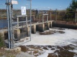
- portaging passed the dam (or whatever it was)
-

- under the bridge.
-

- blue heron
-

- closer to the wind turbine
As soon as I joined up with the Broadkill, it was really smooth sailing. The wind and tide pushed me so well I barely had to paddle at all. I didn’t pass much on this stretch except marsh grass, the occasional blue heron, and this:
What the heck is this?! It looks like a giant should be doing a Mexican hat dance around it. Or better yet, it looks like it belongs at an amusement park in South Carolina!
I knew I was nearing the end of my journey because the wind turbine was much larger! I finally pulled up to a muddy spot on the west side of the Beach Plum parking area. Just a short walk up the path and I was back to my car 🙂

Today’s paddle was 6.58 miles. Shorter than what I normally do, but not bad for a 100% solo day! Here’s the path I took:
Gargatha Landing to Pierce Taylor Road
Today, June 30, 2014, I paddled from Gargatha Landing to Pierce Taylor Rd. This 8.1 mile trip was perfect. It was the perfect length, far enough away from home that I felt like it was an adventure, perfect weather, good wildlife sightings, almost perfect tides, and perfect timing for Brian to pick me up after he was finished work for the day.

 I arrived at Gargatha Landing just as the tide changed and started to go out. The views from this landing are beautiful; you just look out to the east and see nothing but marsh, a few patches of sandy beach in the distance, and the horizon dotted with a couple fishing/hunting shacks. As soon as I launched, the tide carried me gracefully out to Metompkin Island. Along the way I encountered several boaters. Each one was courteous and slowed down when they saw me, but really, I’d prefer that they didn’t! I always like a little wake to bounce around in. By the time the third boater passed me I tried to signal to him to NOT slow down and keep going, but he laughed and threw his hands up in the air, probably saying to himself “what the hell is she doing?”

This is Waldo, the oystercatcher.
First glimpse of Metompkin
As I came around a marsh bend, I finally spotted the sandy beach of Metompkin Island. I love that first glimpse of beach – you just never know exactly when in the journey you will find it and it’s always exciting to me for some reason. As I paddled up the final stretch of creek to the island, there were terrapins falling into the water left and right! Plop, plop, plop, probably heard 50 plops. I’ve never seen so many terrapins sunning themselves. And I’ve never seen so many terrapin heads popping up around my boat either! There must have been hundreds of them! I also saw probably a dozen oystercatchers on a small shelly island as I was approaching Metompkin.
Once I landed on Metompkin, there were a few families that had come out for the day; picnicking and shelling. Brian and I had come out here on a small boat about two years ago and I was surprised at how little Metompkin inlet had changed, considering the fact that we’ve had several very strong storms that I thought would have changed the inlet significantly. I stopped just long enough to snap a few photos, eat some of my lunch, and see tons of terrapin tracks! Not only was I amazed at the number of terrapins in the water, but I’ve also never seen that many terrapin tracks in one spot either!
-

- Terrapin tracks!
-

- Chincoteague Wildlife Refuge?
-

- Metompkin inlet
-

- Families hanging out on the island
The tidal current was running pretty hard and I was about to launch back in the water and continue on, passed the inlet. I wasn’t sure what to expect as far as currents went, so I prepared for the worst (capsizing). I took my phone out of my life jacket pocket, put it in my dry bag, put all my loose things (flip flops, water bottles, etc.) in my dry hatch and carefully launched into the crazy current. Luckily, paddling passed the inlet wasn’t too bad. In fact, it was down right easy. The tide was going out and it just carried me right on towards Assawoman Island.
As I approached Assawoman though, the spot where I thought I would cut west and start paddling in the back bay again was gone! The only feasible way I could see to paddle into the back bay was to go straight out into the open ocean! So much for thinking that Metimpkin inlet hadn’t changed much.  This area was drastically different! Instead of navigating out the inlet and into the ocean, I found an area to portage across (just a narrow strip of sand) and safely put in on the other side, in the back bay.
Once I completed the portage and got back in the water, that’s when the outgoing tide really was against me. As I came around a marsh corner and started due west, I was really struggling to make any headway. I was paddling as hard as I possibly could and I was barely moving at all! It was unreal! Probably the hardest current I’ve ever paddled against. To make me even more nervous, I saw a huge sting ray cruise right in front of me, effortlessly swimming through the crazy currents.  Ugh, you all know how I feel about sting rays. Luckily, the exhausting paddling didn’t last long. After about 10 minutes I reached a small sandy island to take a break. I was so sick of paddling that I even portaged straight across the island instead of paddling around it.
At that point the worst was over. Paddling across the Kegotank Bay (love saying that for some reason) was simple. The wind just pushed me right along. The wind continued to help me all through the marsh creeks that were approaching Wallops Island and Pierce Taylor Rd landing. This stretch of the trip was very relaxing. 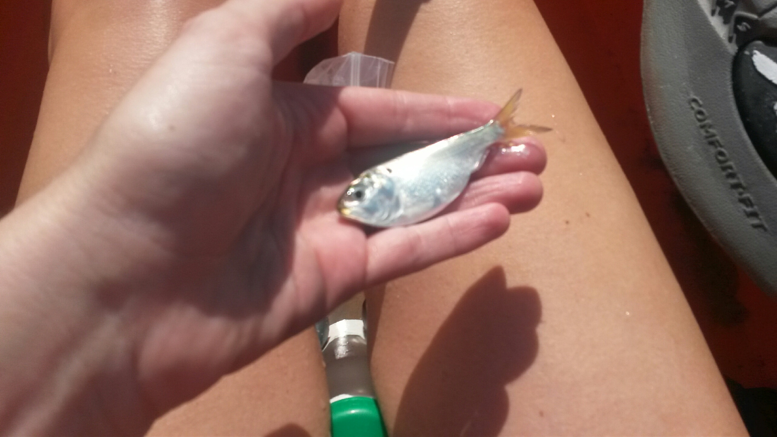 No one around but hundreds of terrapins, more willets than I’ve ever seen, and jumping fish! One little peanut bunker hopping right in my kayak! Scared the crap out of me. It jumped right next to my hip and I ended up sitting on the poor guy. I quickly grabbed him, made him hang tight for a photo, and place him back in the water. He survived and swam away 🙂
 The last interesting thing I saw on this trip was some kind of oyster garden? reef? farm? Not sure what to call it. There was a line of probably 25 floats that I’m assuming had oysters or some kind of shellfish in them. Pretty cool!
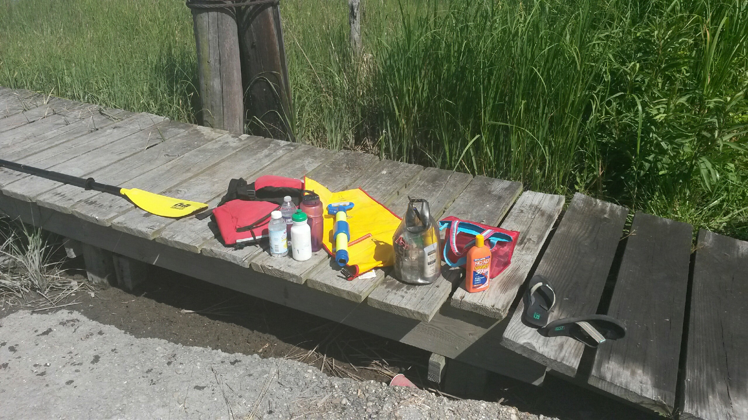
Did I bring enough stuff?
I finished this trip at a public landing on Pierce Taylor Rd. Not much of a landing; the docks and ramp had definitely seen better days. As soon as I got out of my kayak, guess who shows up? My husband – perfect timing. We hadn’t talked since before I left the house this morning; I had just guessed what time I’d be off the water. This trip was perfect from start to finish. Here’s the path I took:
Holts Landing to Delaware Seashore State Park
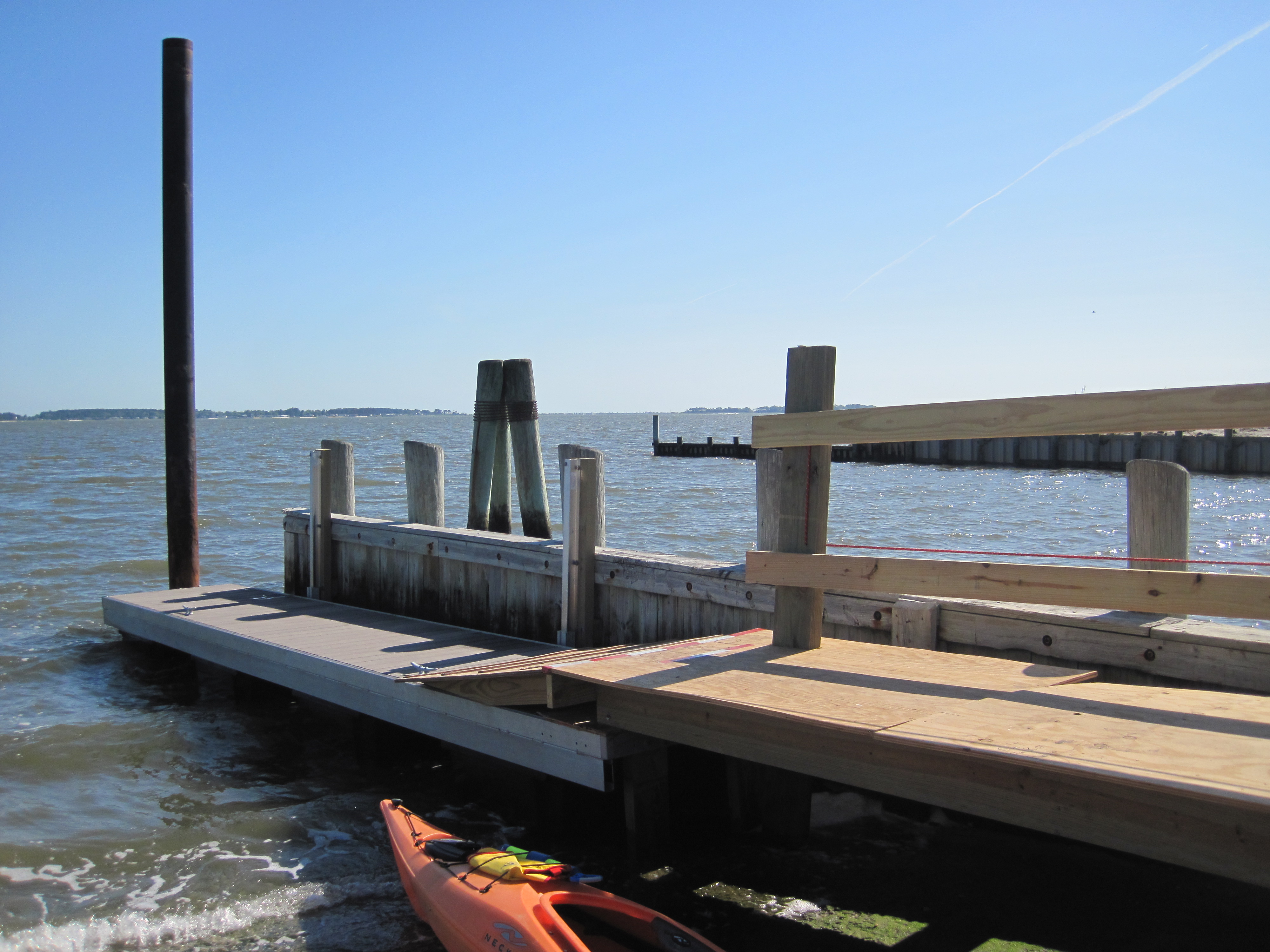
Launching at Holts Landing State Park
On Sunday, June 1, 2014, I paddled across two of Delaware’s 3 inland bays. Although I normally have off on Sundays, I had to go to work in the afternoon. I wanted to make the most of my morning so I decided to get a decent paddle in. The plan was to launch at Holts Landing State Park and have my coworker, Lowell, pick me up at Tower Rd, the north end of Delaware Seashore State Park to take me back to my car.
I expected the stretch across Indian River Bay to be the most difficult as it is open water and typically filled with boat traffic. Luckily, for reasons unknown to me, I only encountered one boat! It was odd because it is pretty much summertime, and the weather was a beautiful day for being out on the water. But I wasn’t complaining because it was quite peaceful without many boats around.
Indian River bridge in the distance
The nice thing about this trip was that I never had to pull out my phone to help me navigate. I have been out on these waters so many times for work that I knew exactly where I was and where I had to go.
Distant view of the Life-Saving Station from Lynch Thicket
It was just about 3 miles to get to Massey’s Ditch. However, instead of going through the ditch, I took a break on an island known as Lynch Thicket before heading east towards Savages Ditch and the marsh islands of Delaware Seashore State Park.
Okay yeah, this post is excruciatingly boring and I apologize. I really didn’t see anything exciting, just the normal sites I see at work everyday. Not that I don’t appreciate working in such a beautiful place, I really do appreciate it everyday, but there just weren’t any fun surprises on this trip. I know where the birds nest, I know where people fish, I know where all the sandy beaches are.
The only somewhat exciting part of this journey was the fact that I finished quickly. I paddled 7 miles in just 2 hours. That is pretty speedy for me, particularly since the wind was coming directly at me the whole time. I finished nearly an hour earlier than expected and since Lowell wasn’t available to pick me up that early, I got a coworker to pick me up and take me to the office. Lowell was able to bring me all the way back to my car a little later. Okay, boring post is over. Here’s my path. Even the path is a boring, almost straight line.
Champ Wharf to Crisfield
It’s Memorial Day Weekend and what does that mean? Time for Brian and Laura to leave town, escape the Ocean City madness, and go on another kayaking-camping adventure.
Last year we had perfect weather and camped out on Cedar Island on the eastern shore of Virginia. This year, the weather forecast was looking perfect again so we headed to the Chesapeake side of the peninsula. Last fall, Brian had been fishing out near the teeny tiny town of Rumbley, MD which is somewhere between Deal Island and Crisfield, and he thought there were some islands out there that had good camping potential. In order to get some decent distance in, he dropped me off in an even smaller town, Champ, MD. As I started to paddle south, he drove to Rumbley and fished for a while. Although Champ had only a handful of houses, there seemed to be quite a bit of activity at the “wharf” (really it was just a beat-up, old boat ramp). There were a few watermen that had just come in, and several families were getting ready to head out on the water for the day.
 Once I got out of the boat ramp area and out of the creek, things quieted down very quickly. Except for the osprey – there must have been a nest on every channel marker and more in the dead trees in the marsh. I don’t think I’ve ever seen/heard such a dense population. Despite the osprey though, the quiet got me thinking – I would love to own property out here one day. Nothing fancy, just a waterfront lot with a little bungalow. I don’t even need proper plumbing and electric. I told Brian later, if we ever get to a point in our lives when we can manage a second home, I want to buy out here (or really anywhere from here south to Cape Charles). Just a place to get away from the crowds, get away from cell phone reception, and spend our days fishing, crabbing, and hanging out on the water.
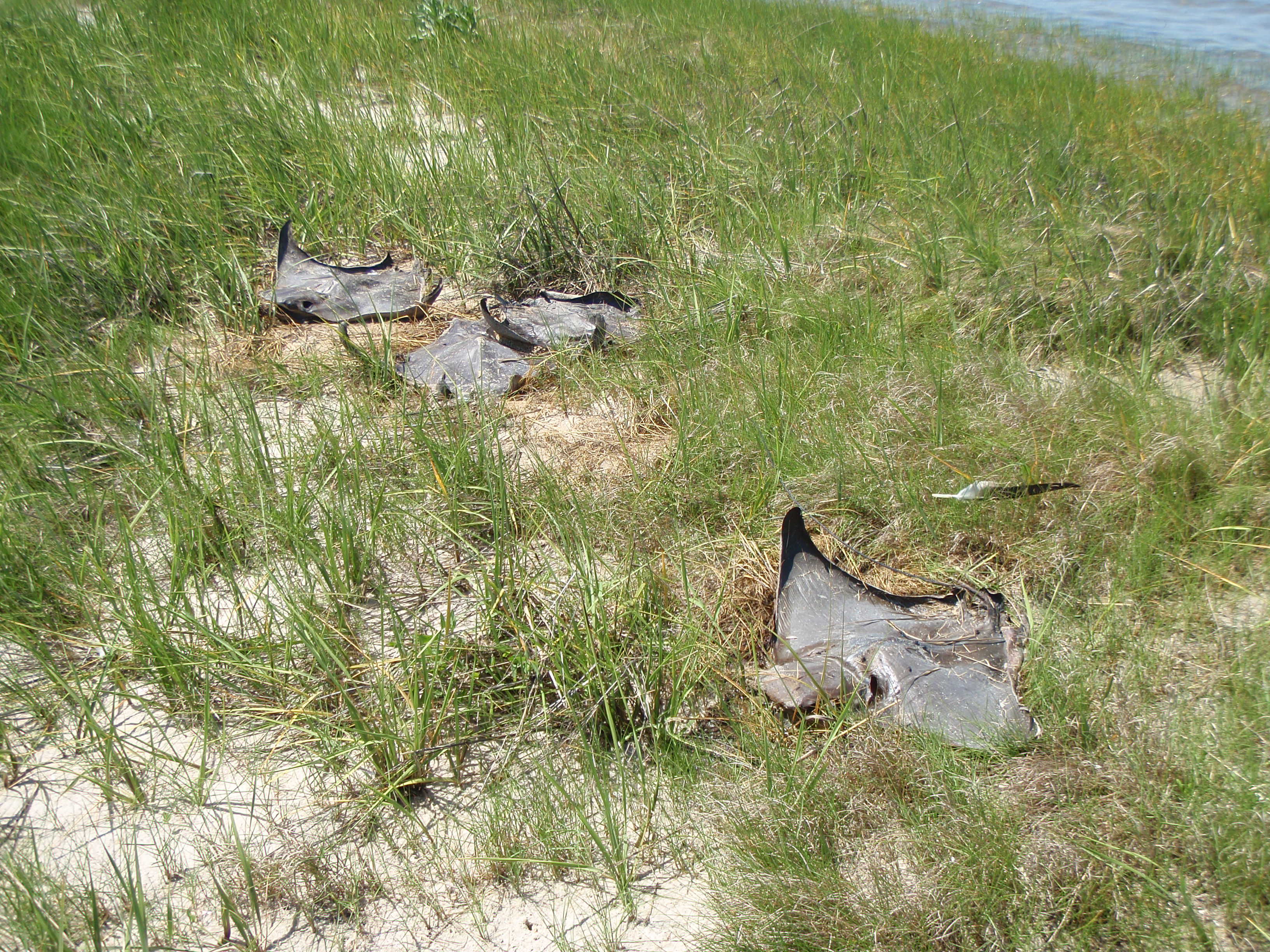 So enough day dreaming. The first spot that I decided to get out on dry land was a small marsh point, about 2 miles into the journey. Bad idea. As soon as I got out of my kayak I was engulfed with flies. As I looked around, it was clear why: sting ray graveyard. There were about 5 cownose rays that were dead and dried up and covered with flies. It appeared that they had swam over the point at a high tide, and as the tide when out, they got stuck. Gross. And to be honest, I didn’t really have much sympathy for them – I’m still bitter about my sting ray incident 5 years ago (another story for another time).
To escape the flies, I hopped back in my kayak and pushed on. The next place I stopped was a small sand bar. After inhaling my sandwich, I decided to take a detour from my original course plan. The wind had started to pick up at an awkward angle and I was not in the mood for battling wind/current issues. I pulled out my trusty Android and “My Tracks” app to see what my options were. I quickly realized I could cut through some of the marsh peninsulas instead of paddling all around them. I veered off to the east and pushed forward.
This seemed like a great plan until I reached a bridge. A bridge that was much to low for me to fit underneath! Ugh portage. It breaks my rhythm, it’s awkward to haul my boat across the road, and worst of all, my kayak was packed with camping equipment, making it extra difficult! The temper tantrum that was going on in my head was only exacerbated by the traffic. Yes, I said traffic. And by traffic I mean one single vehicle – an ATV. Some dude was out on Frenchtown Rd hauling ass on his ATV. And not just down the road once, but repeatedly back and forth, faster and louder each time. Is that what people do around here for fun? Lame.

The next stretch was pretty uneventful, aside from the crazy amount of flies that were swarming around my head the whole time. Usually flies aren’t an issue at all when I’m out on the water; they are most annoying when on land, however this was different. It was the first time I actually put on bug spray while on the water. Other than the flies, the only thing I really noticed about this portion of the trip was the vegetation: black needle rush. In all my years of leading marsh walks, learning about the vegetation level of a salt marsh, I never once encountered black needle rush (even though it is a native of the Chesapeake region). The only reason I knew what is was, was because of a small patch of it that was planted on Poplar Island (where I used to work). However, this was no small patch – this was acres and acres and ACRES of the pointy marsh grass. From a distance, I thought it was some kind of stone wall or old dock since it’s not green like the rest of the marsh grasses this time of year.
 When I came out of that marsh creek and entered the open bay again, I spotted Brian and his yellow kayak. I called him on the radio to see if he could see me to the south (we were some distance away). He was a bit confused because he said I didn’t pass him yet – sneaky me took a short-cut through the marsh creeks!
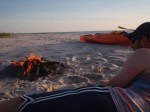
Once he caught up to me we paddled together for a little while until we reached an island labeled as “Pat Island” on Google Earth. This was the island Brian was envisioning camping on and it was perfect. We pulled up onto a sandy strip of land (less than 50 yards wide?) and decided, based on the high tide lines, that this would be a great place to camp. However, we weren’t totally sure if it was okay to camp here so we decided to wait several hours before setting up the tent (it was only mid-afternoon when we got there).
I took a break from paddling while Brian continued to fish around the island. I was amazed at the number of sandy beaches in this area! Everywhere I turned there was a beach or a sand bar. There was even a DUNE at one end of the island! This surprised me because all I’ve heard throughout my career is that there is major habitat loss when it comes to sandy shorelines. I heard that as a seasonal employee in Delaware, and I heard that all the time when I worked on Poplar. However, I wouldn’t go telling all the terrapins to come nest on the islands near Rumbley though, they were COVERED in raccoon tracks!


 You know what else I was amazed at? This awesome HAT I found! O’neil brand, like-new condition, and EXACTLY what I needed – more shade for my face and shoulders. Finders, keepers!
Once the sun started to set and we were getting hungry, we decided to set up camp and have dinner (chicken, broccoli salad, beer). It was cool to actually see the sun set over a horizon of just water – not something I normally see in Maryland 🙂 After the sun set Brian continued to fish – he had the proper “all around white light” too to stay safe! I was pretty beat after 9 miles of paddling in the sun so I relaxed by the fire and watched the stars instead (being out on this island made for some phenomenal stargazing!). An hour or two later Brian got back, but still no keeper fish! What the heck Brian, you said this was your “speckled trout hot spot”.


—————————————
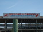
 Morning! After packing up camp and a gourmet breakfast of PB&J sandwiches, it was time to continue on. The plan was for Brian to continue fishing (isn’t that always the plan?) and for me to paddle down to Crisfield where he would pick me up later. I had never been to Crisfield so I didn’t really know what to expect, although the condo buildings in the distance did not fit what I was envisioning.
It was a bit windy so I expected the first stretch, that was over open water, to be the most challenging. I’m not sure of the distance, but I would guess it was about 2 miles of open water. I reached land in just 45 minutes or so and felt pretty accomplished so far – I was off at a great pace. The land I pulled up on was the north end of Jane’s Island State Park. Again, I was astounded at the long sandy beaches – really not something you see very often in he Chesapeake!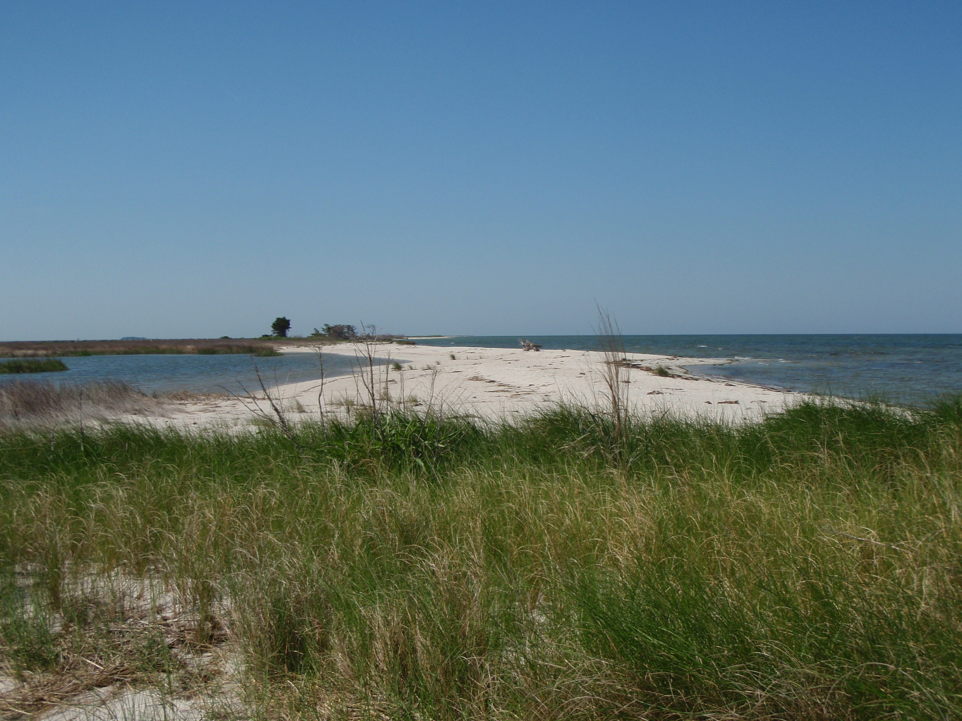
The next hour and a half was tricky but fun. After exploring yet another sand bar and sandy island, I had to navigate through a crazy maze of marsh creeks. If it had not had my trusty Android to guide me through, it probably would have taken me weeks to find my way out of there! At every bend I had to pull out the Google Earth and reevaluate my current position and where I was headed. Also at every intersection of creeks, there were probably 5 or 6 options of direction from which to choose! By the time I made it to the main channel, I was exhausted. Even though I was in protected marsh creeks, the wind was still pushing hard against me.
 Brian called me around this point to say he was packing up and on his way to Crisfield. I figured that since I was in the main channel and that I could almost see Jane’s Island State Park boat ramp, I was probably pretty close and it was good timing. But… I think I was wrong. The last stretch through the Crisfield ditch (not sure if that’s what it’s called, but that’s what I named it) was killer!! Not only was the wind against me, but it was funneling the water through the ditch at a crazy pace. Add boat traffic and wake to that and I had water and waves coming at me from all angles! I did feel pretty awesome when I just cruised by a family in a canoe – a family of 6 PEOPLE in a wobbly canoe. Not sure, but I imagine they didn’t get very far!
As I passed the waterfront hospital (damn, if I have need a hospital stay, send me here, must be beautiful views!), watermen docks, seafood processing buildings (do they have a more official name/term?), people swimming, people fishing, people jet-skiing, condo buildings, the U.S. Coast Guard boats, the Tangier Island Cruises boat… I began to feel incredibly small – just some girl bobbing around in an orange kayak amongst so much activity. I wonder what people thought when they saw me? That girl is… stupid? ambitious? brave? clueless?

Well it doesn’t matter what they thought because although I was probably an hour late to meet Brian, I just paddled 9 miles to get here! And 9 miles yesterday! Plus 2ish miles around islands. That’s like 20 miles in the last 24 hours! What did YOU do today? Here’s my path; blue for Day 1 and red for Day 2:
Fenwick Island State Park to Williamsville, DE
On Monday, May 5 (Happy Cinco de Mayo!), I connected the dots and completed the leg between Fenwick Island State Park and Williamsville, DE. I have now completed everything from Holts Landing State Park (Millville, DE) all the way down to Pierce Taylor Rd in Hallwood, VA. That’s a total of 82 miles and over 24 hours of paddling! And that’s not counting the other random trips over on the Chesapeake side.
The cool thing (in my opinion) about this leg was that it was my first one way trip that I have completed that I DIDN’T need assistance from Brian or anyone else to shuttle me from one end to the other! I was able to ride my bike instead. The logistics got a little confusing. Actually, it was SO confusing that I had to write down my itinerary to make sure I didn’t forget anything. No seriously, I should have taken a photo of the post-it note I had with instructions I wrote for myself – it was pretty ridiculous.
First I loaded my kayak on top of my car (with my awesome new Yakima “hully rollers”), and loaded my bike inside my car. I’m really impressed with how much my little Nissan versa can handle! I then drove to Fenwick and unloaded my kayak and locked it to a picnic table with my dry bag, paddle, and PFD stuffed inside. Then I drove back south to Northside Park in Ocean City. There, I hopped on my bike and pedaled back up north to Fenwick. When I arrived, I had to unlock my kayak, lock my bike to the picnic table, and launch into the Little Assawoman Bay. Once I completed the paddle (that story coming in a minute), I had to load my kayak on my car, drive BACK up to Fenwick, unlock my bike, pack it up in the car, and finally head home. I still can’t believe I didn’t screw up, like leave my keys with my bike, or forget to lock something up properly. Somehow I pulled the whole thing off! Good thing I had that post-it note.
Distant view of Assawoman Wildlife Area
This paddle was interesting in that I paddled a stretch of the coast that I drive everyday, to and from work, so it definitely offered a different perspective from what I’m used to. When I drive up the coast, I am mostly passing houses on the bayside and I usually forget that just on the other side of those houses and the bay, is the Assawoman Wildlife Area. It’s a gorgeous, often forgotten area, full of good kayaking and exploring. Some of those houses along Route 1 are pretty damn lucky – unobstructed views of the ocean to the east, the bay and beautiful, undeveloped land to the west. Must be nice.

Approaching Route 54 bridge
For the first part of this paddle the wind was coming straight out of the west, making paddling a frustrating, but not too difficult. However, about 2 miles in, I saw some threatening looking clouds. Well, I thought they were threatening looking, most people would probably disagree and call me paranoid. I stopped for a quick break at Coastal Kayak (a nice kayak rental outfitter but they were closed) to check the radar on my phone. Yup, the closest precipitation was in Virginia and the “thunder” I thought I heard was a plane.
 I kept heading south, admiring all the fancy homes in Fenwick. I then entered the “Fenwick Ditch” which is a narrow area that connects the Little Assawoman bay in DE, to the Assawoman bay in Maryland. I was a bit worried about how hard the tide would be running through here, but it wasn’t bad. It may have even been slack tide. I went under the Route 54 bridge and I have to say, this was the first time I have passed a tiki bar while paddling. Even though it was Cinco de Mayo, very few people were hanging out at Harpoon Hanna’s. Maybe had it been a warmer day, I would have stopped in for a margarita!
As I came out of the ditch, I headed west. When I started this whole trip, I wasn’t sure if I was going to go to Northside Park, or if I was going to go to the kayak launch in the Bayside community (where I had started the OC paddle last September). I decided I wanted to do this right and connect all the dots, so I paddled over to Bayside. Once I arrived, I was pretty beat so I got out, ate a sandwich, and pressed on to Northside Park.
I was pretty worried about this last stretch because I was going to be going directly into the wind and it was a straight 2 miles across open water. Luckily, it wasn’t that bad! I don’t get it. There are times when going against the wind is torture, and then there are other times when I swear it is actually easier than going WITH the wind! I was cruising! I couldn’t believe how quickly I made it to the park.
The worst part of this whole day was the last part as I got out of my kayak. The park doesn’t exactly have an official kayak launch. There is a nice bit of sandy beach to get out on, but then I had to carry my kayak several hundred yards to my car! So frustrating. By the time I got to my car, I was so tired that I could barely load my kayak onto the roof rack. My arms will killing me, more from carrying/dragging my kayak from the water than the actual 8 mile paddle!
Although the weather was meh, the wind was frustrating at times, and there was very little wildlife to see on this trip, I still felt extremely accomplished since I did the whole thing solo. No help being shuttled, no help disassembling my bike, no help loading my kayak. I was a bit sore the next morning since it has been quite some time since my last long paddle, but it was worth it! Take a look at my path:
And if you want to see the complete 82 miles from Delaware to Virginia, here it is!