
Today, September 22, I paddled my first portion of the Delaware Bayshore AND I completed another 100% solo trip (meaning there was no help from Brian or anyone else to shuttle me from one end to the other).
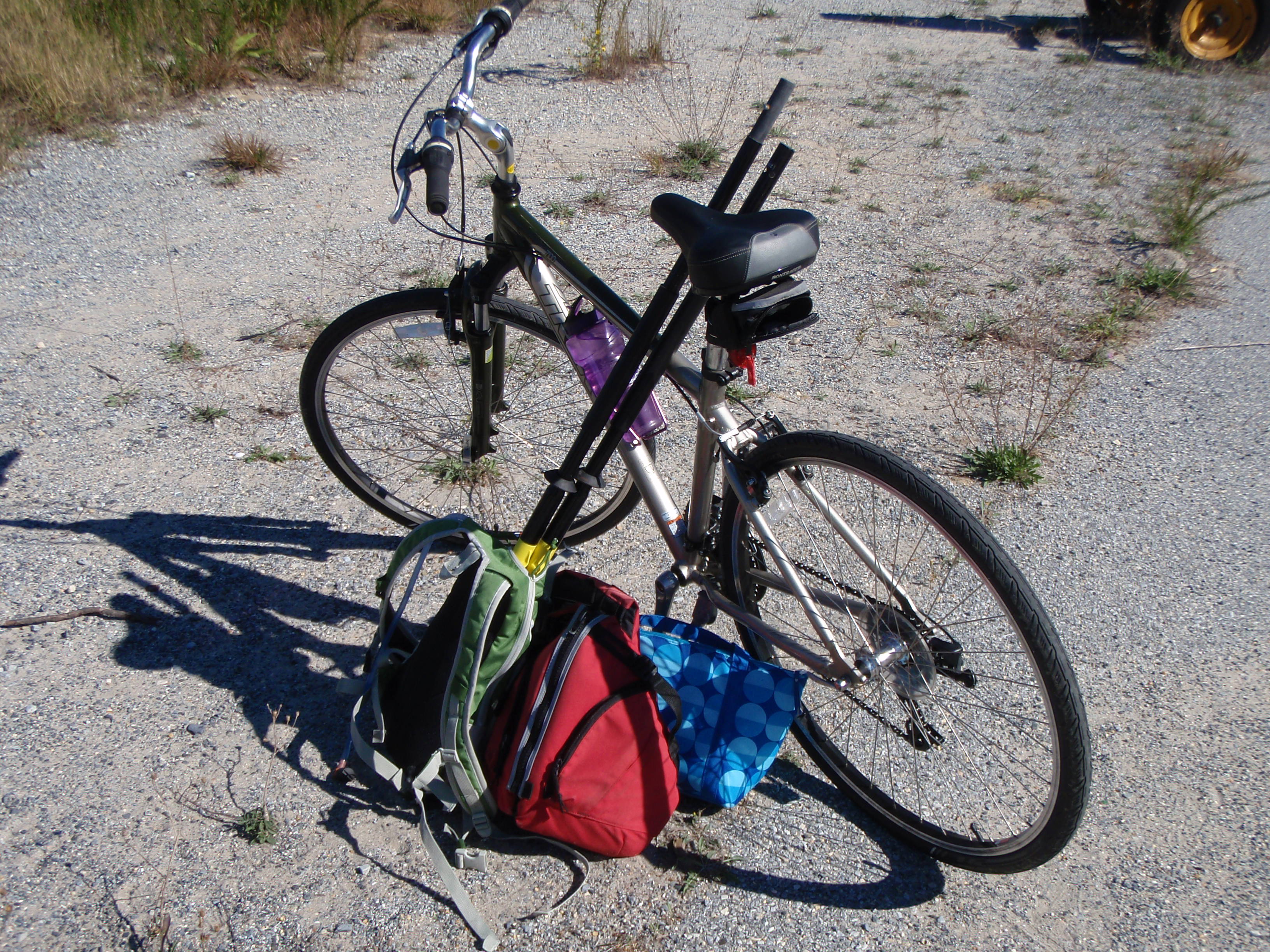
I packed up my little car last night: kayak on roof rack, bike disassembled and inside my tiny hatchback. I’m amazed that silly little car can transport multiple, oddly-shaped objects. It was a bit windy when I woke up but I decided not to let that get me down. I knew that the wind and the tide would both be in my favor. I drove to Prime Hook Beach first to unload my kayak (which I locked to a Prime Hook Wildlife Refuge sign). A couple of construction workers were working on some utility lines and looked at me like I was crazy and I was a little worried that they were going to stop me from leaving my kayak there. But then again, why would they care? If anything it would be the local residents that wouldn’t like it. I then drove down to Beach Plum Island at the south end of Broadkill Beach. Cute little spot – can’t believe I’ve worked for Parks on and off for 8 years and never went there until today.
Once I assembled my bike, I had to figure out how to deal with all my kayaking accessories. Paddle disassembled and in back pack (sticking out by 2 feet, mind you!), PFD clipped to the outside of my back pack, and lunch box over my shoulder. I probably looked pretty ridiculous, but it worked really well.
Although I had to drive out to Route 1 to get here from Prime Hook Beach, Google Maps indicated that I would be able to ride my bike straight up the coast on some sandy-looking back roads.
Wrong. Google Maps you deceived me! Stupid rich gated properties threw a major wrench into my biking plans.


I then had to back track, access the beach at the public access point, and proceed to WALK my bike and all my gear up the beach. Not. Fun. 1.5 miles rolling my bike through sand. I’ll probably be feeling it in my legs tomorrow morning 😦
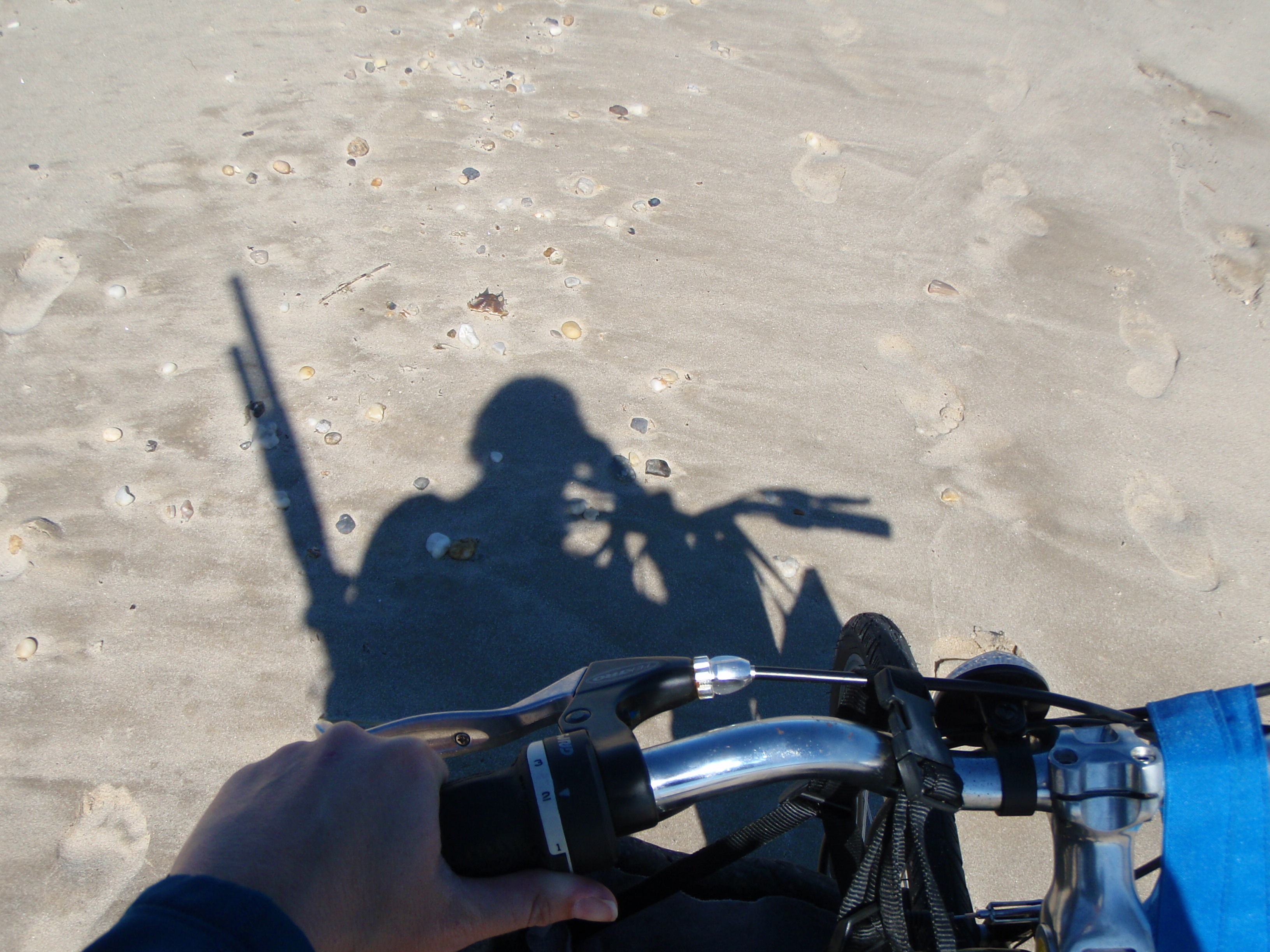
walking up the beach w/ my bike. and my guns (aka kayak paddle)
I finally made it back onto a road and only had about a mile until I reached my kayak. When I got there the construction guys were teasing me about how much they were going to sell my kayak for and then they were teasing each other about not helping me carry my boat down to the water (about 50 yards away from where I stowed it). Nobody actually came to help me but that’s okay because this was one of my “independent woman” kayak trips 🙂
I locked up my bike and they then said they were going to sell that instead of the kayak but I assured them my kayak was worth way more and they missed their chance to make some money!
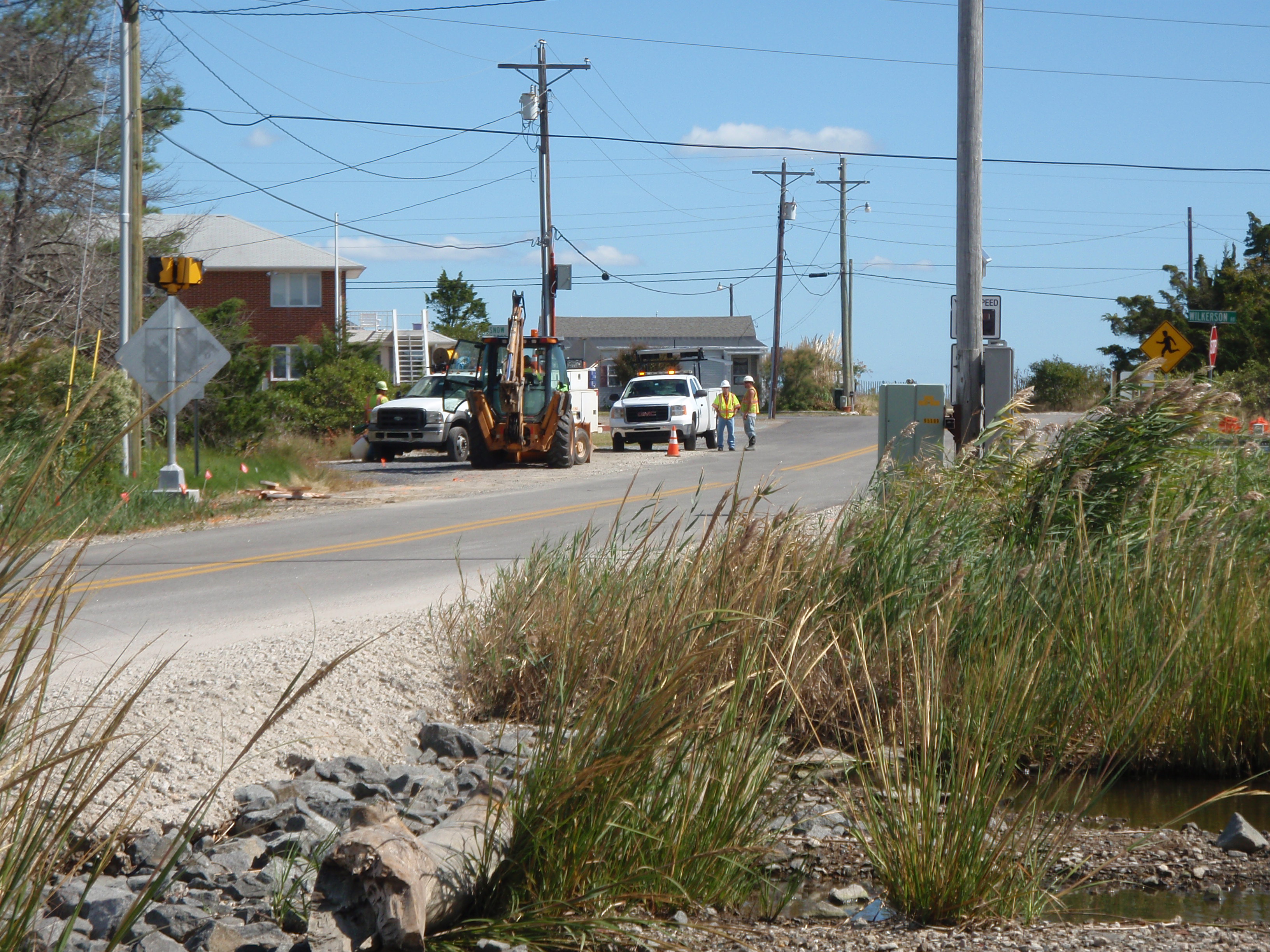
my new construction friends
As I was launching my kayak, a man drove by and told me not to blow away. Yikes. Should I really not be kayaking in this weather? It’s probably gusting to 20 mph. But then again, the wind was blowing at the exact angle and direction I needed to go. And if it got really bad, this water can’t be more than what, 2 feet deep? What’s the worst that can happen?

meh. not too rough. I can do this.
Sure enough, the wind (and tide!) carried me quickly and gracefully. So quickly and gracefully that I actually didn’t get as much of a work out as I had intended for the day. As always, I pulled my phone out to check Google Earth and make sure I was correctly navigating the marsh creeks and not getting lost.
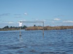
Wrong. I was in the middle of a wide open little bay and Google said I was on land. Very, very wrong. Once again Google Maps, you have failed me. I thought maybe my GPS was off a little, but NOTHING around me matched up with what it looked like on the map. I saw the wind turbine near Roosevelt Inlet off in the distance so I just started out in that general direction. I started to make out a shiny object way ahead which must by the bridge I needed to go under (Broadkill Beach Rd). I continued on, straight towards the shiny object (ooo… shiny object!). But shiny objects are notorious for distracting people and that’s EXACTLY what happened here! As I got closer to the shiny object, I realized I was going off course and the bridge I needed to go underneath was about 200 yards west of the said shiny object. Darn it.
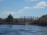
No big deal though, I just had to alter my direction a tad and continue on. As I got closer and closer to the bridge though, I realized there was something blocking my path. Not sure what, but something. I then passed a sign that was facing the other direction. Once I got passed it, I realized it was a Prime Hook Refuge sign saying “Area beyond this sign CLOSED”. Well, not my fault there wasn’t one where I started. Not sure why it was closed but I got through safe and sound. Then I turned my attention forward again and realize there was a dam?! Huh?? Luckily there was a small space for me to get out next to this so-called dam (whatever is was, maybe something to control the tide passing through?). I then just had to portage a few yards and I was able to launch on the other side of the strange structure and continue my journey underneath the bridge and on to the Broadkill River.
-
- “area closed” sign
-
- is that a dam?!
-
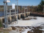
- portaging passed the dam (or whatever it was)
-

- under the bridge.
-

- blue heron
-

- closer to the wind turbine
As soon as I joined up with the Broadkill, it was really smooth sailing. The wind and tide pushed me so well I barely had to paddle at all. I didn’t pass much on this stretch except marsh grass, the occasional blue heron, and this:
What the heck is this?! It looks like a giant should be doing a Mexican hat dance around it. Or better yet, it looks like it belongs at an amusement park in South Carolina!
I knew I was nearing the end of my journey because the wind turbine was much larger! I finally pulled up to a muddy spot on the west side of the Beach Plum parking area. Just a short walk up the path and I was back to my car 🙂

Today’s paddle was 6.58 miles. Shorter than what I normally do, but not bad for a 100% solo day! Here’s the path I took:
